
... newer stories
Samstag, 4. Mai 2013
130504 Stötten
neill, 23:23h
Out with Heidi for a training run on our race bikes. We had no plan of where to go and decided at each turn based on in which direction there were the least clouds.
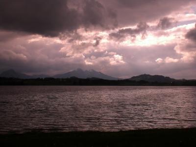
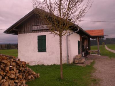
Ended up doing a fantastic 80km trip largely on routes we had never been on before. The old railway line from MArktoberdorf to Roßhaupten has been converted to a cycling path and is fantastic as a race bike route. The next picture is an old station on the route.
82km with 800 meters of climbing
Track at http://www.gpsies.com/map.do?fileId=yptbysrlcnxhhzme
More pictures at https://plus.google.com/photos/103827427036815679772/albums/5866409348860352993?banner=pwa
... link (0 Kommentare) ... comment
130502 Pfronten
neill, 23:17h
Thursday evening and 10 of us cycled to and then around Pfronten. We got absolutely soaked in Achtal - the same thing happened there a few years ago.
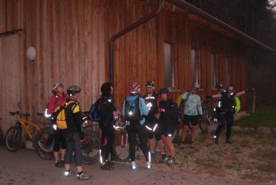
28km and 345 meters of climbing.
Track at http://www.gpsies.com/map.do?fileId=xurgtnlzospzuuwt
More photos at https://plus.google.com/photos/103827427036815679772/albums/5866409348860352993?banner=pwa
28km and 345 meters of climbing.
Track at http://www.gpsies.com/map.do?fileId=xurgtnlzospzuuwt
More photos at https://plus.google.com/photos/103827427036815679772/albums/5866409348860352993?banner=pwa
... link (0 Kommentare) ... comment
... older stories