
... newer stories
Samstag, 11. April 2015
150411 Immenstadt
neill, 19:09h
100 kilometers through the Allgäu and Ausserfern countryside.
Summer in Immenstadt and winter in Tannheimertal. Heidi and I out for six hours on our race bikes.
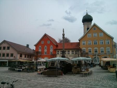
First to Durach and then along the Iller River to Immenstadt. Coffee and a small lunch in the market place at the castle.
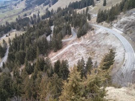
Through Sonthofen and on up the Jochpass. I still needed some time in zone 3 this week so the half hour climb up the Jochpass was the perfect opportunity. Home through the Tannheimer and Ach valleys with a stop for coffee in Tannheim.
My GPS fell off the handlebars at a cattle grid in Achtal which is why there is a break in the track at this point. It bounced down the road but survived (again).
104 km with 1360 meters of climbing. Track is at http://www.gpsies.com/map.do?fileId=yrffouicqujgqbix
Pictures at https://plus.google.com/u/0/photos/103827427036815679772/albums/6123509302367272865
Summer in Immenstadt and winter in Tannheimertal. Heidi and I out for six hours on our race bikes.
First to Durach and then along the Iller River to Immenstadt. Coffee and a small lunch in the market place at the castle.
Through Sonthofen and on up the Jochpass. I still needed some time in zone 3 this week so the half hour climb up the Jochpass was the perfect opportunity. Home through the Tannheimer and Ach valleys with a stop for coffee in Tannheim.
My GPS fell off the handlebars at a cattle grid in Achtal which is why there is a break in the track at this point. It bounced down the road but survived (again).
104 km with 1360 meters of climbing. Track is at http://www.gpsies.com/map.do?fileId=yrffouicqujgqbix
Pictures at https://plus.google.com/u/0/photos/103827427036815679772/albums/6123509302367272865
... link (0 Kommentare) ... comment
... older stories