
Track at http://www.gpsies.com/map.do?fileId=gvqyydptcpwowqjz
... link (0 Kommentare) ... comment
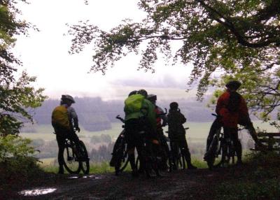
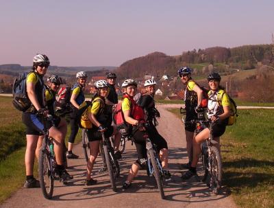
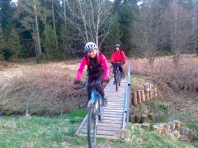
Because the weather was so great, there were only nine of us.
Track at http://www.gpsies.com/map.do?fileId=wzoffoaskqndckqs
Pictures at http://picasaweb.google.com/neill.hogarth/2010CyclingI#
... link (0 Kommentare) ... comment
Track at http://www.gpsies.com/map.do?fileId=rqfcpomypquguybo
Added the track from Vorderschneid to Faistenoy to OpenStreetMap. Still quite a bit missing out that way.
... link (0 Kommentare) ... comment
Track at http://www.gpsies.com/map.do?fileId=clyhftcfcnhtukmx
More pictures at http://picasaweb.google.com/neill.hogarth/2010CyclingI#
... link (0 Kommentare) ... comment
22km around the Grüntensee and then up to Oy and the mast in Maria Rain.
... link (0 Kommentare) ... comment

Track at http://www.gpsies.com/map.do?fileId=ittvtwzeovrvygcj
Max wrote about the trip at http://sites.google.com/site/hogarthadventures/biking/any-time
... link (0 Kommentare) ... comment
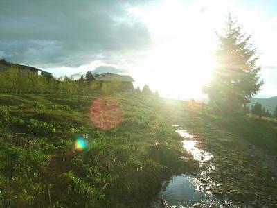
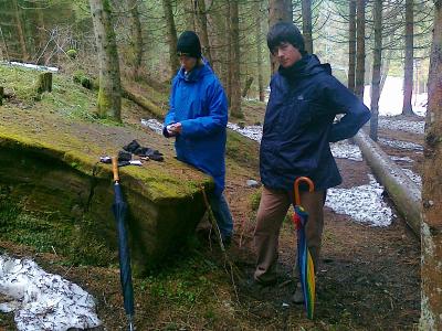
We cycled up to Maria Trost and then back down again. Wet but fun.
Track at http://www.gpsies.com/map.do?fileId=wpxdkrcpwmcbmjfy
Jons pictures are at http://picasaweb.google.de/jon.nesselwang/Bike2010#
... link (0 Kommentare) ... comment
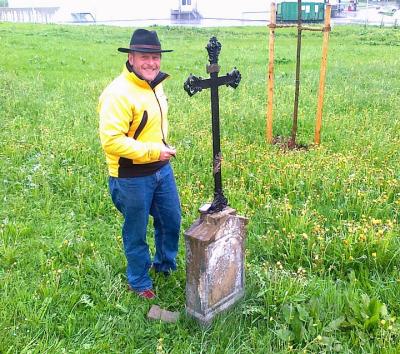
The cache is at http://www.geocaching.com/seek/cache_details.aspx?guid=b6bdabcd-dd81-495e-9f3c-d16ba011f760
... link (0 Kommentare) ... comment
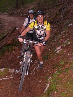
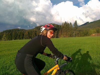
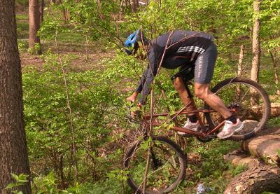
This picture was taken by Jon. More at http://picasaweb.google.com/jon.nesselwang/Bike2010#
Track at http://www.gpsies.com/map.do?fileId=hqacijoqofwjosju
Full size image at http://picasaweb.google.com/neill.hogarth/2010CyclingI#5470092239108088482
... link (0 Kommentare) ... comment
Track at http://www.gpsies.com/map.do?fileId=lcgczptvpnnfiyyw
... link (0 Kommentare) ... comment

Track at http://www.gpsies.com/map.do?fileId=tgkdjsxisyfqpdwh
Photos at http://picasaweb.google.com/neill.hogarth/2010CyclingI#
Jon was along with us and has downloaded his pictures to http://picasaweb.google.com/jon.nesselwang/Bike2010#
Max was out with Group 1 who also did the hanging bridge but a longer route. His pictures are at http://picasaweb.google.de/Maximilian.Hogarth/Biking20101?authkey=Gv1sRgCL3U3ayxuvWikwE#5465659752563401666 and his track at http://www.gpsies.com/map.do?fileId=hogezvsfelopqrlw
And Sepp has written the report (in German) which is at http://home.allgaeu.org/a3453/2010%20Bike%20Season%20ger.htm with the title Tour 02 29.04.2010
... link (0 Kommentare) ... comment

Track at http://www.gpsies.com/map.do?fileId=huivkylfuxhroivq
More pictures at http://picasaweb.google.com/neill.hogarth/2010CyclingI#
... link (0 Kommentare) ... comment
We left Nesselwang at 11:30 and were in Walkertshofen (Hotel Burgberg - http://www.hotelburgberg.de/) for our evening meal - 85kms.
http://www.gpsies.com/map.do?fileId=lhcjrwscljcphsyw
After a great night in Hotel Burgberg we left at 09:00 and reached the Karlsplatz (Stachus) in Munich about eight hours later - 92kms
http://www.gpsies.com/map.do?fileId=ameyeksauxuqscpw
On the way we also found a Geocache
http://www.geocaching.com/seek/cache_details.aspx?guid=88e7c627-4926-4aa9-a5e9-109cbd8e24ca
We caught the train home and then cycled back from Seeg to Nesselwang - 11kms
http://www.gpsies.com/map.do?fileId=lefbymecbbibwlah
A total for the weekend of 188kms and loads of fun.
All my pictures are at http://picasaweb.google.com/neill.hogarth/StachusForIcedCoffee#
Jon's photos are at http://picasaweb.google.de/jon.nesselwang/AprilTour2010#
Sepp has written a full report of the weekend (in German) under the title of "April Tour nach München 24-25/04/2010". It is at http://home.allgaeu.org/a3453/2010%20Bike%20Season%20ger.htm
... link (0 Kommentare) ... comment
Luckily a few people had remembered to brink some drinks with them and I had a small bottle of home made schnapps from Gisela Ohrnberger.
Gabi, Irene R., Irene Z., Karin K., Gisela, Christa, Moni JS,
Track at http://www.gpsies.com/map.do?fileId=fdipdzjpwhmetzvb
More pictures at http://picasaweb.google.com/neill.hogarth/2010CyclingI#
... link (0 Kommentare) ... comment

If you take a look at the track at http://www.gpsies.com/map.do?fileId=rjjcggjplqmerukp you can see that my GPS receiver had a bit of a problem at the start. this is because the last time it was switched on it was in the USA.
Max also wrote about the trip. His notes are at http://sites.google.com/site/hogarthadventures/biking/tuesday
... link (0 Kommentare) ... comment
The fun part was our step aerobic routine http://www.youtube.com/watch?v=phdNJFF03hs
To celebrate I was out geocaching today with Alison and max. We did a cache called Fox on the Run ( http://www.geocaching.com/seek/cache_details.aspx?guid=b5518072-826f-47b5-93c1-aaa914df8b9d ). I was using a new Garmin Dakota 20 GPS receiver lent to me by Jon. It is easy to use and has a map installed. Great fun.
The track is at http://www.gpsies.com/map.do?fileId=wepmacrfiytygazb With this new receiver you can just pull the tracks across from the receiver already in gpx format. A big move up from my beloved Geko.
Full size picture at http://picasaweb.google.com/neill.hogarth/Geoaching2010#
... link (0 Kommentare) ... comment
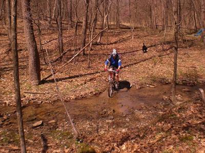
We headed up to Town Run Park Mountain Biking Trail ( http://www.indianaoutfitters.com/mtn_biking/town_run.htm ) and after a few tries found the car park. The southern section was closed due to roadworks but the northern section was fun enough. After a slow trip round to check out the trail, we went round again at speed taking photos on the way. Norbert then did another "quick" run and covered the whole route in 22 minutes.
This was my first time on a specially created mountain bike trail and I really enjoyed it. Especially good was knowing that no one was coming the other way.
All the pictures are at http://picasaweb.google.com/neill.hogarth/2010Indiana#
... link (0 Kommentare) ... comment
Three of us drove to Paintball Valley ( http://www.valleybranchretreat.com/ ) in Brown County. Here there are about 30-40kms of mountain bike trails.
Our American colleagues had lent us their mountain bikes - thanks Mike, thanks Pat.
The three of us set off to the far side of the area - up ridges and down valleys. Good fun.
Right across the other side of the park Wolfgang broke his derailer holder and could no longer ride. I cycled back and got the car which I then drove round to pick him up (after he had waded a river). He took the car to try and get the bike repaired in Columbus while Norbert and I crossed the river and then cycled back through the woods.
We soon got totally lost but we had the owners dog along that knew the way so we followed the dog and eventually got back to camp.
Good fun.
All pictures at http://picasaweb.google.com/neill.hogarth/2010Indiana#
... link (0 Kommentare) ... comment
Three of us drove to Paintball Valley in Brown County. Here there are about 30-40kms of mountain bike trails.
The three of us set off to the far side of the area - up ridges and down valleys. Good fun.
Right across the other side Wolfgang broke his derailer holder and could no longer ride. I cycled back and got the car which I then drove round to pick him up (after he had waded a river). He took the car to get the bike repaired while Norbert and I crossed the river and then cycled back through the woods.
We soon got totally lost but we had a dog along that knew the way so we followed the dog and eventually got back to camp.
Good fun.
All pictures at http://picasaweb.google.com/neill.hogarth/2010BrownCounty#
... link (0 Kommentare) ... comment