
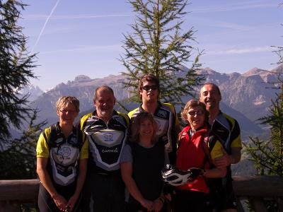
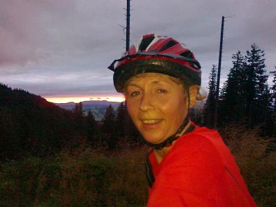
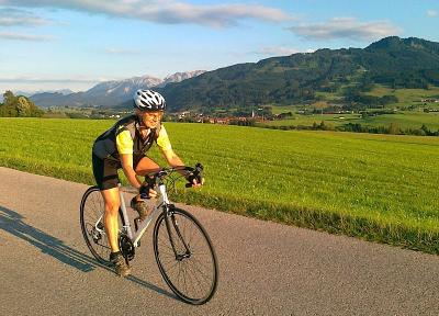
Track is at http://www.gpsies.com/map.do?fileId=enttumoruriigrrf
My pictures are at http://picasaweb.google.de/neill.hogarth/StVigilDay4#
... link (0 Kommentare) ... comment
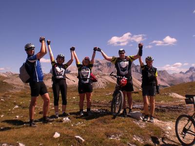
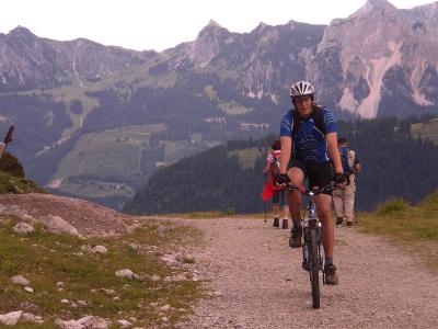
Track is at http://www.gpsies.com/map.do?fileId=qztzrklttnpzyuvq and yes. It really is that steep.
My photos are at http://picasaweb.google.de/neill.hogarth/StVigilDay3#
Jon and Max were along part of the way (between geocaching) and there photos are at
Max: http://picasaweb.google.de/Maximilian.Hogarth/DolomitesDay3?authkey=Gv1sRgCJbD3abnleStEA#
Jon: http://picasaweb.google.com/jon.nesselwang/DollyDay3#
... link (0 Kommentare) ... comment
Track is at http://www.gpsies.com/map.do?fileId=goustagajevflnhg
Photos are at http://picasaweb.google.de/neill.hogarth/StVigilDay2#
... link (0 Kommentare) ... comment
Track is at http://www.gpsies.com/map.do?fileId=pqniingfyyolwusb
My pictures are at http://picasaweb.google.de/neill.hogarth/StVigilDay1#
... link (0 Kommentare) ... comment
Track is at http://www.gpsies.com/map.do?fileId=vggnbwwrgmfmwtbx
... link (0 Kommentare) ... comment

Track is at http://www.gpsies.com/map.do?fileId=ktanmlpwofpmbdkd
Pictures from http://picasaweb.google.com/neill.hogarth/2010CyclingIV#5512427033410601282
... link (0 Kommentare) ... comment

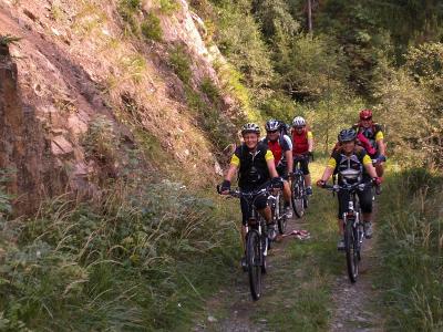
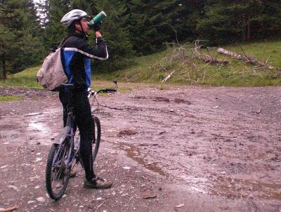
From Nesselwang we rode to Hopferau and then past the Hopfen See. Non stop on to Füssen for a few photos of the Lechfall (photo above which was very full after all this rain). Then across the border in to Austria and on to Vils. In Vils I got a puncture but luckily I had a puncture repair kit and Jon got the piece of metal out of the tyre (with his teeth).

After repairing the puncture we continued back in to Germany and then through Pfronten back to Jons where I realised that some where along the way I had lost my mobile :-(
The track is at http://www.gpsies.com/map.do?fileId=hmzxdhnclejocqas
I didn't take any pictures (beacause I lost my phone) but Jon did and they are at http://picasaweb.google.com/jon.nesselwang/Bike2010#5511995569754757954 Just go right to see the rest.
... link (0 Kommentare) ... comment

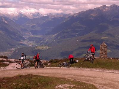
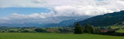
This is a great picture of an Alm just inside Austria that was taken by Max. The water is a large puddle because of all the rain we have had. The original is at http://picasaweb.google.com/neill.hogarth/2010CyclingIV#5511871283737581202 As you can see in the picture, the rain fell as snow in the mountains.
Loads of water in the rivers and stunning views.
Track at http://www.gpsies.com/map.do?fileId=dkazcxtobdikkcfw
Pictures at http://picasaweb.google.com/neill.hogarth/2010CyclingIV#
Jon's pictures start here http://picasaweb.google.com/jon.nesselwang/Bike2010#5511844883354688418 Use the arrow to the right to click through them.
... link (0 Kommentare) ... comment
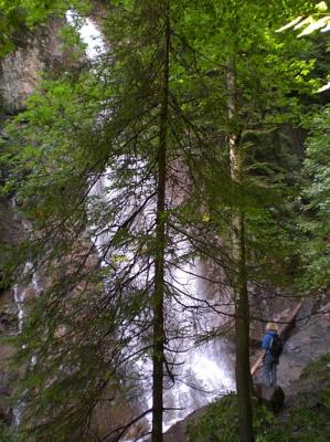
We easily found the cache after the 200 meter climb up past the stream. Because we have had so much rain recently, the waterfall was very impressive.
A link to the cache is here http://www.geocaching.com/seek/cache_details.aspx?guid=2200e03a-d823-409f-b54e-0d3d66fc470a
Photos here http://picasaweb.google.com/neill.hogarth/Geoaching2010#
... link (0 Kommentare) ... comment
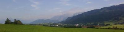
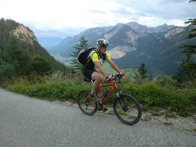
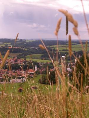
This picture is taken looking East towards Nesselwang. And people ask why I want to live here? The original is at http://picasaweb.google.com/neill.hogarth/2010CyclingIV#5510167697684958354
The same track as here http://www.gpsies.com/map.do?fileId=jhlzirdtszgkgzqo
... link (0 Kommentare) ... comment
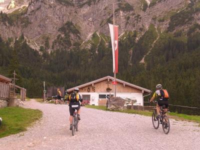
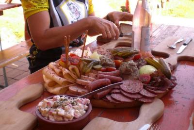
It is a steep climb to the Alm but the Mohren (Weizern and Cola) at the top made it all worth while.
Track at http://www.gpsies.com/map.do?fileId=lsjxntulndcqkvip
Photos at http://picasaweb.google.com/neill.hogarth/2010CyclingIV#
... link (0 Kommentare) ... comment
The weather turned out OK and we cycled up the Engelbergweg to above the Grüne Strich and then down past the Bayern Kurve and the Kronen Hütte.
Christa got nice and wet by falling off in to the biggest puddle she could find.
Track at http://www.gpsies.com/map.do?fileId=exznoxhsqzjrobba
More photos at http://picasaweb.google.com/neill.hogarth/2010CyclingIV#

Christa just climbed out of the huge puddle behind her :-)
... link (0 Kommentare) ... comment
Track is at http://www.gpsies.com/map.do?fileId=nfmeudcwlwxmwmps
Photos at http://picasaweb.google.com/neill.hogarth/2010CyclingIV#
... link (0 Kommentare) ... comment
Great picture by Jon
Track is at http://www.gpsies.com/map.do?fileId=jxgmzuvigaxviofj and yes it is really that steep at kilometer 15 (and a single trail!).
Photos are at http://picasaweb.google.com/neill.hogarth/2010CyclingIV# and Jons photos are at http://picasaweb.google.com/jon.nesselwang/Bike2010#
Sepp wrote a report under the heading Tour 13 19.08.2010 at http://home.allgaeu.org/a3453/2010%20Bike%20Season%20ger.htm
... link (0 Kommentare) ... comment
Track is at http://www.gpsies.com/map.do?fileId=lmsnacyrghhjmufh with a nice steep descent.
Photos at http://picasaweb.google.com/neill.hogarth/2010CyclingIV#
... link (0 Kommentare) ... comment
http://www.geocaching.com/seek/cache_details.aspx?guid=04f9e677-30c4-4f77-a0b2-95b103bbedf6
Got back just in time to walk up the Waterfall path to the Kronenhütte for lunch with the French family and Max. To round things off nicely, we took the summer sledge run down the mountain.
Great photo taken by Max
Photos at http://picasaweb.google.com/neill.hogarth/2010Stuff#
... link (0 Kommentare) ... comment
There were 17 of us in total. The real heroes of the day were the French family. They just got on their bikes and cycled 80kms. Johanna did the whole 100kms!
[photo by Max]
The track is at http://www.gpsies.com/map.do?fileId=qbxkhztionkwubjl
As normal Sepp has written a long report about the whole day in German at http://home.allgaeu.org/a3453/2010%20Lindau.htm
Photos at http://picasaweb.google.com/neill.hogarth/2010Lindau#
Max wrote a report at http://maxhogarth.blogspot.com/2010/08/wednesday-bodensee-tour.html and his photos are at http://picasaweb.google.com/Maximilian.Hogarth/BodenseeTourAugust?authkey=Gv1sRgCN_6ktyc0q63dw#
... link (0 Kommentare) ... comment
It was dark by the time we reached the Fichtelhütte but the view of lights as far as you could see was amazing.
Track at http://www.gpsies.com/map.do?fileId=pdrwucwtzyvccilk
The pictures are at http://picasaweb.google.com/neill.hogarth/2010CyclingIII#
... link (0 Kommentare) ... comment
GPS battery ran out but here is the track from a
previous ride along the same route.
http://www.gpsies.com/map.do?fileId=jhlzirdtszgkgzqo
Full size picture at http://picasaweb.google.com/neill.hogarth/2010CyclingIII#
... link (0 Kommentare) ... comment
When the rain was less we set off back down in to the valley and then decided to ride home via Tannheimertal and Wertachtal. In Tannheimertal it rained again but we had jackets and "aren't made of chocolate". In Wertach Max treated me to an ice and then we cycled home around the Grünten lake. It was however flooded so after Max got very wet feet, we took the road home.
Photos at http://picasaweb.google.com/neill.hogarth/2010Gappenfeldalm#
and the track is at http://www.gpsies.com/map.do?fileId=wsrrgzmdymebamav (1300 meters of climb and 72 kilometers.
Here is Max's report about the day http://maxhogarth.blogspot.com/2010/08/gappenfeldalpe-sunday-biketour.html and his pictures http://picasaweb.google.de/Maximilian.Hogarth/Biking20101?authkey=Gv1sRgCL3U3ayxuvWikwE#
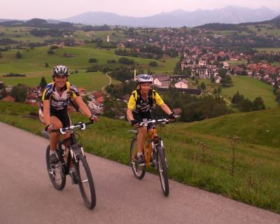
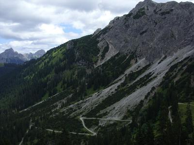
This one that he took is great. It shows just how far we climbed and the spectacular scenery
... link (0 Kommentare) ... comment
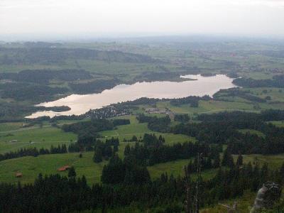
The picture is from last year and shows the Grüntensee from the mountains.
Track at http://www.gpsies.com/map.do?fileId=jtnruefjastcfope
... link (0 Kommentare) ... comment