

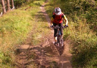
Some short trailing and great views.
Track at http://www.gpsies.com/map.do?fileId=boaxovvspyczbzdg
10km and 500m of climbing.
All the pictures at https://picasaweb.google.com/103827427036815679772/2012Nauders4?authkey=Gv1sRgCKPP8dO7hNGmngE
Wera's pictures at https://picasaweb.google.com/115576074860061116725/Nauders2012?authkey=Gv1sRgCI3bhpCLt6fLfQ
... link (0 Kommentare) ... comment
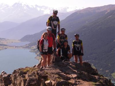
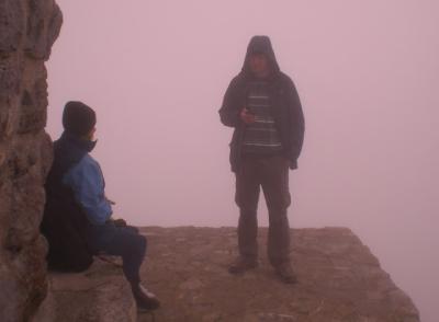
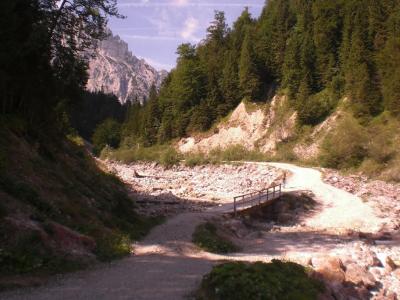
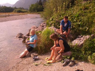
So we used two cable cars and our bikes to cycle round the Reschensee. Started in Austria then downhill in to Italy. Along the shore then up a lift in Italy and then back through the mountains to Austria and a well deserved swim in the Schwarz See.
Track at http://www.gpsies.com/map.do?fileId=klokxmkvubxbqony
48km and 2200m of climbing (but 1400 of that was with the two cable cars)

More photos at https://picasaweb.google.com/103827427036815679772/2012Nauders3?authkey=Gv1sRgCN6t1OCHrMLcSQ#
Wera's pictures at https://picasaweb.google.com/115576074860061116725/Nauders2012?authkey=Gv1sRgCI3bhpCLt6fLfQ
... link (0 Kommentare) ... comment

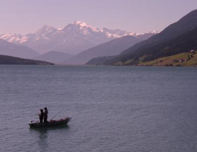
Starting from Nauders in Austria then downhill in to Switzerland. Back in to Italy via the legendary Val D'Uina with its amazing gorge. Cleverly we had already parked the bus in Italy so we drove back to Austria.

Track at http://www.gpsies.com/map.do?fileId=adwuyxlmwjbiirbu
49km and 1500m of climbing.
More pictures at https://picasaweb.google.com/103827427036815679772/2012Nauders2?authkey=Gv1sRgCPqzv7W-hbWmuQE#
Wera's pictures at https://picasaweb.google.com/115576074860061116725/Nauders2012?authkey=Gv1sRgCI3bhpCLt6fLfQ
... link (0 Kommentare) ... comment
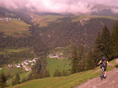
Track at http://www.gpsies.com/map.do?fileId=tqcbnfclmimwfaat
22km and 830m of climbing.
More photos at https://picasaweb.google.com/103827427036815679772/2012Nauders1?authkey=Gv1sRgCL-V6Y_3nqmFeQ#
Wera's pictures at https://picasaweb.google.com/115576074860061116725/Nauders2012?authkey=Gv1sRgCI3bhpCLt6fLfQ
Once again we used the bike holder that Jon and I designed a few years ago and once again it took 10 bikes.

... link (0 Kommentare) ... comment
http://www.gpsies.com/map.do?fileId=gpaqlcdivgbzbyes
27 kms with 300m of climbing.
... link (0 Kommentare) ... comment
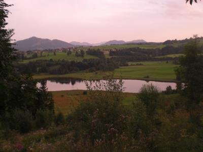
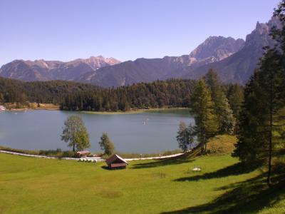
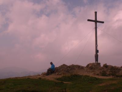
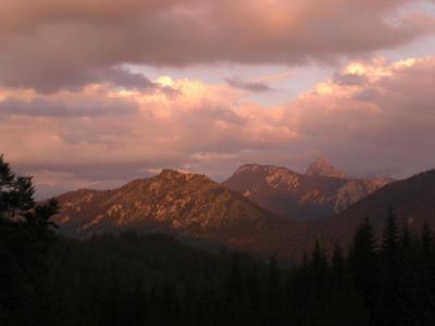
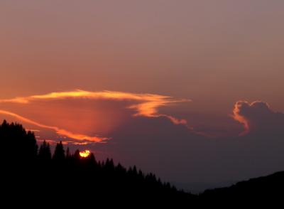
The following picture is the view.
But it was fun anyway. Alison Max and I walked up the 700 meters from the car park and stopped on the way down at the Grüntenhütte for a drink.
More pictures at https://picasaweb.google.com/103827427036815679772/2012#
... link (0 Kommentare) ... comment
Track at http://www.gpsies.com/map.do?fileId=myvtxbpcmpxgrmyc
... link (0 Kommentare) ... comment
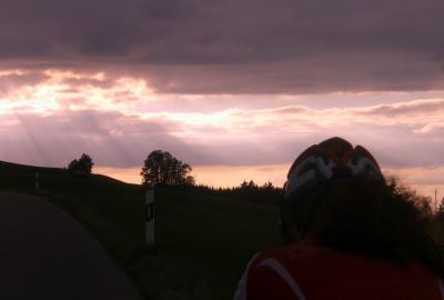
Five of us took part and they were all really fit (except me). I was really wondering what I was doing during the last hour of climbing in the sweltering heat.
After a beer at the top things were great again. Amazing how one drink can make such a difference.
The track is at http://www.gpsies.com/map.do?fileId=rlygdegrslnpweaa. 78 kilometers and nearly 1400 meters of climbing. No wonder I was "tired".
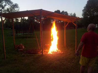
In the evening we barbecued. It's a tough life
More pictures at https://picasaweb.google.com/103827427036815679772/2012CyclingV#
... link (0 Kommentare) ... comment
Nesselwang to Munich. 150km through Bavaria. Visited places I had never been before including the towns of Schongau and Weilheim and the monastory at Andechs. At Andechs they have been brewing beer for hundreds of years so we tried some.
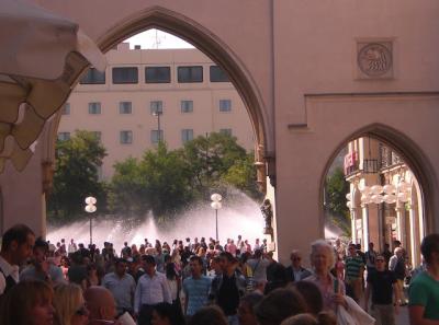
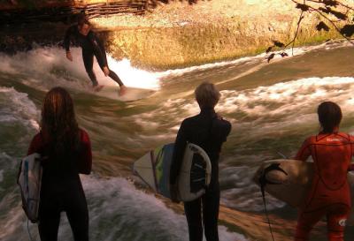
In Munich we ate lunch in the pedestrian zone and then went to the English Garden to watch the wave surfers, eat ice cream and enjoy the sun.
Caught the train home and then cycled the last bit from Seeg to Nesselwang which put our totals for the day at 165km and 1500m of climbing.
The track is saved at GPSies under http://www.gpsies.com/map.do?fileId=jwycyphvnjtnvqpy
More pictures at https://picasaweb.google.com/103827427036815679772/2012CyclingV#
... link (0 Kommentare) ... comment
Track at http://www.gpsies.com/map.do?fileId=rglqxmtakvzzkhsh
More pictures at https://picasaweb.google.com/103827427036815679772/2012CyclingIV#
... link (0 Kommentare) ... comment
Over the Edelsberg and then down the trail to the Stubetal Alp for sausage and chips before returning home.
Track at http://www.gpsies.com/map.do?fileId=ncwbyuhghwhgcdmp
... link (0 Kommentare) ... comment
... link (0 Kommentare) ... comment
Track at http://www.gpsies.com/map.do?fileId=eianufiqzzpghokl
36km and 770m of climbing.
... link (0 Kommentare) ... comment
Track at http://www.gpsies.com/map.do?fileId=ubfkdzdywxvmycer
... link (0 Kommentare) ... comment
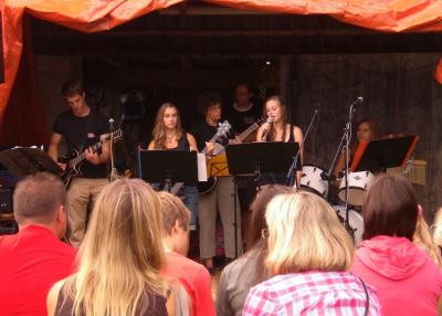
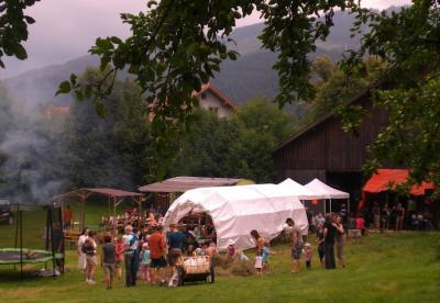
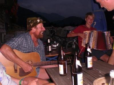
All my pictures and two video clips at https://picasaweb.google.com/103827427036815679772/Viehweidefest2012#
... link (0 Kommentare) ... comment
Track at http://www.gpsies.com/map.do?fileId=rxrxlaycgtakeqlo
40 km and 570 hm
Photos at https://picasaweb.google.com/103827427036815679772/2012CyclingIV#
... link (0 Kommentare) ... comment
http://www.gpsies.com/map.do?fileId=badknwvtdmxqxkrg
700 meters of climbing in 41km.
Photos at https://picasaweb.google.com/103827427036815679772/2012CyclingIV#
Jons photos at https://plus.google.com/photos/100547066824249637955/albums/5725589139170705201/5771410477132026290
... link (0 Kommentare) ... comment
37km and 800hm
Track at http://www.gpsies.com/map.do?fileId=jbxrmywkotgklpdq
More photos at https://picasaweb.google.com/103827427036815679772/2012CyclingIII#
... link (0 Kommentare) ... comment
Route at http://www.gpsies.com/map.do?fileId=bqxhqawwxyonmswa
More pictures at https://picasaweb.google.com/103827427036815679772/2012CyclingIII#
... link (0 Kommentare) ... comment
Track at http://www.gpsies.com/map.do?fileId=ttztexaxitnykfli
26km and 520hm in 2:22 hours.
... link (0 Kommentare) ... comment
track at http://www.gpsies.com/map.do?fileId=wbwrusieexkzhakk
... link (0 Kommentare) ... comment
Track at http://www.gpsies.com/map.do?fileId=hxswqevzrgnqfmkh
... link (0 Kommentare) ... comment