
... newer stories
Sonntag, 26. Mai 2013
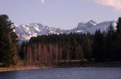
130523 Buronhütte
neill, 00:05h
An overcast Thursday evening and later rain. The second half of the ride was wet and very cold.
17 kms and 460 meters of climbing.
Track at http://www.gpsies.com/map.do?fileId=cfxiucszmssduzcx
Camera was broken as I pushed Jon's buggy over it.
17 kms and 460 meters of climbing.
Track at http://www.gpsies.com/map.do?fileId=cfxiucszmssduzcx
Camera was broken as I pushed Jon's buggy over it.
... link (0 Kommentare) ... comment
Montag, 20. Mai 2013
130516 Mühlbach
neill, 19:44h
The weather forecast said rain but luckily they lied.
An enjoyable tour with more tracks and trails than roads.
28kms and 550 meters of climbing
Track at http://www.gpsies.com/map.do?fileId=zwozmvizmsvvbcvm
An enjoyable tour with more tracks and trails than roads.
28kms and 550 meters of climbing
Track at http://www.gpsies.com/map.do?fileId=zwozmvizmsvvbcvm
... link (0 Kommentare) ... comment
Dienstag, 14. Mai 2013
130514 Tannheimertal
neill, 23:32h
With the "Tuesday Bikers" on a sunny evening. Up in to Austria and then back down in to Germany. Doing 66km/h one meter behind Jon I was wondering how long you need to brake at that speed?
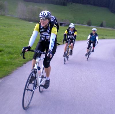
52 km and 561 meters of climbing
Track at http://www.gpsies.com/map.do?fileId=fqmtznpbiqotfpcy
Jon's pictures at https://plus.google.com/photos/100547066824249637955/albums/5865862959006086625/5878189394089432610
52 km and 561 meters of climbing
Track at http://www.gpsies.com/map.do?fileId=fqmtznpbiqotfpcy
Jon's pictures at https://plus.google.com/photos/100547066824249637955/albums/5865862959006086625/5878189394089432610
... link (0 Kommentare) ... comment
Donnerstag, 9. Mai 2013
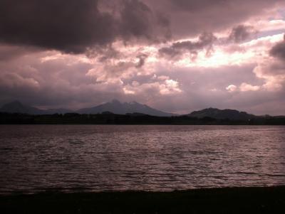
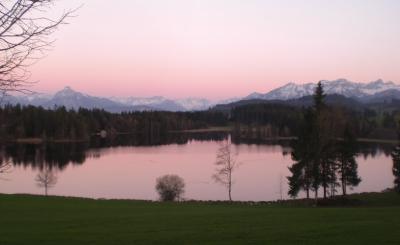
130509 Faulensee
neill, 22:00h
A Sunday tour to a lake I had never even heard of - the Faulensee. We rode over the Beichelstein to get there and add a few meters of climbing and back via Vils in Austria.
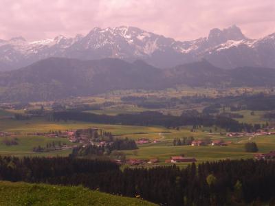
On the way back we also rode "through" the Forgensee lake. It is a resevoir and not currently full so the old road was above water level.
52 kms and nearly 800 meters of climbing.
Track is at http://www.gpsies.com/map.do?fileId=voekzodakucmmnbf
More pictures at https://plus.google.com/photos/103827427036815679772/albums/5876039696493748161?banner=pwa
Jon's pictures are at https://plus.google.com/photos/100547066824249637955/albums/5876255920545131825
... link (0 Kommentare) ... comment
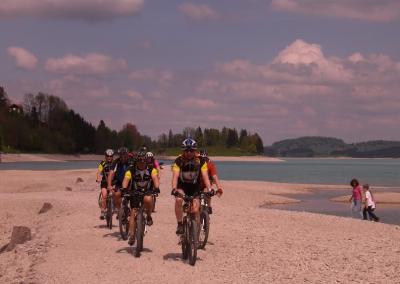
Sonntag, 5. Mai 2013
130505 Postsloch
neill, 23:51h
My first "mountain" mountain biking this year. After the 80kms yesterday, a gentle mountain bike ride half way up the local mountain and back down again.
Only 9km but nearly 400 meters of climbing.
Track at http://www.gpsies.com/map.do?fileId=xnoptxunouqeolxb
Only 9km but nearly 400 meters of climbing.
Track at http://www.gpsies.com/map.do?fileId=xnoptxunouqeolxb
... link (0 Kommentare) ... comment
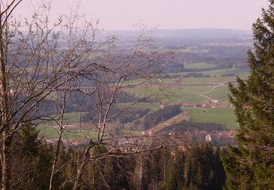
Samstag, 4. Mai 2013
130504 Stötten
neill, 23:23h
Out with Heidi for a training run on our race bikes. We had no plan of where to go and decided at each turn based on in which direction there were the least clouds.
Ended up doing a fantastic 80km trip largely on routes we had never been on before. The old railway line from MArktoberdorf to Roßhaupten has been converted to a cycling path and is fantastic as a race bike route. The next picture is an old station on the route.
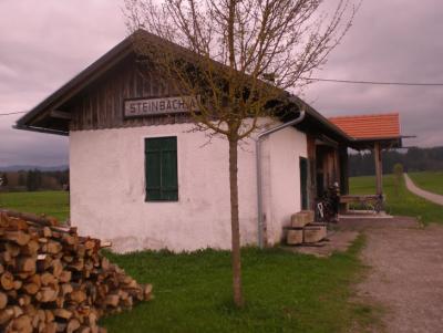
82km with 800 meters of climbing
Track at http://www.gpsies.com/map.do?fileId=yptbysrlcnxhhzme
More pictures at https://plus.google.com/photos/103827427036815679772/albums/5866409348860352993?banner=pwa
Ended up doing a fantastic 80km trip largely on routes we had never been on before. The old railway line from MArktoberdorf to Roßhaupten has been converted to a cycling path and is fantastic as a race bike route. The next picture is an old station on the route.
82km with 800 meters of climbing
Track at http://www.gpsies.com/map.do?fileId=yptbysrlcnxhhzme
More pictures at https://plus.google.com/photos/103827427036815679772/albums/5866409348860352993?banner=pwa
... link (0 Kommentare) ... comment
130502 Pfronten
neill, 23:17h
Thursday evening and 10 of us cycled to and then around Pfronten. We got absolutely soaked in Achtal - the same thing happened there a few years ago.
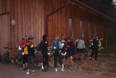
28km and 345 meters of climbing.
Track at http://www.gpsies.com/map.do?fileId=xurgtnlzospzuuwt
More photos at https://plus.google.com/photos/103827427036815679772/albums/5866409348860352993?banner=pwa
28km and 345 meters of climbing.
Track at http://www.gpsies.com/map.do?fileId=xurgtnlzospzuuwt
More photos at https://plus.google.com/photos/103827427036815679772/albums/5866409348860352993?banner=pwa
... link (0 Kommentare) ... comment
Mittwoch, 1. Mai 2013
130501 Mayday
neill, 22:12h
Missed the Tuesday night reace biketour last night so went out for an hour today.
In all the villages I passed through, they were putting up the new maypoles.
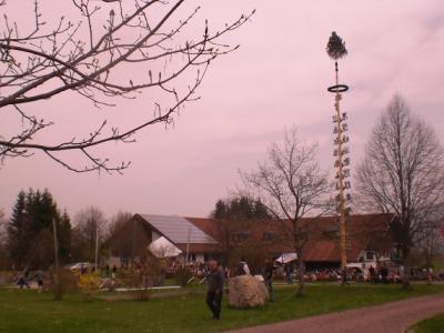
22kms and 250 meters of climbing.
Track at http://www.gpsies.com/map.do?fileId=wiarczqkirgobnqz
In all the villages I passed through, they were putting up the new maypoles.
22kms and 250 meters of climbing.
Track at http://www.gpsies.com/map.do?fileId=wiarczqkirgobnqz
... link (0 Kommentare) ... comment
Freitag, 26. April 2013
130425 Hanging Bridge
neill, 21:44h
A classic "beginning of season" tour.
11 of us were out on a lovely warm spring evening.
28kms and 450 meters of climbing
Track is at http://www.gpsies.com/map.do?fileId=eejopzztpnwzoqww
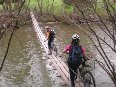
More pictures at https://plus.google.com/photos/103827427036815679772/albums/5866409348860352993?banner=pwa
11 of us were out on a lovely warm spring evening.
28kms and 450 meters of climbing
Track is at http://www.gpsies.com/map.do?fileId=eejopzztpnwzoqww
More pictures at https://plus.google.com/photos/103827427036815679772/albums/5866409348860352993?banner=pwa
... link (0 Kommentare) ... comment
Freitag, 19. April 2013
130418 Sechs Weiher
neill, 02:03h
After the great race bike tour at lunch time, we were out with the mountain bikes this evening. Through the local countryside past six lakes.
22km and 300 meters of climbing
Track at http://www.gpsies.com/map.do?fileId=ynfvqgknblohaxcp
More pictures at https://plus.google.com/photos/103827427036815679772/albums/5866409348860352993?banner=pwa
22km and 300 meters of climbing
Track at http://www.gpsies.com/map.do?fileId=ynfvqgknblohaxcp
More pictures at https://plus.google.com/photos/103827427036815679772/albums/5866409348860352993?banner=pwa
... link (0 Kommentare) ... comment
Donnerstag, 18. April 2013
130418 Ottaker and back
neill, 17:23h
Sun shine and warm weather today. It is a Wednesday but by taking an extended „lunch break“ we (Heidi and I) managed a two hour race bike tour across the Allgäu hills. 40 kilometers and 620 meters of climbing with an average speed of 20km/h isn't bad for the first „serious“ ride of 2013.

Track is at http://www.gpsies.com/map.do?fileId=gyyasgininvacdja
Track is at http://www.gpsies.com/map.do?fileId=gyyasgininvacdja
... link (0 Kommentare) ... comment
Montag, 15. April 2013
140415 Grüntensee
neill, 21:39h
A quick run round the lake on the race bike after work.
http://www.gpsies.com/map.do?fileId=xsavjvjghbbjebbe
19.3km 217m of climb
http://www.gpsies.com/map.do?fileId=xsavjvjghbbjebbe
19.3km 217m of climb
... link (0 Kommentare) ... comment
Sonntag, 14. April 2013
140414 Wertach Valley
neill, 18:10h
Another lovely day so once again off on my mountain bike. This time down in to the Wertach valley and then up again and then down again and so on.

Some snow covered patches but mostly just muddy.
http://www.gpsies.com/map.do?fileId=txidywcmwjpnzwhq
20km 258m of climbing.
Photos at https://plus.google.com/photos/103827427036815679772/albums/5866409348860352993?banner=pwa
Some snow covered patches but mostly just muddy.
http://www.gpsies.com/map.do?fileId=txidywcmwjpnzwhq
20km 258m of climbing.
Photos at https://plus.google.com/photos/103827427036815679772/albums/5866409348860352993?banner=pwa
... link (0 Kommentare) ... comment
Samstag, 13. April 2013
130413 Spring at last
neill, 23:20h
A week ago I was skiing but finally spring has arrived so I went out for my first ride of the year on my mountain bike - in shorts!
http://www.gpsies.com/map.do?fileId=fhsenklcvyjsngwy
22.7km 347 meters of climb 1hr38min.
http://www.gpsies.com/map.do?fileId=fhsenklcvyjsngwy
22.7km 347 meters of climb 1hr38min.
... link (0 Kommentare) ... comment
130412 Brocken
neill, 23:11h
While on a business trip to nearby Werdingerrode we took a trip on the Brocken Railway (http://www.hsb-wr.de/en/start/) to the top of the Brocken mountain pulled by a narrow gauge engine.

Many years ago when I was in the Royal Signals based in Germany we were always warned that the other side (Russians and East Germans) was sat on the Brocken listening to us.
We visited the building where they had all there listening equipment and the dome that the antennas were in. A quarter of a century ago I would never have believed I would be in the radio dome on the Brocken one day.

This picture was taken inside the dome.
Many years ago when I was in the Royal Signals based in Germany we were always warned that the other side (Russians and East Germans) was sat on the Brocken listening to us.
We visited the building where they had all there listening equipment and the dome that the antennas were in. A quarter of a century ago I would never have believed I would be in the radio dome on the Brocken one day.
This picture was taken inside the dome.
... link (0 Kommentare) ... comment
Samstag, 6. April 2013
130406 Oberjoch
neill, 23:19h
The end of the first April week and time we were cycling. But there is still snow everywhere.
But rather than complain, Max and I went skiing in Oberjoch.
Perfect snow conditions, absolutely no people (no surprise there) and absolutely no visibility.

We had hoped we would come out above the clouds but we were a few hundred meters too low.
But rather than complain, Max and I went skiing in Oberjoch.
Perfect snow conditions, absolutely no people (no surprise there) and absolutely no visibility.
We had hoped we would come out above the clouds but we were a few hundred meters too low.
... link (0 Kommentare) ... comment
... older stories