
... newer stories
Freitag, 21. Juni 2013
130620 Himmelsreich
neill, 17:37h
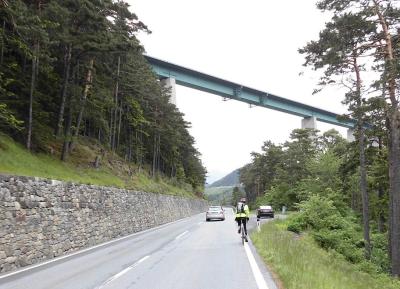
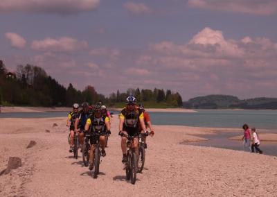
Two hours before we were due to set off this evening there was a huge thunder storm with sheets of water. By the time we left the sun was shining again so seven of us cycled up the long steep track to the Himmelsreich pass in Pfronten.
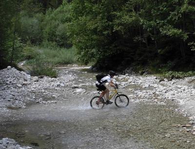
From Himmelreich we followed the super steep and stony trail back down in to the valley. All of us managed to cycle at the least most of the way which was a great achievement.
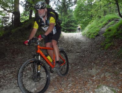
Photo by Jon
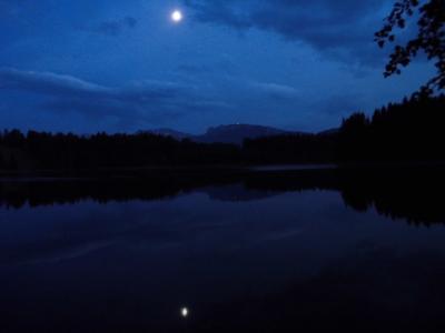
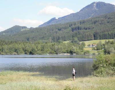
We next cycled to the Kögelweiher lake for a swim in the moonlight. It really is a tough life.
30 kms and 574 meters of climbing
http://www.gpsies.com/map.do?fileId=bvodnpsvdghdnnre
Pictures at https://plus.google.com/photos/103827427036815679772/albums/5887203753058455121/5892013168505436338?banner=pwa&pid=5892013168505436338&oid=103827427036815679772
Jons photos are at https://plus.google.com/photos/100547066824249637955/albums/5865862959006086625/5891854948848635890?pid=5891854948848635890&oid=100547066824249637955
From Himmelreich we followed the super steep and stony trail back down in to the valley. All of us managed to cycle at the least most of the way which was a great achievement.
Photo by Jon
We next cycled to the Kögelweiher lake for a swim in the moonlight. It really is a tough life.
30 kms and 574 meters of climbing
http://www.gpsies.com/map.do?fileId=bvodnpsvdghdnnre
Pictures at https://plus.google.com/photos/103827427036815679772/albums/5887203753058455121/5892013168505436338?banner=pwa&pid=5892013168505436338&oid=103827427036815679772
Jons photos are at https://plus.google.com/photos/100547066824249637955/albums/5865862959006086625/5891854948848635890?pid=5891854948848635890&oid=100547066824249637955
... link (0 Kommentare) ... comment
Mittwoch, 19. Juni 2013
130618 Marktoberdorf
neill, 01:10h
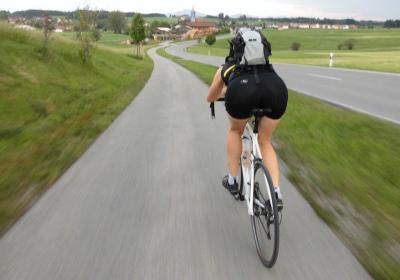
At the end of a really hot day (33°C in the shade) we went out on our race bikes this evening. Finished the ride with a swim in the warm Grundweiher. When I got back two ex-colleagues invited me for a drink outside the local pub. What a great way to spend an evening.
53km with 600 meters of climbing.
http://www.gpsies.com/map.do?fileId=wqgefhyjwrtpuchw
Pictures at https://plus.google.com/photos/103827427036815679772/albums/5887203753058455121/5890934060708825778?banner=pwa&pid=5890934060708825778&oid=103827427036815679772
Jons pictures at https://plus.google.com/photos/100547066824249637955/albums/5865862959006086625/5891108934355601650?pid=5891108934355601650&oid=100547066824249637955
... link (0 Kommentare) ... comment
Sonntag, 16. Juni 2013
130616 Rehbach
neill, 20:46h
Gabi, Irene, Max and I went for a gentle ride up the Vils valley and then back down the Wertach valley. For three of us it was a chance to reduce the alcohol in our blood after Christa's 50th birthday yesterday.
Pictures at https://plus.google.com/photos/103827427036815679772/albums/5887203753058455121/5890126296502806386?banner=pwa&pid=5890126296502806386&oid=103827427036815679772
38 kms and 590 meters of climbing.
Track at http://www.gpsies.com/map.do?fileId=ecxbollcdpduenem
Max's report at http://maxhogarth.blogspot.de/2013/06/sunday-rehbach.html
... link (0 Kommentare) ... comment
Freitag, 14. Juni 2013
130613 Reuttewanne
neill, 15:51h
Nine of us sweated our way to the Upper Reuttewanne Alp and then enjoyed the run down in to Jungholz. Because it was such a nice evening, we then returned to Nesselwang through the Vils valley.
Jon joined Group 2 today. Welcome to fun cycling Jon.
Pictures at https://plus.google.com/photos/103827427036815679772/albums/5887203753058455121/5890128364602735986?banner=pwa&pid=5890128364602735986&oid=103827427036815679772
27 kms and 750 meters of climbing.
Track at http://www.gpsies.com/map.do?fileId=gfsoizgrvyiismls
Jon's pictures at https://plus.google.com/photos/100547066824249637955/albums/5865862959006086625/5889317188572514162?pid=5889317188572514162&oid=100547066824249637955
... link (0 Kommentare) ... comment
Samstag, 8. Juni 2013
130608 Jochpass
neill, 23:46h
Out alone on my race bike. Over the Jochpass to Sonthofen and then back over the Kranzegger Steig.
62kms with 750 meters of climbing and a fantastic 300 meter descent to Hindelang.
Track at http://www.gpsies.com/map.do?fileId=dahhfaawhyjdebvq
62kms with 750 meters of climbing and a fantastic 300 meter descent to Hindelang.
Track at http://www.gpsies.com/map.do?fileId=dahhfaawhyjdebvq
... link (0 Kommentare) ... comment
Freitag, 7. Juni 2013
130606 Sorg Alpe
neill, 12:43h
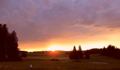
Finally a Thursday evening that was warm and sunny. We cycled through Vilstal and Jungholz to the Sorg Alpe. Shortly after we arrived the other group also appeared so there were twenty of us in total.
Tried to cycle back along the lake but the path was still under water from the flooding.
35kms and 580 meters of climbing
Track at http://www.gpsies.com/map.do?fileId=vmqvzdkpumwpatfs
Pictures at https://picasaweb.google.com/103827427036815679772/2013CyclingIII
Tried to cycle back along the lake but the path was still under water from the flooding.
35kms and 580 meters of climbing
Track at http://www.gpsies.com/map.do?fileId=vmqvzdkpumwpatfs
Pictures at https://picasaweb.google.com/103827427036815679772/2013CyclingIII
... link (0 Kommentare) ... comment
Freitag, 31. Mai 2013
130530 Brenner Pass
neill, 19:30h
Got out of the train at the top of the Brenner Pass and then cycled the 38kms downhill to the station in Innsbruck.
We left the top of the pass in rain and arrived in rain but the 30 kms in between were dry allowing for some fast curves. Fun!
Track at http://www.gpsies.com/map.do?fileId=aismbsddjhknyowg
Photos at https://picasaweb.google.com/103827427036815679772/2013Milan?noredirect=1
We left the top of the pass in rain and arrived in rain but the 30 kms in between were dry allowing for some fast curves. Fun!
Track at http://www.gpsies.com/map.do?fileId=aismbsddjhknyowg
Photos at https://picasaweb.google.com/103827427036815679772/2013Milan?noredirect=1
... link (0 Kommentare) ... comment
130530 Rovereto
neill, 19:28h
Had a few hours to wait for the train to the Brenner Pass so we cycled 480 meters up out of the valley, changed in to dry tricots and then cycled back down for a cappucino and ice.
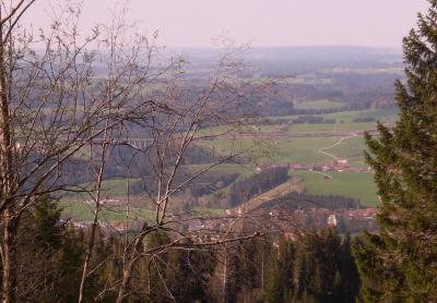
Despite the 500 kms the last four days, the route was great fun and the views were stunning.
16 kms and 480 meters of climbing. Track at http://www.gpsies.com/map.do?fileId=zcbugechphrrkqyl
Photos at https://picasaweb.google.com/103827427036815679772/2013Milan?noredirect=1
Despite the 500 kms the last four days, the route was great fun and the views were stunning.
16 kms and 480 meters of climbing. Track at http://www.gpsies.com/map.do?fileId=zcbugechphrrkqyl
Photos at https://picasaweb.google.com/103827427036815679772/2013Milan?noredirect=1
... link (0 Kommentare) ... comment
Mittwoch, 29. Mai 2013
130529 Lake Garda
neill, 21:58h
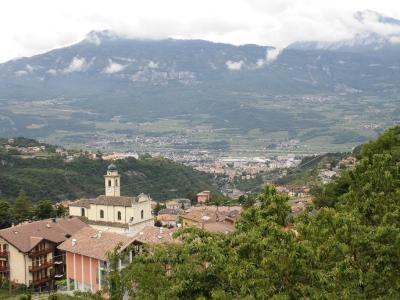
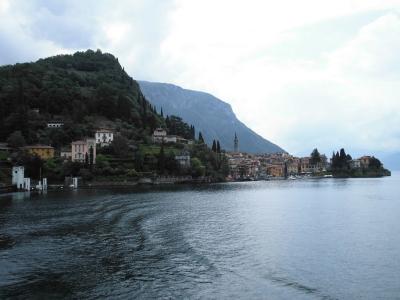
On the way home from Milan, we got off the train at Desenzano del Garda at the south end of Lake Garda and then cycled along the west shore before crossing the pass to Rovereto.
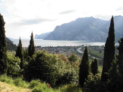
The route was 88kms with "only" 760 meters of climbing and would have been easy if I hadn't have cycled the 400 kms the previous three days.
http://www.gpsies.com/map.do?fileId=pcpiwstehaeudkwh
The weather was warm but windy. Only half an hour of rain and we sat that out while eating pizza.
Photos at https://picasaweb.google.com/103827427036815679772/2013Milan?noredirect=1
... link (0 Kommentare) ... comment
Dienstag, 28. Mai 2013
130526 Milan
neill, 21:27h
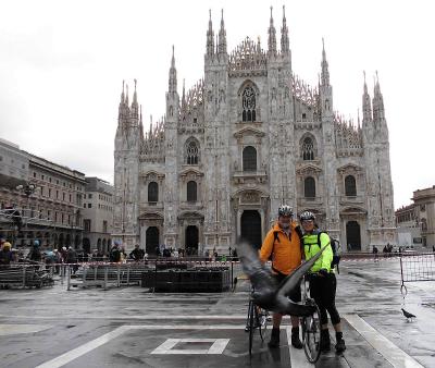
Two of us took three days to cycle the 418kms from Nesselwang to Milan. Set off in rain and at a temperature of 6°C but the weather got better and we had a fun five days (including the two days of cycling and train riding to get back).
418 kms with 4000 meters of climbing. Track at http://www.gpsies.com/map.do?fileId=anftazlpzetzogeg
The first day we cycled from home, over the Fernpass and then along the Inn Valley to beyond Landeck. On the second day we rode in to Switzerland, on up to St. Moritz (and the Cresta Run) and then over the Maloja Pass. The third day we rode past Lake Como and on to Milan. On the fourth day we rode to the cathedral for a photo and then caught the train to start home.
Photos at https://picasaweb.google.com/103827427036815679772/2013Milan?noredirect=1
... link (0 Kommentare) ... comment
Sonntag, 26. Mai 2013
130523 Buronhütte
neill, 00:05h
An overcast Thursday evening and later rain. The second half of the ride was wet and very cold.
17 kms and 460 meters of climbing.
Track at http://www.gpsies.com/map.do?fileId=cfxiucszmssduzcx
Camera was broken as I pushed Jon's buggy over it.
17 kms and 460 meters of climbing.
Track at http://www.gpsies.com/map.do?fileId=cfxiucszmssduzcx
Camera was broken as I pushed Jon's buggy over it.
... link (0 Kommentare) ... comment
Montag, 20. Mai 2013
130516 Mühlbach
neill, 19:44h
The weather forecast said rain but luckily they lied.
An enjoyable tour with more tracks and trails than roads.
28kms and 550 meters of climbing
Track at http://www.gpsies.com/map.do?fileId=zwozmvizmsvvbcvm
An enjoyable tour with more tracks and trails than roads.
28kms and 550 meters of climbing
Track at http://www.gpsies.com/map.do?fileId=zwozmvizmsvvbcvm
... link (0 Kommentare) ... comment
Dienstag, 14. Mai 2013
130514 Tannheimertal
neill, 23:32h
With the "Tuesday Bikers" on a sunny evening. Up in to Austria and then back down in to Germany. Doing 66km/h one meter behind Jon I was wondering how long you need to brake at that speed?
52 km and 561 meters of climbing
Track at http://www.gpsies.com/map.do?fileId=fqmtznpbiqotfpcy
Jon's pictures at https://plus.google.com/photos/100547066824249637955/albums/5865862959006086625/5878189394089432610
52 km and 561 meters of climbing
Track at http://www.gpsies.com/map.do?fileId=fqmtznpbiqotfpcy
Jon's pictures at https://plus.google.com/photos/100547066824249637955/albums/5865862959006086625/5878189394089432610
... link (0 Kommentare) ... comment
Donnerstag, 9. Mai 2013
130509 Faulensee
neill, 22:00h
A Sunday tour to a lake I had never even heard of - the Faulensee. We rode over the Beichelstein to get there and add a few meters of climbing and back via Vils in Austria.
On the way back we also rode "through" the Forgensee lake. It is a resevoir and not currently full so the old road was above water level.
52 kms and nearly 800 meters of climbing.
Track is at http://www.gpsies.com/map.do?fileId=voekzodakucmmnbf
More pictures at https://plus.google.com/photos/103827427036815679772/albums/5876039696493748161?banner=pwa
Jon's pictures are at https://plus.google.com/photos/100547066824249637955/albums/5876255920545131825
... link (0 Kommentare) ... comment
Sonntag, 5. Mai 2013
130505 Postsloch
neill, 23:51h
My first "mountain" mountain biking this year. After the 80kms yesterday, a gentle mountain bike ride half way up the local mountain and back down again.
Only 9km but nearly 400 meters of climbing.
Track at http://www.gpsies.com/map.do?fileId=xnoptxunouqeolxb
Only 9km but nearly 400 meters of climbing.
Track at http://www.gpsies.com/map.do?fileId=xnoptxunouqeolxb
... link (0 Kommentare) ... comment
... older stories