
... newer stories
Mittwoch, 6. August 2014
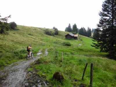
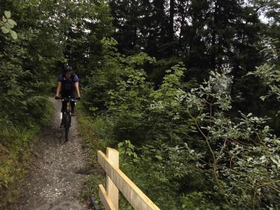
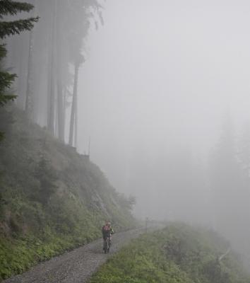
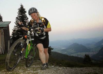
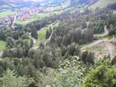
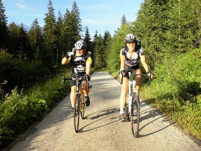
140805 Tannheimertal
neill, 11:31h
The "standard" ride through Tannheimertal. With Moni and Heidi. It didn't rain until we got back to Nesselwang.
52kms and 590 meters of climbing
Track at http://www.gpsies.com/map.do?fileId=klsojlkpbucpnqgy
52kms and 590 meters of climbing
Track at http://www.gpsies.com/map.do?fileId=klsojlkpbucpnqgy
... link (0 Kommentare) ... comment
Sonntag, 3. August 2014
140803 Mittelberg
neill, 22:20h
Heidi and I both needed training time to complete our training schedules this week so we spent two hours riding up and down hills.
34kms and 660 meters of climbing
Track is at http://www.gpsies.com/map.do?fileId=vucwzcmplmamzfmo
34kms and 660 meters of climbing
Track is at http://www.gpsies.com/map.do?fileId=vucwzcmplmamzfmo
... link (0 Kommentare) ... comment
140802 Nesselwang Marktfest
neill, 15:48h
Last night was the annual Marktfest in Nesselwang
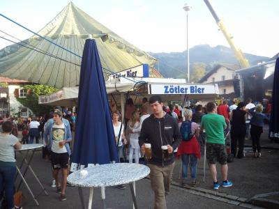
A video I took at midnight is at https://plus.google.com/u/0/photos/103827427036815679772/albums/6035783557911106593/6043304149483009730?pid=6043304149483009730&oid=103827427036815679772
A video I took at midnight is at https://plus.google.com/u/0/photos/103827427036815679772/albums/6035783557911106593/6043304149483009730?pid=6043304149483009730&oid=103827427036815679772
... link (0 Kommentare) ... comment
Freitag, 1. August 2014
140731 Seeg
neill, 20:20h
A fantastic route worked out by Wera. Through spectacular Allgäu scenery. We finished with a swim in the Kögelweiher.
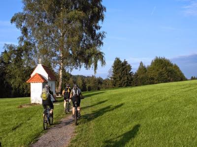
41km and 680 meters of climbing
Track at http://www.gpsies.com/map.do?fileId=uapcfqmirlwlqhrt
Photos at https://plus.google.com/u/0/photos/103827427036815679772/albums/6030336146678088705
41km and 680 meters of climbing
Track at http://www.gpsies.com/map.do?fileId=uapcfqmirlwlqhrt
Photos at https://plus.google.com/u/0/photos/103827427036815679772/albums/6030336146678088705
... link (0 Kommentare) ... comment
Mittwoch, 30. Juli 2014
140729 Pfeiferberg
neill, 09:15h
A wet Tuesday again so Heidi, Max, Nico and I went out on our mountain bikes. Wet but fun.
32km and 884 meters of climbing
Track is at http://www.gpsies.com/map.do?fileId=nuxenltvkatcrpfs
Max's blog is at http://maxhogarth.blogspot.de/2014/07/stubentalalm-and-obere-reuterwanne.html
32km and 884 meters of climbing
Track is at http://www.gpsies.com/map.do?fileId=nuxenltvkatcrpfs
Max's blog is at http://maxhogarth.blogspot.de/2014/07/stubentalalm-and-obere-reuterwanne.html
... link (0 Kommentare) ... comment
Sonntag, 27. Juli 2014
140727 Füssen
neill, 15:31h
Out alone on my race bike trying to get the hours finished for this weeks training program. It rained before and after the ride but not during.
49km and 540 meters of climbing
Track at http://www.gpsies.com/map.do?fileId=uystbzpjrkhzsejk
49km and 540 meters of climbing
Track at http://www.gpsies.com/map.do?fileId=uystbzpjrkhzsejk
... link (0 Kommentare) ... comment
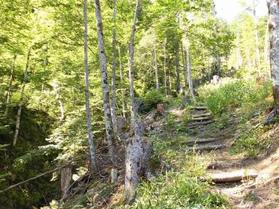
Freitag, 25. Juli 2014
140724 Reuttewanne
neill, 09:21h
Up passed the Haslacher Alm and then on to the Obere Reuttewanne Alp. All the way trying to keep my pulse as low as possible.
Down a great trail that Wera showed us - Suzi and Jon both fell off at the stony bits.
A beer in the Untere Reutewanne Alp and then Group 1 turned up so I cycled back up to the upper Alp with them and then back home the way we had come in the dark.
21km with 870 meters of climbing
Track is at http://www.gpsies.com/map.do?fileId=kfpribhcicdavbxt
Pictures at https://plus.google.com/u/0/photos/103827427036815679772/albums/6030336146678088705
Jon's pictures are at https://plus.google.com/photos/+JonFrench/albums/6001035885012242001
... link (0 Kommentare) ... comment
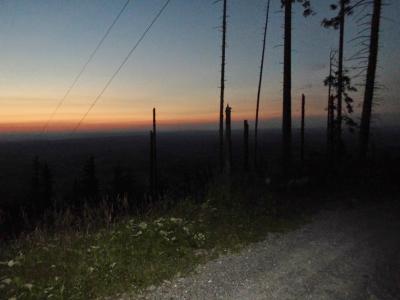
Mittwoch, 23. Juli 2014
140722 Edelsberg
neill, 00:16h
Lots of rain forecast and lots fell so four of us went out with mountain bikes and rode up the Edelsberg - from the front and then from the back. Despite the rain and low cloud it was a fantastic ride with three great people.
22km and 1085 kms of climbing.
Track at http://www.gpsies.com/map.do?fileId=qxwulvjckymvpsyo
Picture by Max
Max's blog is at http://maxhogarth.blogspot.de/2014/07/kappler-alm-gundhutte-and-fichtelhutte.html
Pictures at https://plus.google.com/u/0/photos/103827427036815679772/albums/6030336146678088705
... link (0 Kommentare) ... comment
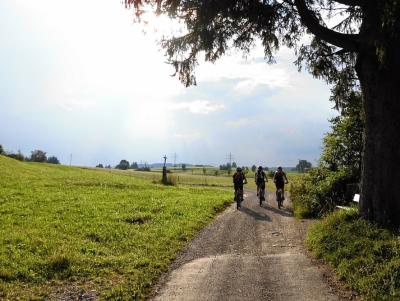
140720 Wald
neill, 00:14h
First of all to the lake and back with Alison and the mountain bikes and then a gentle race bike around Allgäu.
49km and 720 meters of climbing
Track at http://www.gpsies.com/map.do?fileId=crbeteqiqksjlxvd
49km and 720 meters of climbing
Track at http://www.gpsies.com/map.do?fileId=crbeteqiqksjlxvd
... link (0 Kommentare) ... comment
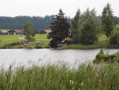
Samstag, 19. Juli 2014
140719 Roßberg Alpe
neill, 21:41h
1200 meters of climbing with the road bike at 34°C.
Just me alone on my road bike. The long way to the Roßberg Alpe for a "Brotzeit".
In the evening I went swimming with Rhiannon.

67 km
Track at http://www.gpsies.com/map.do?fileId=zqfnthjzbphwcnsy
Pictures at https://plus.google.com/u/0/photos/103827427036815679772/albums/6030336146678088705
Just me alone on my road bike. The long way to the Roßberg Alpe for a "Brotzeit".
In the evening I went swimming with Rhiannon.
67 km
Track at http://www.gpsies.com/map.do?fileId=zqfnthjzbphwcnsy
Pictures at https://plus.google.com/u/0/photos/103827427036815679772/albums/6030336146678088705
... link (0 Kommentare) ... comment
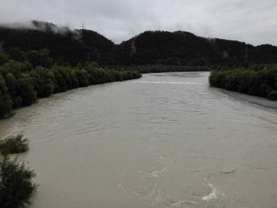
140719 Taxi for the water rescue
neill, 14:30h
This morning I was a taxi for the water rescue boat.
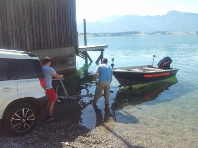
Pictures at https://plus.google.com/u/0/photos/103827427036815679772/albums/6035783557911106593
Pictures at https://plus.google.com/u/0/photos/103827427036815679772/albums/6035783557911106593
... link (0 Kommentare) ... comment
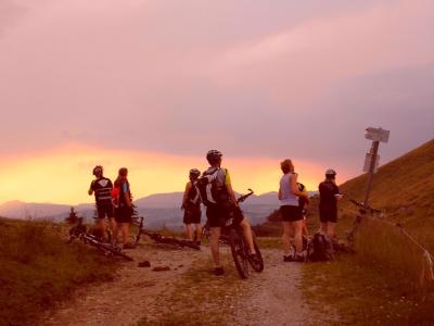
Freitag, 18. Juli 2014
140717 Edelsberg
neill, 11:01h
10 of us rode into Pfronten and then along Vilstal. We then turned up the hill to the Edelsberg. Enjoyed great views toned red by the sunset and then the ride down to the "Bistro Hoigarte".
Another great evening in the mountains.
35 km and 970 meters of climbing
Track is at http://www.gpsies.com/map.do?fileId=ngfgmclaslqfvimu
Pictures are at https://plus.google.com/u/0/photos/103827427036815679772/albums/6030336146678088705
Another great evening in the mountains.
35 km and 970 meters of climbing
Track is at http://www.gpsies.com/map.do?fileId=ngfgmclaslqfvimu
Pictures are at https://plus.google.com/u/0/photos/103827427036815679772/albums/6030336146678088705
... link (0 Kommentare) ... comment
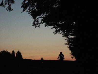
Mittwoch, 16. Juli 2014
140715 Jochpass
neill, 00:17h
A quick 1000 meters of climbing after work.
Three of us went through the Königsstrasse to Sonthofen and then back via the Jochpass.
At the bottom of the pass the Bad Hindelangers were playing their Alp Horns and at the top the Oberjochers. Jon made a video with the Alphorns as background music. You can watch it at https://www.facebook.com/photo.php?v=10204352693965926
66 kms
Track at http://www.gpsies.com/map.do?fileId=kfmvuqaxwahrtjqm
Jon's photos ara at https://plus.google.com/photos/+JonFrench/albums/6001035885012242001/6036597563877839778?pid=6036597563877839778&oid=100547066824249637955
... link (0 Kommentare) ... comment
Montag, 14. Juli 2014
140714 Water Skiing
neill, 23:38h
Annual TV Nesselwang trip to water skiing. A lot of kids out on the boards for the first time and a few experts showing how it is done.
Great fun!
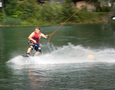
Lucas French on a wave board.
Pictures at https://plus.google.com/u/0/photos/103827427036815679772/albums/6036002061461750641
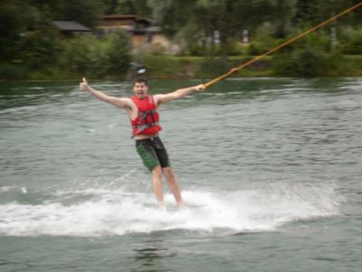
Max showing us how to ride a "plate".
Great fun!
Lucas French on a wave board.
Pictures at https://plus.google.com/u/0/photos/103827427036815679772/albums/6036002061461750641
Max showing us how to ride a "plate".
... link (0 Kommentare) ... comment
Sonntag, 13. Juli 2014
140713 Breitenberg
neill, 23:30h
A late afternoon Sunday tour up the Breitenberg. First time in three years and definitely easier than back then. The training is paying off.
Three of us had never cycled up the Breitenberg and were amazed by the stunning view at the top.
On the way home we stopped at the Kögelhof.

47 km and 1170 meters of climbing
Track at http://www.gpsies.com/map.do?fileId=avdewgmsegpxlwqw
Pictures at https://plus.google.com/u/0/photos/103827427036815679772/albums/6030336146678088705
Three of us had never cycled up the Breitenberg and were amazed by the stunning view at the top.
On the way home we stopped at the Kögelhof.
47 km and 1170 meters of climbing
Track at http://www.gpsies.com/map.do?fileId=avdewgmsegpxlwqw
Pictures at https://plus.google.com/u/0/photos/103827427036815679772/albums/6030336146678088705
... link (0 Kommentare) ... comment
Samstag, 12. Juli 2014
140712 Weissensee
neill, 20:28h
Race bike trip in the rain on my own.
36km and 440 meters of climbing.
Track is at http://www.gpsies.com/map.do?fileId=hcdkmjvkiuqzddmr
36km and 440 meters of climbing.
Track is at http://www.gpsies.com/map.do?fileId=hcdkmjvkiuqzddmr
... link (0 Kommentare) ... comment
Freitag, 11. Juli 2014
140710 Kappeler Alp
neill, 10:07h
It has been raining since Monday but it stopped for a bit this evening so we cycled up to the Kapeller Alp. Left in cloudy overcast, cycled up in drizzle and down again in pouring rain.
We were in the pub very early :-)
16 km and 636 meters of climbing
Track at http://www.gpsies.com/map.do?fileId=vqdohhypbsdkslrb
Photos at https://plus.google.com/u/0/photos/103827427036815679772/albums/6030336146678088705
We were in the pub very early :-)
16 km and 636 meters of climbing
Track at http://www.gpsies.com/map.do?fileId=vqdohhypbsdkslrb
Photos at https://plus.google.com/u/0/photos/103827427036815679772/albums/6030336146678088705
... link (0 Kommentare) ... comment
... older stories