
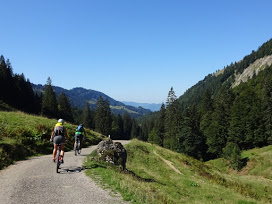
Took the race bike and cycled to the ski arena in Ofterschwang. I then cycled on to Obermaiselstein where the village council would like to offer refugees free Wifi.
Round the back of the Ochsenberg and then home via the Jochpass.
100km and 1288meters of climbing.
http://www.gpsies.com/map.do?fileId=ylnvjjxtphncluni
Life is great when you can combine work and fun
... link (0 Kommentare) ... comment
24km and 485 meters of climbing
http://www.gpsies.com/map.do?fileId=tuqfyhgtgnzmtnxk
... link (0 Kommentare) ... comment
Race bike ride through Tammheimertal
57km with 700 meters of climbing.
http://www.gpsies.com/map.do?fileId=rrlihdkpcqycimhn
... link (0 Kommentare) ... comment
20km and 200 meters of climbing
http://www.gpsies.com/map.do?fileId=eknfjdchtluihwgo
... link (0 Kommentare) ... comment

15km and 560 meters of climbing.
Track is at http://www.gpsies.com/map.do?fileId=jtwitgohvsuvqeey
Pictures are at https://goo.gl/photos/jfzb2vzuEWFLf5oaA
... link (0 Kommentare) ... comment
Lonch at the Pizzeria and then the long drive home.
12km with 370 meters of climbing. Track is at
http://www.gpsies.com/map.do?fileId=fkauztbjtqxrefgl
My pictures are at https://goo.gl/photos/odTbfVPddLC5jhZL8
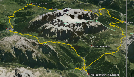
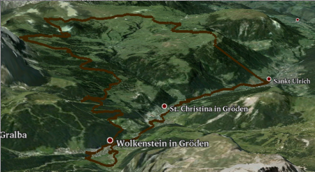
And Hopsing's report of the whole holiday (which is well worth a read if you understand German) is here -http://www.frenchie.de/4_Tage_Wolkenstein_Sep_2015.html
... link (0 Kommentare) ... comment
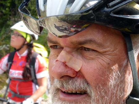
At the bottom we took two cable cars back up to a summit. From the top there was an extra bike park trail so we followed that all the way down to the road. I was too slow over a jump so nosedived and landed on my head. Broke my helmet.
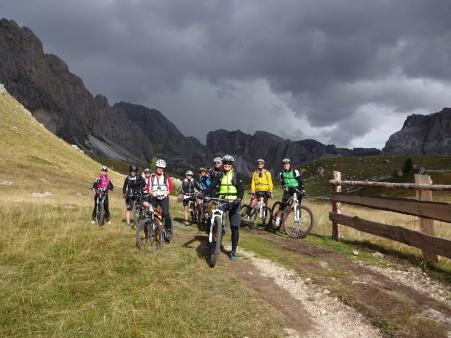
Back up to another pass and then more trailing. Mud paths, ski slopes and rocky tracks. Eventually things got serious and we cycled back up to a mountain hut at the top of the pass for a fantastic lunch.
From the pass it was another long series of downhills and then uphill past a monstrous landslide. Finally we took a last lift to the top of the pass and then a stunning trail almost all the way back down.
Finished with coffee in the village.
54km with 3075 meters of climbing - but most of that with lifts.
7km and 1800 meters of climbing was with lifts.
Track is at
http://www.gpsies.com/map.do?fileId=yqegbezoplkwhsyt
My pictures are at https://goo.gl/photos/odTbfVPddLC5jhZL8
Hubert's pictures at https://goo.gl/q82wN8
Caro's pictures at https://drive.google.com/folderview?id=0B8GQ5A_ddT-wWTBORlZyWXlMdFk&usp=sharing&tid=0B8GQ5A_ddT-wZ25BZ1g3ZmdlUW8
Stefanos's pictures at https://drive.google.com/folderview?id=0B8GQ5A_ddT-wT1o1REVkMWd5Sk0&usp=sharing&tid=0B8GQ5A_ddT-wZ25BZ1g3ZmdlUW8
Inge's pictures are at https://picasaweb.google.com/SpyderwomanTV/Wolkenstein3Tag120915?authkey=Gv1sRgCJ6u_MiEjYzEag&feat=email
... link (0 Kommentare) ... comment
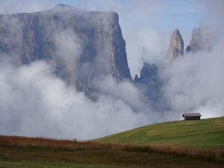
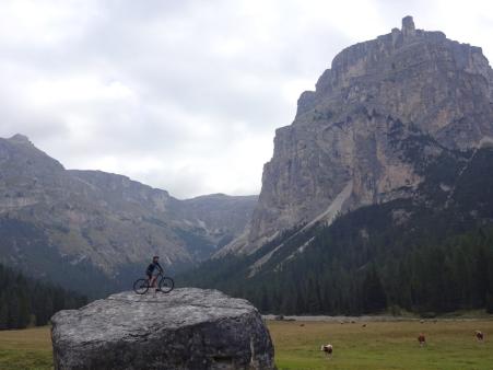
Next we used a cable car to reach the plateau. Going uphill we disappeared into the clouds but at the top were met by sunshine and stunning views. We cycled in a circle around the plateau stopping off for Capuccino at a mountain hut. At the hut I fished some bits of tree out of my underpants. Reminders of the trail through the undergrowth. We continued across fields and lonely lanes eventually crossing through a deep valley After the climb we stopped for a, by now well deserved, late lunch. Good food with views in to the snow sprinkled mountains. (It was cold last night and only warm today when the sun came out.)
After lunch it was all gentle uphills and long downhills until we eventually reached Wolkenstein and stopped at a Café for a drink in the sun. Regenerated the 80 meters back up to the hotel was no problem.
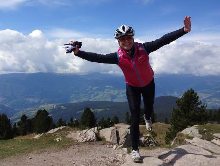
A fantastic day of mountain biking in spectacular scenery and with just the right amount of meters and kilometers in preparation for a long day tomorrow.
41km with 1700 meters of climbing. But 2km and 800 meters were with the lift. Track is at
http://www.gpsies.com/map.do?fileId=neqqopxtxpmrjjwk
My pictures are at https://goo.gl/photos/odTbfVPddLC5jhZL8
... link (0 Kommentare) ... comment
Downhill along a flowy trail to a small hut where we enjoyed drinks, lunch and more amazing views in the sunshine. Wera managed to get a puncture by hitting a stone too fast.
Heidi, Wera and I followed a really fun trail down to the middle station of the cable car while the rest took a slightly longer route. The others cycled down a ski slope and Hubert managed to fall off. He thinks there may be some damage to his shoulder but not enough to stop him cycling.
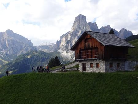
We took the cable car up to the top of the mountain while admiring the super steep track we were bypassing and then followed a long flowy trail back down. Eventually at a lonely Alm we joined a track and then further down followed a beautiful trail through the woods.
Back in St. Ulrich we drank a coffee and then returned to the cars. And now we are at our hotel in Wolkenstein.
I have a new GPS receiver and haven't yet fully got the hang of it so my track is a mess. Good that Wera also has a GPS.
35 km of which 2 were with the lift and 1945 meters of climbing of which 700 were with the lift.
Track is at http://www.gpsies.com/map.do?fileId=uyjuehyjmwtunhru
My pictures are at https://goo.gl/photos/odTbfVPddLC5jhZL8
Hubert's pictures at https://goo.gl/q82wN8
Caro's pictures at https://drive.google.com/folderview?id=0B8GQ5A_ddT-wWTBORlZyWXlMdFk&usp=sharing&tid=0B8GQ5A_ddT-wZ25BZ1g3ZmdlUW8
Stefanos's pictures at https://drive.google.com/folderview?id=0B8GQ5A_ddT-wT1o1REVkMWd5Sk0&usp=sharing&tid=0B8GQ5A_ddT-wZ25BZ1g3ZmdlUW8
Inge's pictures are at https://picasaweb.google.com/SpyderwomanTV/Wolkenstein1Tag100915?authkey=Gv1sRgCP3N9PDEpJLMMQ&feat=email#
... link (0 Kommentare) ... comment
31km with 500 meters of climbing.
Track is at http://www.gpsies.com/map.do?fileId=seyegnumwliitelz
... link (0 Kommentare) ... comment
38km nad 675 meters of climbng. Track is at http://www.gpsies.com/map.do?fileId=miwqshaskthlibns
... link (0 Kommentare) ... comment
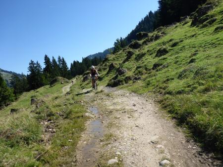
Up to the Kappeler Alp from Kappel and then back down to Nesselwang. Started raining at the top so we got wet and muddy.
13km with 570 meters of climbing.
Track is at http://www.gpsies.com/map.do?fileId=zaqiamkjwvhheoxt
... link (0 Kommentare) ... comment
Crazy.
Stopped for a drink at the Alpe Scheidwang and for lunch just before crossing back in to Germany.
64km with 2095 meters of climbing! Track is at http://www.gpsies.com/map.do?fileId=hkejqkxgjkxglomv
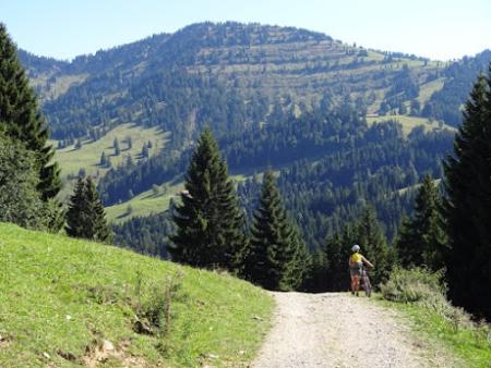
After the Imberg Hütte (at about 43km) there was a sign saying that the road was closed to mountainbikers. It didn't say how far and we had no choice so we pushed past the Alms. It is an extremely steep descent.
64km and 2100 meters of climbing
Track is at http://www.gpsies.com/map.do?fileId=hkejqkxgjkxglomv
Photos are at https://goo.gl/photos/jfzb2vzuEWFLf5oaA
Stefano and Caro's pictures are at https://drive.google.com/folderview?id=0B2cYruylmFdGZnRndE01NjBKV1k&usp=sharing_eid&invite=CIWs1bwG
... link (0 Kommentare) ... comment
33km with 390 mters of climbing
Track is at http://www.gpsies.com/map.do?fileId=wtsnbwrildymnsle
... link (0 Kommentare) ... comment
Track is at http://www.gpsies.com/map.do?fileId=icvnelnhhaknnlcs
... link (0 Kommentare) ... comment
44km with 400 meters of climbing
http://www.gpsies.com/map.do?fileId=tkisdgqvfkjdwwja
... link (0 Kommentare) ... comment
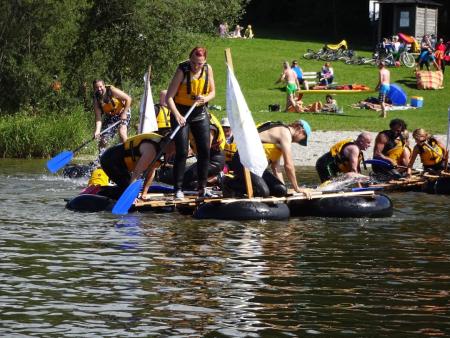
After the racing things got silly with each team trying to capture the others flags and untieing the knots that held the rafts together.
I ended up paddling two planks balanced on one inner tube back to the bank.
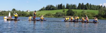
Afterwards we grilled on the beach until sunset.
Photos at https://goo.gl/photos/Kdz5kXdYBMkvnSYM8
... link (0 Kommentare) ... comment
Up the Ellegg for a beer then down to the lake for lunch then back over the hills home.
Track is at http://www.gpsies.com/map.do?fileId=xjoenwufxbssbich
... link (0 Kommentare) ... comment
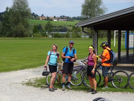
In the evening I needed to go to Isny but before that we did a short and flat run round the Grüntensee. Finally I have received my Polar training watch back and it seems to be repaired.
22km with 300 meters of climbing
Track is at http://www.gpsies.com/map.do?fileId=hgmjzaldylelbntz
... link (0 Kommentare) ... comment