
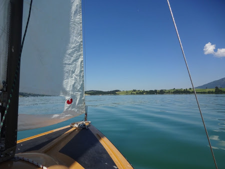
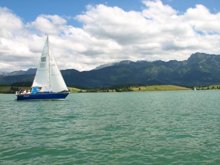
Very little wind so little distance sailed. We had thrown my water bottle overboard to simulate a "man overboard when the wind suddenly dropped to nothing. For over half an hour we floated near to but out of reach of the bottle before the wind picked up and we finally got back to the bottle. A little later we did briefly achieve two and a half knots during a gust.
30°C and not a cloud in the sky.
Track is at http://www.gpsies.com/map.do?fileId=ixanycqyvokhgmhm
... link (0 Kommentare) ... comment
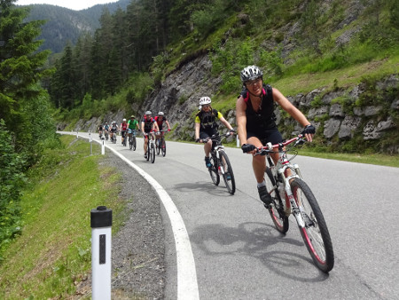
If I ride at a high pulse then the next day is difficult. As long as I remain under a pulse of 135 (as when we cycled to Dubrovnik) then the next day is no problem at all.
23km and 234 meters of climbing.
http://www.gpsies.com/map.do?fileId=ixanycqyvokhgmhm
... link (0 Kommentare) ... comment
110 km and 2009(!) meters of climbing. http://www.gpsies.com/map.do?fileId=tfhowivblfazhzjv
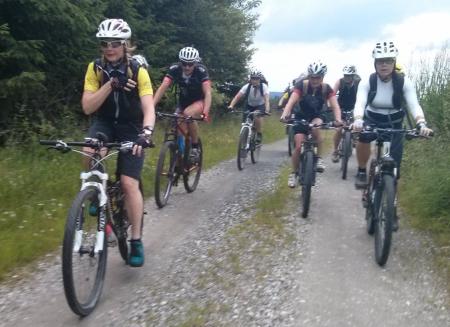
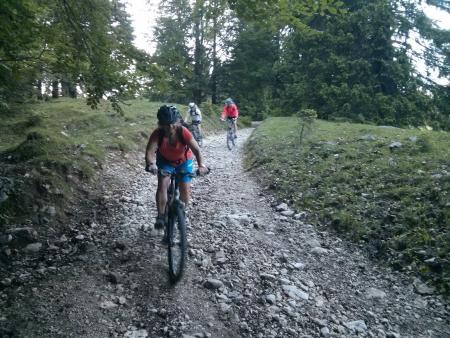
Photos at https://goo.gl/photos/JYAG6B6TM26n8ogq6
Inges Bilder: https://picasaweb.google.com/SpyderwomanTV/6307858585766739025?authkey=Gv1sRgCJbDmp_z6evfzgE&feat=email
... link (0 Kommentare) ... comment
And Jon had friends round :-(
So I was out on my own.
Did the Tannheimertal route with my race bike.
48.5 km with 565 meters of climbing. And all in 2:03! Track is at http://www.gpsies.com/map.do?fileId=xngdrurnpgedhwff
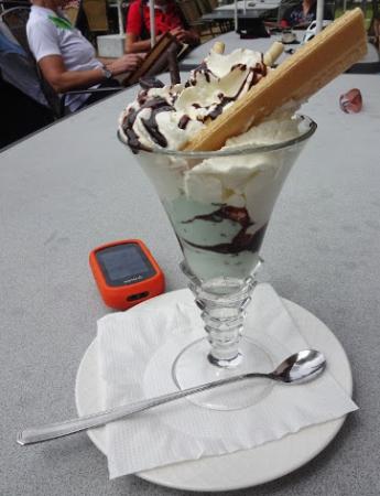
Afterwards I decided I had earned an ice cream and at the ice cafe I met Marion and Robert and then Caro so we enjoyed a hot amaretto with cream.
... link (0 Kommentare) ... comment
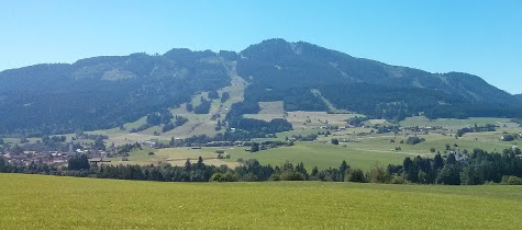
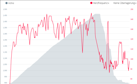
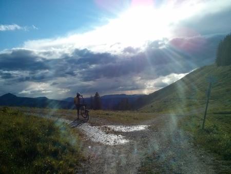
Up to Sportheim Böck and then back down past the Kappeller Alp. Just looking at my heartbeat shows which part of the trip was uphill. An average of over 130 uphill and under 100 downhill and flat.
14 km and 605 meters of climbing.Track is at http://www.gpsies.com/map.do?fileId=jfenqayykwlhpahh
... link (0 Kommentare) ... comment
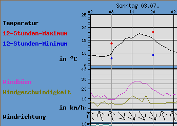
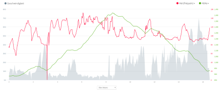
As the following diagram shows the wind was about 10km/h (5-6 knots) but there were a lot of lulls.
7 nautical miles in total. Our track is at http://www.gpsies.com/map.do?fileId=otoqgbfbtubirxom
Original photo at https://goo.gl/photos/qdM9peYJsuZzbJLZ6 (thanks Chris)
... link (0 Kommentare) ... comment
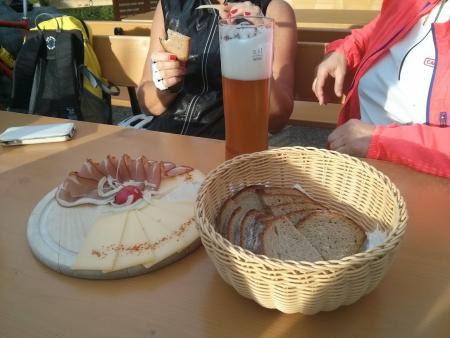
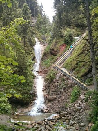
On the way back we stopped at the Falkenstein Restaurant in Pfronten.
65km and 780 meters of climbing. Track is at http://www.gpsies.com/map.do?fileId=gfwuxyukbrymdajd
Pictures at https://goo.gl/photos/JYAG6B6TM26n8ogq6
Inges pictures at https://www.google.com/url?hl=en-GB&q=https://picasaweb.google.com/lh/sredir?uname%3DSpyderwomanTV%26target%3DALBUM%26id%3D6303217317790472705%26authkey%3DGv1sRgCOuC0_jdpbjQDg%26invite%3DCK7mx5oE%26feat%3Demail&source=gmail&ust=1467695183122000&usg=AFQjCNHX1IFIY_JA2xvcCcopFA9IJ4DeFA
... link (0 Kommentare) ... comment
25km and 490 meters of climbing. Track is at http://www.gpsies.com/map.do?fileId=ncwnelvuncawshpm
Pictures at https://goo.gl/photos/JYAG6B6TM26n8ogq6
... link (0 Kommentare) ... comment
4km with 177 meters of climbing (probably my shortest bike ride this year) Track is at http://www.gpsies.com/map.do?fileId=ytqjlnlejhqwange
... link (0 Kommentare) ... comment
42km with 540 meters of climbing. Track is at http://www.gpsies.com/map.do?fileId=asfojizlsuzulamw
... link (0 Kommentare) ... comment
20.6km with 242 meters of climbing. Track is at http://www.gpsies.com/map.do?fileId=wzizgpgexivjpfud
... link (0 Kommentare) ... comment
They were correct about the weather. It was like watching a river fall out of the sky.
22km with 283 meters of climbing. Track is at http://www.gpsies.com/map.do?fileId=pqubwdoztfvtbmhy
... link (0 Kommentare) ... comment
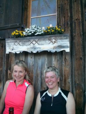
A beer at the Bärenmoos tasted fantastic. Afterwards we did the Milchhäusle trail.
36km and 796 meters of climbing. Track is at http://www.gpsies.com/map.do?fileId=cjzxqimnkxphofzn
... link (0 Kommentare) ... comment
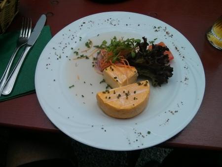
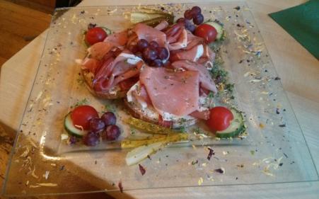
There was some food there so this seems like a good point to add a collage of a few recent "cycling meals"
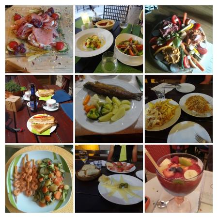
Original is at https://goo.gl/photos/wqf6vrzCTFbhv5HeA
... link (0 Kommentare) ... comment
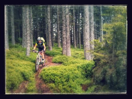
Up to the Edelsberg past Maria Trost and then all the way back down on wet (and therefore challenging) trails. Brilliant fun.
Afterwards a bite to eat and a few drinks at Wera and Gremml's. :-)
22.5 km and 842 meters of climbing. Track is at http://www.gpsies.com/map.do?fileId=nhoabdtonjxmxkjp
Photos at https://goo.gl/photos/JYAG6B6TM26n8ogq6
... link (0 Kommentare) ... comment
35km and 816 meters of climbing. Track is at http://www.gpsies.com/map.do?fileId=jyrpywtsixzwxfaz
... link (0 Kommentare) ... comment
Track is at http://www.gpsies.com/map.do?fileId=sgumvrmuxicjnbsh
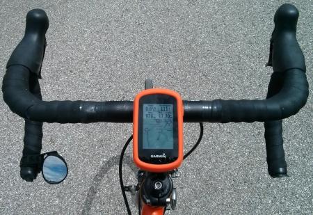
I was using my Garmin pulse band to measure my pulse. All the information was in my GPS and all appeared to be transferred to my mobile phone but there were no calories and no elevation gained shown. Asked for an explanation at https://forums.garmin.com/showthread.php?354302-Garmin-Connect-showing-0-calories
Photos at https://goo.gl/photos/g74VhzgtnUrDvxuRA
... link (0 Kommentare) ... comment
After I had finished it suggested that I had used 492 calories. I did a very similar ride in 2014 (28.03.2014) using my Polar system and that suggested 686 calories so the Garmin system is obviously crediting me with far less calories.
Similarly I did the Reutewanne with my polar system on 17.09.2015 with my Polar system and was credited with 1563 calories and this week on 17.06.2016 with the Garmin system I only earned 716 calories.
One or both systems are lieing.
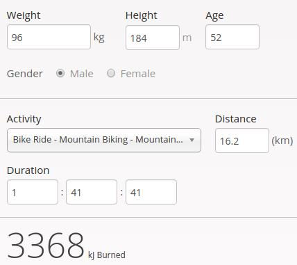
A calculator at http://www.mapmyride.com/improve/calorie_calculator/ calculated 3368kj for the Reuttewanne which is about 800 calories. For the ride round the Grüntensee it suggested 1042 calories!
Another calculator at http://mtb-sauerland.bplaced.net/grevenstein/training/bergauf.htm says 858 calories for the Reuttewanne and 622 fpr the Grüntensee.
At the end of the day I am confused. It looks like "guess a number". But for the time being I'll believe Garmin as it is the easiest.
23km and 285 meters of climbing. Track is at http://www.gpsies.com/map.do?fileId=jkwhppzagstdpwir
... link (0 Kommentare) ... comment
I was using my new pulse measuring belt that connects directly to my GPS. My GPS saves all the values and later synchronises them with Garmin Connect which then gives me all the information on my smartphone. Google Connect also shares the data with myfitnesspal which then knows how many calories I have used up exercising. Cool!
I used up over 700 Kcal cycling but in Alten Reichenbach I put 500 back.
15.5km and 647 meters of climbing. Track is at http://www.gpsies.com/map.do?fileId=wwpdvfchoohkepdq
Photos at https://goo.gl/photos/JYAG6B6TM26n8ogq6
... link (0 Kommentare) ... comment