
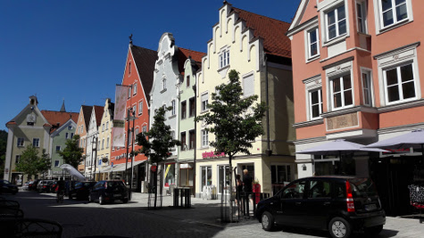
We cycled to Marktoberdorf and got lost twice on the way home but it was fun.
53km with 736 meters of climbing. Track is at http://www.gpsies.com/map.do?fileId=hemfzohlmdaicfvp
So today I totalled 93km and 1886 meters of climbing!
Picture are at https://goo.gl/photos/6ddzpfM69G3NzYWv6
... link (0 Kommentare) ... comment
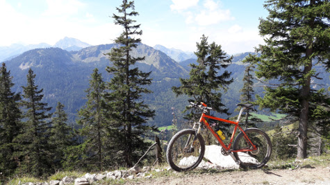
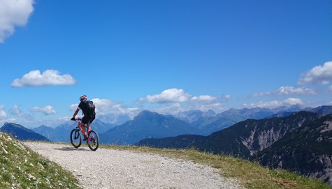
From the village of Pfronten to the restaurant on top of the mountain is 1000 meters of climbing but I took things nice and steady.
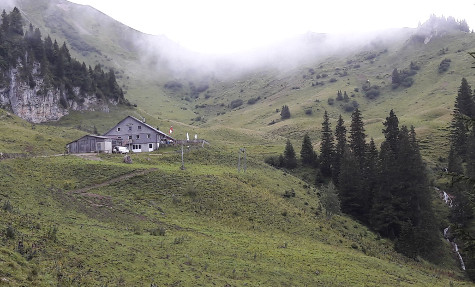
At the top I enjoyed a well deserved beer and soup and enjoyed the view. Last time I was up there was over 20 years ago when it was being rebuilt and I was doing the wiring.
Got home and enjoyed a coffee at Farina's and then Heidi rang and said "you want to go out on our race bikes?"
39km and 1156 meters of climbing. Track is at http://www.gpsies.com/map.do?fileId=guebvasgxmuphjme
Picture are at https://goo.gl/photos/6ddzpfM69G3NzYWv6
... link (0 Kommentare) ... comment
26km with 365 meters of climbing. Track is at http://www.gpsies.com/map.do?fileId=yiobacmiixzazobv
... link (0 Kommentare) ... comment
19km with 409 meters of climbing. Track is at http://www.gpsies.com/map.do?fileId=uwqrgrrokejtijie
... link (0 Kommentare) ... comment
22km with 300 meters of climbing. Track is at http://www.gpsies.com/map.do?fileId=zvflblcbuoisrqru
... link (0 Kommentare) ... comment

We were back at dark and enjoyed tea and biscuits at Jons.
20km and 602 meters of climbing. Track at http://www.gpsies.com/map.do?fileId=llqvcizpxhlsqgnt
... link (0 Kommentare) ... comment
We not only climbed to the Bildstöckle; we also climbed the old Joch Pass and came home past the Stuibental Alm. Being fit is fun.
56km and 1557 meters of climbing. Track is at http://www.gpsies.com/map.do?fileId=pxppghuvozuvkogm
My photos are at https://goo.gl/photos/6ddzpfM69G3NzYWv6
... link (0 Kommentare) ... comment
So I cycled to Mindelheim where the guy was more than helpful. He only has the system 5 months but it was no problem for him.
I used some of the money for a "Döner Teller" and used the free wifi that is powered by our company.
Then I cycled home - via a colleagues house to scrounge more water. Five hours cycling in 30°C needs a lot of water :-)
125km and 1165 meters of climbing. Track is at http://www.gpsies.com/map.do?fileId=vosqbrtziisucxzc
... link (0 Kommentare) ... comment
18km and 756 meters of climbing. Track is at http://www.gpsies.com/map.do?fileId=mcfelbmxihkzncwi
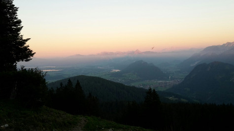
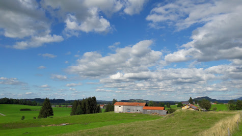
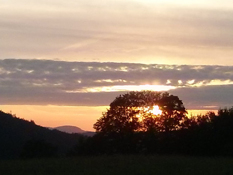
The following picture is of the view across the mountains at sunset. Thanks Marion.
Photos at https://goo.gl/photos/jqxzCujyshAs3j4z6
... link (0 Kommentare) ... comment
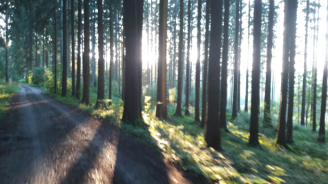
A sunny evening with the setting sun filtering through the trees and everything deep green from the last rays of sunlight.
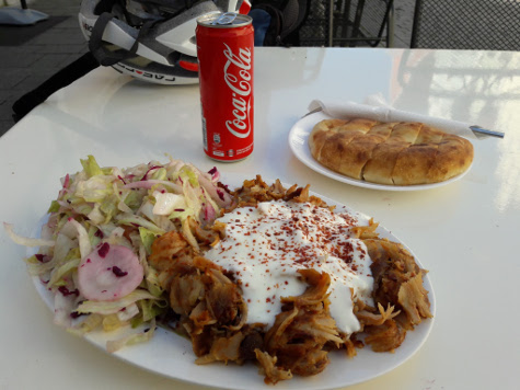
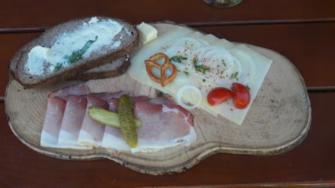
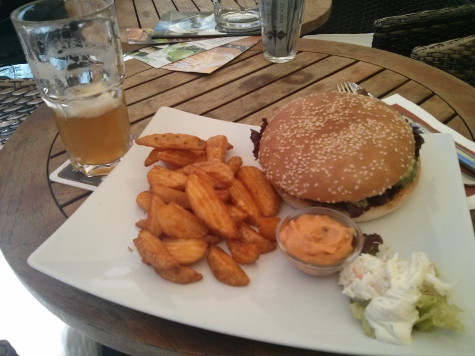
It was a good job we cycled so far, as this was my lunch
61km with 865 meters of climbingTrack is at http://www.gpsies.com/map.do?fileId=bgjdhggojtdpfpjs
... link (0 Kommentare) ... comment
26km and 390 meters of climbing. Track is at http://www.gpsies.com/map.do?fileId=arrpovdrfppeiewn
... link (0 Kommentare) ... comment
58 km and 1174 meters of climbing. Track is at http://www.gpsies.com/map.do?fileId=tltqhxsggvpahjek
My photos at https://goo.gl/photos/jqxzCujyshAs3j4z6
... link (0 Kommentare) ... comment
27km and 392 meters of climbing. Track is at http://www.gpsies.com/map.do?fileId=tzuiwlvkxihkccaa
... link (0 Kommentare) ... comment
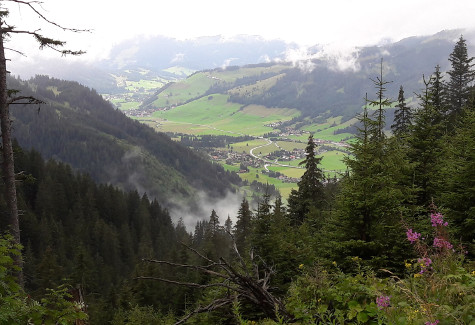
We made up the route situatively on the way and the result was a stunning tour with a bit of everything.
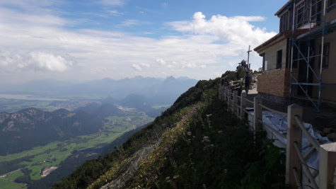
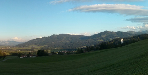
73km and 1923 meters of climbing. The 700 meter climb up to the Grüntenhütte and beyond was just as steep as it looks.
Track is at http://www.gpsies.com/map.do?fileId=qgslhptzrgcekquy
My pictures are at https://goo.gl/photos/jqxzCujyshAs3j4z6
The following is a section from the panorama at http://gruenten.panomax.de (15. Aug. 2016 14:40) showing me taking the photo above.
... link (0 Kommentare) ... comment
123km with 1513 meters of climbing. Track is at http://www.gpsies.com/map.do?fileId=pqtjykyoghcgnqgl
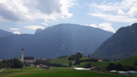
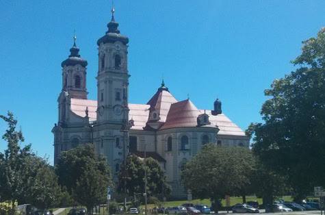
Cycled back through Ottobeuren where I took this picture
Photos at https://goo.gl/photos/jqxzCujyshAs3j4z6
... link (0 Kommentare) ... comment
29km and 722 meters of climbing. Track is at http://www.gpsies.com/map.do?fileId=rdzuorjgbfdzltxy
Photos at https://goo.gl/photos/jqxzCujyshAs3j4z6
... link (0 Kommentare) ... comment
I nearly convinced myself that it did not matter because I had burned so many calories at the weekend but I knew that those were the sort of thoughts that would have me back at 100kg in no time.
So I did a quick trip around the lake and added the climb up to Mittelberg to get all the needed calories.
25km and 402 meters of climbing. Track is at http://www.gpsies.com/map.do?fileId=rklhngwfvqoyldrf
... link (0 Kommentare) ... comment
73km and 1581 meters of climbing. Track is at http://www.gpsies.com/map.do?fileId=xfgcykpzbnrwpsfk
The last time I did this ride was in 2010 with Max and the Grüntensee was flooded over its banks. Exactly the same today.
My pictures are at https://goo.gl/photos/jqxzCujyshAs3j4z6
Jons pictures are at https://goo.gl/photos/isi8D1XwCb1M4Pd48
... link (0 Kommentare) ... comment
I ended up cycling to Landsberg am Lech and then taking the train back to Seeg and cycling home from there.
Track to Landsberg is at http://www.gpsies.com/map.do?fileId=zzhekceaffpxwybg (73km and 567 meters climbing)
Track from Seeg home is at http://www.gpsies.com/map.do?fileId=kingsldydhzizatc (12km and 192 meters cllimbing)
... link (0 Kommentare) ... comment
27km and 856 meters of climbing. Track is at http://www.gpsies.com/map.do?fileId=zsvolkgegdfqrebf
... link (0 Kommentare) ... comment