
21km and 200 meters of climbing. Track at http://www.gpsies.com/map.do?fileId=ywscljjzjnnydtci
... link (0 Kommentare) ... comment
7km with 370 meters of climbing. Track at http://www.gpsies.com/map.do?fileId=ceenoagyjzdnnrec
... link (0 Kommentare) ... comment
... link (0 Kommentare) ... comment
31km and 447 meters of climbing. Track is at http://www.gpsies.com/map.do?fileId=elijcvbvgloxsbba
... link (0 Kommentare) ... comment
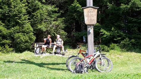
And afterwards beer and a long and complicated discussion about correlation with Julia :-)
30km and 458 meters of climbing. Track is at http://www.gpsies.com/map.do?fileId=wgzutgnewbkxhfoi
... link (0 Kommentare) ... comment
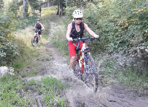
Two interesting (and steep) trails - one on slippy river stones and one down steps.
28km and 682 meters of climbing. Track is at http://www.gpsies.com/map.do?fileId=kwmmpmyvafgdfkgi
My pictures at https://goo.gl/photos/urhFXKrYeCWhZh4QA
... link (0 Kommentare) ... comment
Lots of interesting trails all the way back down to the hotel just beating the thunder and lightning.
32 kms and 1015 meters of climbing (without the 900 in the cable car). Track is at http://www.gpsies.com/map.do?fileId=oxghkpupzaoywogq
My pictures at https://goo.gl/photos/urhFXKrYeCWhZh4QA
... link (0 Kommentare) ... comment
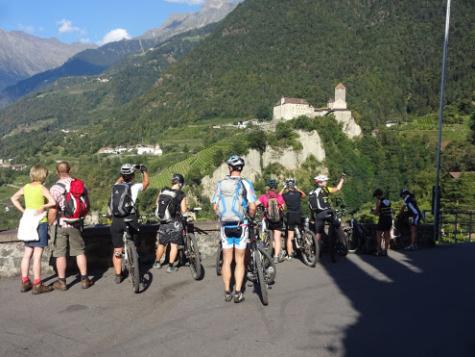
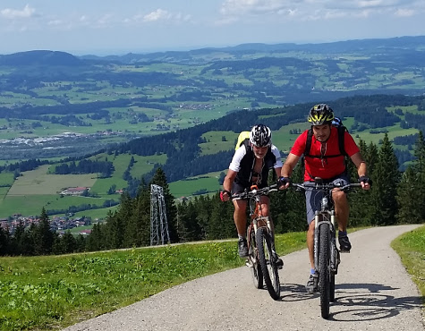
We used the Meran 2000 cable car to get up in to the mountains and then enjoyed some exciting trails and stunning views. On one descent I went over the handlebars and landed on my head directly on a sharp rock. Luckily my helmet took the impact and was destroyed but my head was OK.
47.7 km and 1414 meters of climbing (without the 1000 meters in the cable car). Track is at http://www.gpsies.com/map.do?fileId=izivjcmawajuypmt
My pictures at https://goo.gl/photos/urhFXKrYeCWhZh4QA
... link (0 Kommentare) ... comment
On the way down we followed an exciting bike trail (http://www.bikesport-magazin.de/holyhansen) which was great fun.
18.6km and 915 meters of climbing. Track is at http://www.gpsies.com/map.do?fileId=nkhhfegyfozfwmrx
My pictures at https://goo.gl/photos/urhFXKrYeCWhZh4QA
Hubert was with Group 1. His pictures are at https://drive.google.com/drive/folders/0B_sTz_QNmXn6RUgxLXZkN3lHWU0
... link (0 Kommentare) ... comment
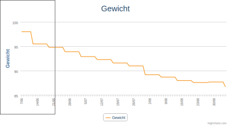
In the last 90 days I have gone from 0ver 98 to under 87 kilograms.
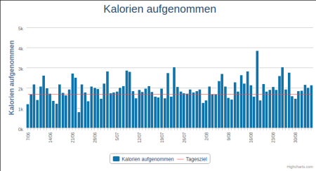
A lot of days I exceeded my calorie target as shown in this graph
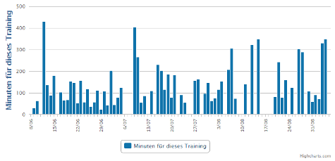
but I did a lot of exercise (about 2500 kilometers of cycling in about 170 hours) which burned the calories
so that the actual netto calories were (on average) well below the target.
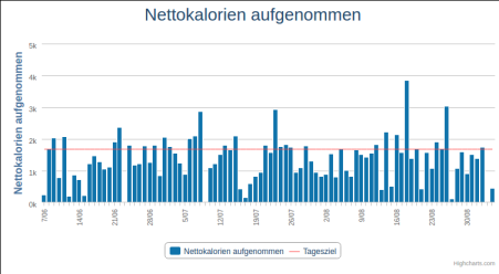
All the graphs in original size at https://goo.gl/photos/f2SCMnPEt4nzdsKA9
... link (0 Kommentare) ... comment
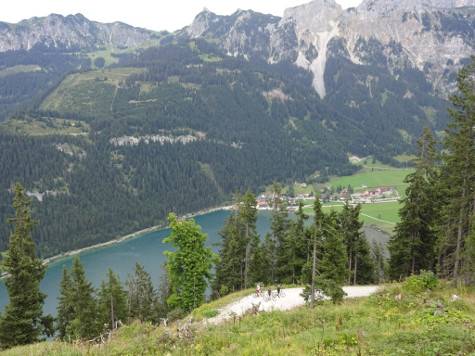
(take a close look at the picture and you can see the three ladies waving at the bottom.)
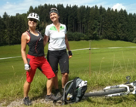
After cycling up to the Ödenalpe for lunch, we cycled to a cafe for capuccino and cake and then back over a small Austrian pass.
77km and 1746 meters of climbing. Track is at http://www.gpsies.com/map.do?fileId=hqfjvorimalnkfvx
My pictures are at https://goo.gl/photos/6ddzpfM69G3NzYWv6
... link (0 Kommentare) ... comment
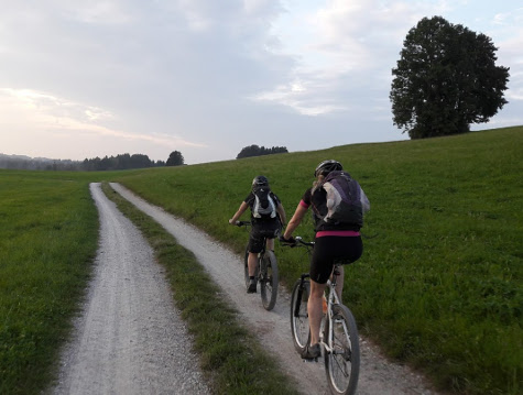
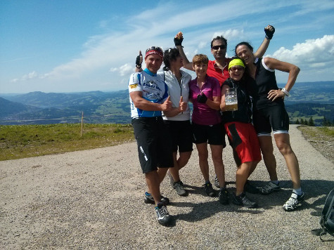
We cycled to Marktoberdorf and got lost twice on the way home but it was fun.
53km with 736 meters of climbing. Track is at http://www.gpsies.com/map.do?fileId=hemfzohlmdaicfvp
So today I totalled 93km and 1886 meters of climbing!
Picture are at https://goo.gl/photos/6ddzpfM69G3NzYWv6
... link (0 Kommentare) ... comment
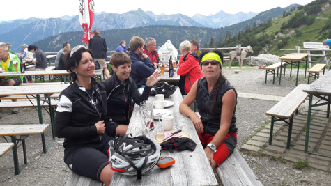
From the village of Pfronten to the restaurant on top of the mountain is 1000 meters of climbing but I took things nice and steady.
At the top I enjoyed a well deserved beer and soup and enjoyed the view. Last time I was up there was over 20 years ago when it was being rebuilt and I was doing the wiring.
Got home and enjoyed a coffee at Farina's and then Heidi rang and said "you want to go out on our race bikes?"
39km and 1156 meters of climbing. Track is at http://www.gpsies.com/map.do?fileId=guebvasgxmuphjme
Picture are at https://goo.gl/photos/6ddzpfM69G3NzYWv6
... link (0 Kommentare) ... comment
26km with 365 meters of climbing. Track is at http://www.gpsies.com/map.do?fileId=yiobacmiixzazobv
... link (0 Kommentare) ... comment
19km with 409 meters of climbing. Track is at http://www.gpsies.com/map.do?fileId=uwqrgrrokejtijie
... link (0 Kommentare) ... comment
22km with 300 meters of climbing. Track is at http://www.gpsies.com/map.do?fileId=zvflblcbuoisrqru
... link (0 Kommentare) ... comment

We were back at dark and enjoyed tea and biscuits at Jons.
20km and 602 meters of climbing. Track at http://www.gpsies.com/map.do?fileId=llqvcizpxhlsqgnt
... link (0 Kommentare) ... comment
We not only climbed to the Bildstöckle; we also climbed the old Joch Pass and came home past the Stuibental Alm. Being fit is fun.
56km and 1557 meters of climbing. Track is at http://www.gpsies.com/map.do?fileId=pxppghuvozuvkogm
My photos are at https://goo.gl/photos/6ddzpfM69G3NzYWv6
... link (0 Kommentare) ... comment
So I cycled to Mindelheim where the guy was more than helpful. He only has the system 5 months but it was no problem for him.
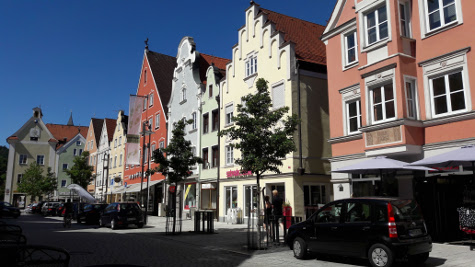
I used some of the money for a "Döner Teller" and used the free wifi that is powered by our company.
Then I cycled home - via a colleagues house to scrounge more water. Five hours cycling in 30°C needs a lot of water :-)
125km and 1165 meters of climbing. Track is at http://www.gpsies.com/map.do?fileId=vosqbrtziisucxzc
... link (0 Kommentare) ... comment
18km and 756 meters of climbing. Track is at http://www.gpsies.com/map.do?fileId=mcfelbmxihkzncwi
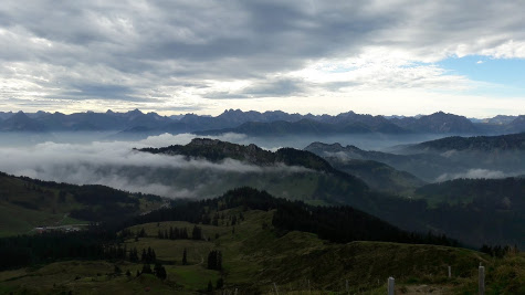
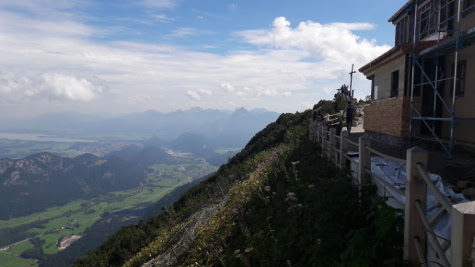
The following picture is of the view across the mountains at sunset. Thanks Marion.
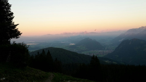
Photos at https://goo.gl/photos/jqxzCujyshAs3j4z6
... link (0 Kommentare) ... comment
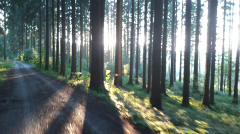
A sunny evening with the setting sun filtering through the trees and everything deep green from the last rays of sunlight.
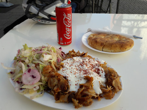
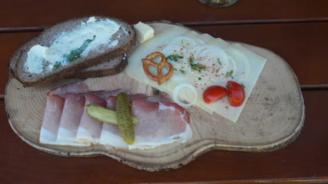
It was a good job we cycled so far, as this was my lunch
61km with 865 meters of climbingTrack is at http://www.gpsies.com/map.do?fileId=bgjdhggojtdpfpjs
... link (0 Kommentare) ... comment
26km and 390 meters of climbing. Track is at http://www.gpsies.com/map.do?fileId=arrpovdrfppeiewn
... link (0 Kommentare) ... comment
58 km and 1174 meters of climbing. Track is at http://www.gpsies.com/map.do?fileId=tltqhxsggvpahjek
My photos at https://goo.gl/photos/jqxzCujyshAs3j4z6
... link (0 Kommentare) ... comment
27km and 392 meters of climbing. Track is at http://www.gpsies.com/map.do?fileId=tzuiwlvkxihkccaa
... link (0 Kommentare) ... comment
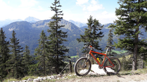
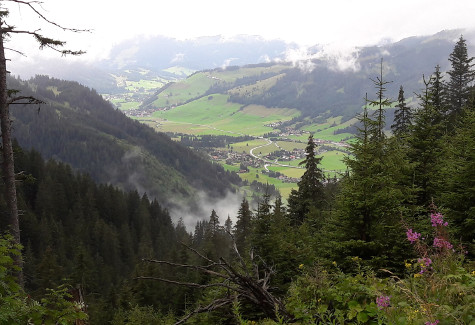
We made up the route situatively on the way and the result was a stunning tour with a bit of everything.
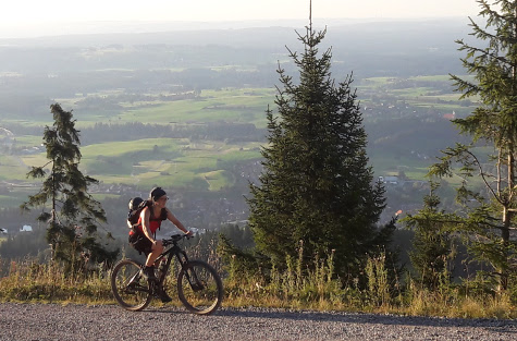
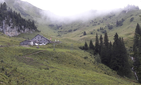
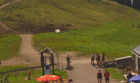
73km and 1923 meters of climbing. The 700 meter climb up to the Grüntenhütte and beyond was just as steep as it looks.
Track is at http://www.gpsies.com/map.do?fileId=qgslhptzrgcekquy
My pictures are at https://goo.gl/photos/jqxzCujyshAs3j4z6
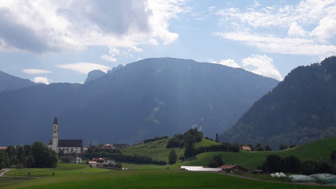
The following is a section from the panorama at http://gruenten.panomax.de (15. Aug. 2016 14:40) showing me taking the photo above.
... link (0 Kommentare) ... comment