... newer stories
Donnerstag, 28. September 2017
170926 Grüntensee Tuesday
neill, 19:53h
After a long long abscence I was back out with Team Tuesday.
Just round the Grüntensee but who cares.
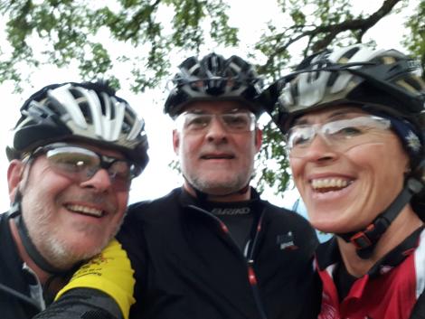
22km with 270 meters of climbing. Track is at https://www.gpsies.com/map.do?fileId=qqnzxhrdnisqddiu
Just round the Grüntensee but who cares.

22km with 270 meters of climbing. Track is at https://www.gpsies.com/map.do?fileId=qqnzxhrdnisqddiu
... link (0 Kommentare) ... comment
Montag, 25. September 2017
170925 Grüntensee
neill, 22:07h
My shoulder didn't hurt at all after Saturdays bike ride so I went out and did it again this evening. I was even slower this time but still managed above 20km/h.
18km and 195 meters of climbing. Track is at https://www.gpsies.com/map.do?fileId=emvpmidcrtdfzuoj
18km and 195 meters of climbing. Track is at https://www.gpsies.com/map.do?fileId=emvpmidcrtdfzuoj
... link (0 Kommentare) ... comment
Samstag, 23. September 2017
170923 back on the bike
neill, 18:37h
They (the doctors and therapist) told me that after six weeks my shoulder would be fully healed and I could start "training it up". So (six weeks and one day after the operation) I was just out for a roadbike ride. Very slowly and very gently and not too far but none the less a bike ride.
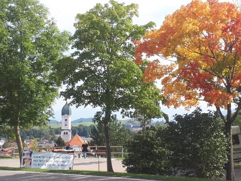
As the picture shows autumn is happening.
Life is getting better every day.
18.6km with an amazing 200 meters of climbing!
Track is at https://www.gpsies.com/map.do?fileId=rcamydtyglpapkao

As the picture shows autumn is happening.
Life is getting better every day.
18.6km with an amazing 200 meters of climbing!
Track is at https://www.gpsies.com/map.do?fileId=rcamydtyglpapkao
... link (0 Kommentare) ... comment
Sonntag, 17. September 2017
170917 "weight lifting"
neill, 19:41h
My shoulder OP is now five weeks ago so I am allowed to start "training". After four weeks I was using a half filled bottle of water (500g) and pulling it in various directions via a rope over the door handle. Now I have moved up to a whole 1000g!
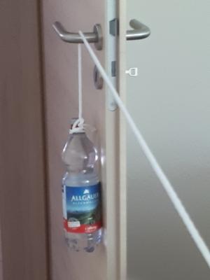
I bet all the ladies in the fitness studio would be very impressed by this.

I bet all the ladies in the fitness studio would be very impressed by this.
... link (0 Kommentare) ... comment
Sonntag, 27. August 2017
170827 Schneidbach
neill, 15:23h
Got the hang of this "hiking" thing. Just walk with interesting people and then you don't notice how boring it is :-)
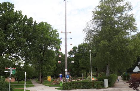
Gertrud and Jon kept me amused during a 70 minute walk today.
https://www.gpsies.com/map.do?fileId=bzdnuprxcsupyyvp
6.5KM and we achieved 5.5km/h. Not so bad.

Gertrud and Jon kept me amused during a 70 minute walk today.
https://www.gpsies.com/map.do?fileId=bzdnuprxcsupyyvp
6.5KM and we achieved 5.5km/h. Not so bad.
... link (0 Kommentare) ... comment
Samstag, 26. August 2017
170826 Schlossbergalm
neill, 21:26h
Can't MTB. Can't road bike. :-(
So have to walk :-(
This morning I walked to Haslach and back "just for the exercise"
https://www.gpsies.com/map.do?fileId=tmtetzaqhvymuwkr
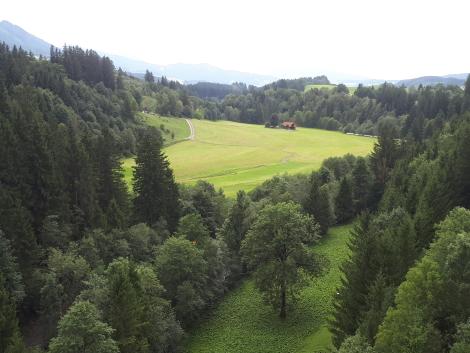
and this afternoon to the Schlossbergalm with Christine for a good long chat.
https://www.gpsies.com/map.do?fileId=ttvjsqpzaiwckwso
A total of 12.7km.
So have to walk :-(
This morning I walked to Haslach and back "just for the exercise"
https://www.gpsies.com/map.do?fileId=tmtetzaqhvymuwkr

and this afternoon to the Schlossbergalm with Christine for a good long chat.
https://www.gpsies.com/map.do?fileId=ttvjsqpzaiwckwso
A total of 12.7km.
... link (0 Kommentare) ... comment
Freitag, 25. August 2017
170825 Bayerstetten
neill, 21:05h
From today (2 weeks after the OP) I no longer ned to wear my "mobile shelf" so I went for a walk to Bayerstetten and back. Gentle and slow but my shoulder isn't hurting so we are getting there.
https://www.gpsies.com/map.do?fileId=wniwnayngyiajohe
I am also doing a set of exercises six times a day to stop my shoulder siezing up.
https://www.gpsies.com/map.do?fileId=wniwnayngyiajohe
I am also doing a set of exercises six times a day to stop my shoulder siezing up.
... link (0 Kommentare) ... comment
Dienstag, 15. August 2017
170815 Gschwend
neill, 19:26h
Still walking around with my shoulder on a "mobile shelf" round my neck so no big adventures planned today. I have to wear this thing for another 10 days. Great!
But I managed a monster tour all the way to Gschwend and back. 4.5km. Had to stop and rest at Chris' and then for a coffee at Strömer's in Brand. I can't believe that only 10 days ago I did the Uina tour.

[next day] did the same walk again. Much quicker and less out of breath. Must be getting fit.
But I managed a monster tour all the way to Gschwend and back. 4.5km. Had to stop and rest at Chris' and then for a coffee at Strömer's in Brand. I can't believe that only 10 days ago I did the Uina tour.

[next day] did the same walk again. Much quicker and less out of breath. Must be getting fit.
... link (0 Kommentare) ... comment
170813 Pfronten Hörnle
neill, 19:18h
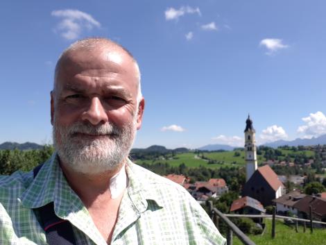
The smallest tour this year. 1.5km with 35 meters of climbing. On Friday I had a small operation on my shoulder. Sunday lunchtime they took the last tubes out so I went for a walk up the neighbouring hillock in the sun. I think I took about an hour :-)

... link (0 Kommentare) ... comment
Mittwoch, 9. August 2017
170808 Bayerstetten
neill, 09:53h
Tuesday evening but just Heidi and I.
Cycled up towards Haslacheralp in the drizzle and then turned left to Bayerstetten Kopf. Back down to Bayerstetten where it started chucking it down. It was like having buckets of water tipped over you. In the five minutes it took to get home, we were soaked through.
10km and 348 meters of climbing. Track is at https://www.gpsies.com/map.do?fileId=bliwbxapcexnrvbd
... link (0 Kommentare) ... comment
Sonntag, 6. August 2017
170805 Uina Schlucht
neill, 16:26h
Caro has been planning this tour all summer and on Friday my shoulder is being operated on so it was "now or not this year".
We were on the motorway by 04:30 and in Martina (Switzerland) two hours later.
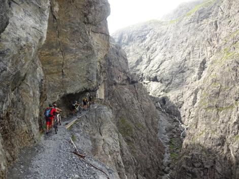
Cycled up the Engadin to Sur En and then up the Uina valley to the Uina Dadaint Alp for breakfast. Then on through the gallery to the Sesvenna hut in Italy. Via Burgeis and Reschen back in to Austria and then back down to the cars.
Three countries in 12 hours
72km and 2228 meters of climbing (1200 in one go - no wonder I was knackered). Track is at https://www.gpsies.com/map.do?fileId=cjvvfqqqxgczmskf
We were on the motorway by 04:30 and in Martina (Switzerland) two hours later.

Cycled up the Engadin to Sur En and then up the Uina valley to the Uina Dadaint Alp for breakfast. Then on through the gallery to the Sesvenna hut in Italy. Via Burgeis and Reschen back in to Austria and then back down to the cars.
Three countries in 12 hours
72km and 2228 meters of climbing (1200 in one go - no wonder I was knackered). Track is at https://www.gpsies.com/map.do?fileId=cjvvfqqqxgczmskf
... link (0 Kommentare) ... comment
170803 Allatsee
neill, 16:25h
Wera, Bettina and I cycled to the Allatsee for a swim.
(They swam I didn't because of the tape on my broken toe)

The route there was partly on paths I didn't even know existed.
(They swam I didn't because of the tape on my broken toe)

The route there was partly on paths I didn't even know existed.
... link (0 Kommentare) ... comment
Montag, 31. Juli 2017
170729 waterskiing
neill, 18:20h
This years "firm summer party" was waterskiing.
Great fun and my big toe is only "a bit broken"
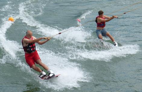
And they let Daniel and I on the lift together.
Great fun and my big toe is only "a bit broken"

And they let Daniel and I on the lift together.
... link (0 Kommentare) ... comment
Freitag, 28. Juli 2017
170727 Neumayr Hütte
neill, 21:13h
Five of us set off from the Alpspitzhalle and three of us did the whole tour - Wera, Bettina and I. Moni and Karin turned home earlier so didn't get rained on as we did.
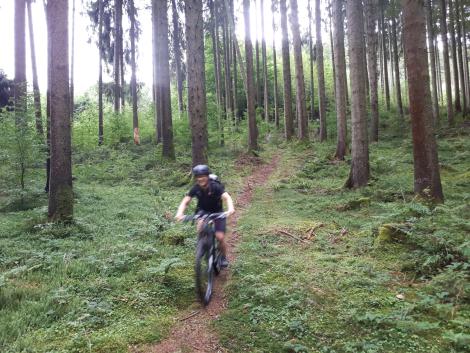
33km and 786 meters of climbing. Track is at http://www.gpsies.com/map.do?fileId=tixsxpolsuafsles

33km and 786 meters of climbing. Track is at http://www.gpsies.com/map.do?fileId=tixsxpolsuafsles
... link (0 Kommentare) ... comment
Freitag, 21. Juli 2017
170720 Senkele
neill, 09:39h
thursday evening tour planned by Wera. Wera, Gisela, Karin K., Moni JS, Jon and I.
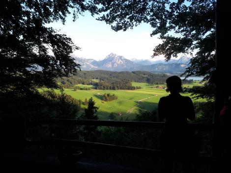
36km and 661 meters of climbing. Track is at http://www.gpsies.com/map.do?fileId=lscjoxzhttgzkmwn

36km and 661 meters of climbing. Track is at http://www.gpsies.com/map.do?fileId=lscjoxzhttgzkmwn
... link (0 Kommentare) ... comment
Sonntag, 16. Juli 2017
170716 Tarscher Trail
neill, 21:59h
Second day in Vinschgau. Wera had a plan but the cable car only took bikes up before nine or after three o'clock so we needed a new plan.
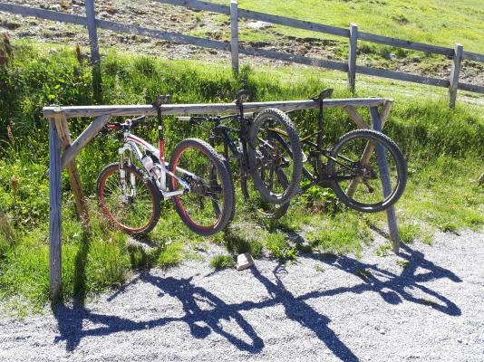
Decided on the Tarscher Trail. All the up hill was with a chair lift and then an S1-S2 grade trail back downhill.
5km and no uphill climbing. Track is at http://www.gpsies.com/map.do?fileId=wmnxqhsssvdhbtix
Pictures from Gremml at https://photos.app.goo.gl/NVRn60ZyJftumCbf2

Decided on the Tarscher Trail. All the up hill was with a chair lift and then an S1-S2 grade trail back downhill.
5km and no uphill climbing. Track is at http://www.gpsies.com/map.do?fileId=wmnxqhsssvdhbtix
Pictures from Gremml at https://photos.app.goo.gl/NVRn60ZyJftumCbf2
... link (0 Kommentare) ... comment
... older stories
