Samstag, 18. Oktober 2014
141018 Holzstetten
neill, 21:00h
Autumn but 20°C. Out all afternoon on my race bike through Allgäu. Rode to Eggenthal and then via Wildpoldsried to Kempten. Max picked me up with the car at McDonalds.
82km and 970 meters of climbing
Track at http://www.gpsies.com/map.do?fileId=zgifgdrhhgmdjnjd
82km and 970 meters of climbing
Track at http://www.gpsies.com/map.do?fileId=zgifgdrhhgmdjnjd
... link (0 Kommentare) ... comment
Samstag, 11. Oktober 2014
141011 Ellegg & Jochpass
neill, 21:55h
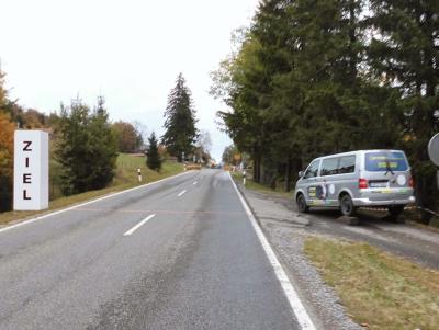
Out on my own with my race bike enjoying a sunny evening after an afternoon of rain. The Jochpass road was closed for an old timer race so I rode the first part up the old pass (extremely steep -see the profile at about 40kms) and then was told by a marshall that no more cars would be coming so rode up an empty Jochpass - just me on my own enjoying the scenery. Just as I reached the top they opened the pass again for traffic. The picture shows me reaching the finish line of the race. Just the cheering crowds are missing.
63kms and 925 mters of climbing
Track is at http://www.gpsies.com/map.do?fileId=iwbitzeuddqypgtg

63kms and 925 mters of climbing
Track is at http://www.gpsies.com/map.do?fileId=iwbitzeuddqypgtg
... link (0 Kommentare) ... comment
Sonntag, 5. Oktober 2014
141005 Alpspitz & Spinning
neill, 22:51h
Sunday afternoon and still missing 45 minutes in Zone 3 so once up the Alpspitz as fast as possible and then straight down again to go to spinning in the new studio in Nesselwang.
12km and 580 meters of climbing
Track is at http://www.gpsies.com/map.do?fileId=siiqgmplzsmtzien
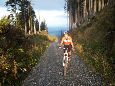
With todays ride I reached the 4000 kilometer mark! 4000km cycled in 2014. And so many hours of fun.
In the studio they have spinning bikes with so many lights, dials and displays that you almost forget that you are also working out. Great fun.
12km and 580 meters of climbing
Track is at http://www.gpsies.com/map.do?fileId=siiqgmplzsmtzien

With todays ride I reached the 4000 kilometer mark! 4000km cycled in 2014. And so many hours of fun.
In the studio they have spinning bikes with so many lights, dials and displays that you almost forget that you are also working out. Great fun.
... link (0 Kommentare) ... comment
Samstag, 4. Oktober 2014
141004 Geichpass
neill, 19:55h
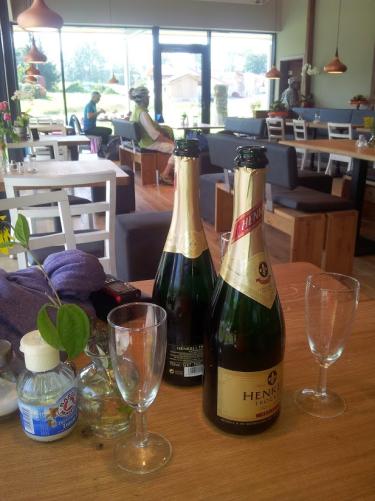
After spending the morning "brunching" in Rückholz with Alison, I went out for a race bike ride.
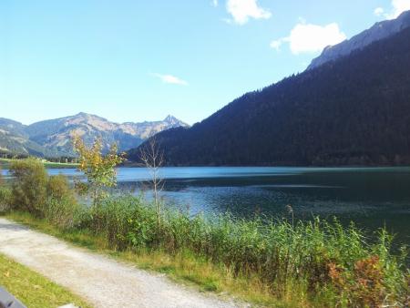
I was planning to cycle through Tannheimertal and back through Pfronten but the temperature was so perfect and the weather so nice that I changed the plan and cycled down the Geichpass and back via Reutte.
76km and 720 meters of climbing. Track at http://www.gpsies.com/map.do?fileId=enbfjueohztedvty

I was planning to cycle through Tannheimertal and back through Pfronten but the temperature was so perfect and the weather so nice that I changed the plan and cycled down the Geichpass and back via Reutte.

76km and 720 meters of climbing. Track at http://www.gpsies.com/map.do?fileId=enbfjueohztedvty
... link (0 Kommentare) ... comment
Sonntag, 28. September 2014
140928 Wildpoldsried
neill, 15:02h
A warm and sunny Sunday morning so Heidi and I were race biking. We had both been at parties the night before - Alison and I at two from mid afternoon to midnight - so needed to cycle off alcohol and food.
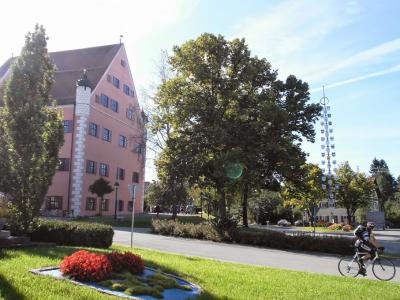
Over 70 kilometers through the warm and sunny countryside. The route was mainly on cycle paths or side roads.
71kms and 970 meters of climbing
Track is at http://www.gpsies.com/map.do?fileId=snxlnfhwiajjgmzv

Over 70 kilometers through the warm and sunny countryside. The route was mainly on cycle paths or side roads.
71kms and 970 meters of climbing
Track is at http://www.gpsies.com/map.do?fileId=snxlnfhwiajjgmzv
... link (0 Kommentare) ... comment
Mittwoch, 24. September 2014
140923 Lengenwang
neill, 19:05h
Out with the race bikes - just the two of us. We took a wrong turning in Seeg and ended up pushing the bikes through a wood. At one point I took a wrong turning and we did a complete circuit of a clearing - watched by a hunter up on his seat.
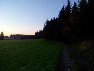
Luckily we have good lights because it was pitch black when we got back.
At the end of August you need warm clothes and good lights but if you have them then life is good.
38km with 500 meters of climbing
Track at http://www.gpsies.com/map.do?fileId=excczuguysujgwsh

Luckily we have good lights because it was pitch black when we got back.
At the end of August you need warm clothes and good lights but if you have them then life is good.
38km with 500 meters of climbing
Track at http://www.gpsies.com/map.do?fileId=excczuguysujgwsh
... link (0 Kommentare) ... comment
Sonntag, 21. September 2014
140921 Alpspitz
neill, 22:17h
Almost no biking this week - except Thursday night. So this evening Heidi and I braved the rain to cycle up the Alpspitz. Actually it turned to drizzle as we passed the Explorer Hotel and started again when we got home.
12km with 580 meters of climbing.
Track is at http://www.gpsies.com/map.do?fileId=kfoubesghzjabsgp
12km with 580 meters of climbing.
Track is at http://www.gpsies.com/map.do?fileId=kfoubesghzjabsgp
... link (0 Kommentare) ... comment
Samstag, 20. September 2014
140918 Hängebrücke
neill, 17:38h
Thursday evening and there were only three of us out cycling in Group 2 - Bettina, Karin and I. We originally planned a gentle ride round the 7 lakes but once we got in to the Wertach Valley, Bettina changed the plan to the hanging bridge tour.
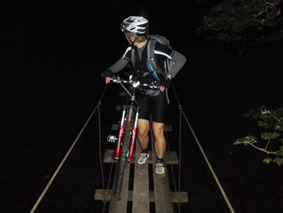
Group 1 rode up the Alpspitz and got soaked but we stayed dry. Afterwards we visited Suzi for food and drink as it was her birthday.
24km and 430 meters of climbing. Track is at http://www.gpsies.com/map.do?fileId=nssizyajygemjqtm

Group 1 rode up the Alpspitz and got soaked but we stayed dry. Afterwards we visited Suzi for food and drink as it was her birthday.
24km and 430 meters of climbing. Track is at http://www.gpsies.com/map.do?fileId=nssizyajygemjqtm
... link (0 Kommentare) ... comment
Sonntag, 14. September 2014
140914 Cappuccino in Livigno
neill, 15:19h
A morning tour to finish our long weekend in Livigno. We rode up one side of the valley and then down the other side. Trails all the way - partly flowy and partly challenging but all great fun.
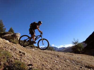
Four days of dream tours in a beautiful valley with a fun group of people.

18 kms with 520 meters of climbing
Track is at http://www.gpsies.com/map.do?fileId=hugoalmjnogaudhz
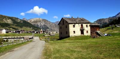
In the four days we climbed a total of 4600 meters!
My photos are at https://plus.google.com/u/0/photos/103827427036815679772/albums/6058985831149643201
Jon's pictures are at https://plus.google.com/u/0/photos/+JonFrench/albums/6059274502830412641?cfem=1
Max was also in Livigno but he was cycling with the heros in group 1. His blog is here.

Four days of dream tours in a beautiful valley with a fun group of people.

18 kms with 520 meters of climbing
Track is at http://www.gpsies.com/map.do?fileId=hugoalmjnogaudhz

In the four days we climbed a total of 4600 meters!
My photos are at https://plus.google.com/u/0/photos/103827427036815679772/albums/6058985831149643201
Jon's pictures are at https://plus.google.com/u/0/photos/+JonFrench/albums/6059274502830412641?cfem=1
Max was also in Livigno but he was cycling with the heros in group 1. His blog is here.
... link (0 Kommentare) ... comment
Samstag, 13. September 2014
140913 Monte della Rezze - Livigno
neill, 20:10h
Started the third day in Livigno by catching the Tagliede cable car 500 meters up the mountain. We then pushed and biked across a lunar landscape up to the top of the Monte della Rezze at 2858 meters above sea level. There we drank a Grappa that we found in the refuge hut and enjoyed the view.

We cycled back to a small lake near the top of the Carosello3000 lift and then down a challenging but fun trail to the Fedaria Alm. From there we followed the valley down to a stunningly beautiful restaurant on the side of the valley - La Tea da Memi. The farmhouse is 140 years old and has been perfectly restored by the owner (a carpenter) and his wife. They now live there all year round and run it as a restaurant.
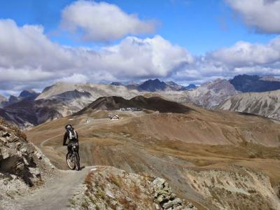
We came back to the hotel along a track that followed the side of the main valley and so, for the first time, cycled downhill to the hotel at the end of the day. From here we can see the Monte della Rezze a thousand meters above us and it is hard to believe we really cycled to the top of it.
31km and 1100 meters of climbing + 500 with the lift.
Track is at http://www.gpsies.com/map.do?fileId=zrljyckxjvkqxvyv
My photos are at https://plus.google.com/u/0/photos/103827427036815679772/albums/6058982472128112385
Jons photos are at https://plus.google.com/u/0/photos/+JonFrench/albums/6058601229724589249

We cycled back to a small lake near the top of the Carosello3000 lift and then down a challenging but fun trail to the Fedaria Alm. From there we followed the valley down to a stunningly beautiful restaurant on the side of the valley - La Tea da Memi. The farmhouse is 140 years old and has been perfectly restored by the owner (a carpenter) and his wife. They now live there all year round and run it as a restaurant.

We came back to the hotel along a track that followed the side of the main valley and so, for the first time, cycled downhill to the hotel at the end of the day. From here we can see the Monte della Rezze a thousand meters above us and it is hard to believe we really cycled to the top of it.
31km and 1100 meters of climbing + 500 with the lift.
Track is at http://www.gpsies.com/map.do?fileId=zrljyckxjvkqxvyv
My photos are at https://plus.google.com/u/0/photos/103827427036815679772/albums/6058982472128112385
Jons photos are at https://plus.google.com/u/0/photos/+JonFrench/albums/6058601229724589249
... link (0 Kommentare) ... comment
... nächste Seite
