... newer stories
Freitag, 7. Juni 2013
130606 Sorg Alpe
neill, 12:43h
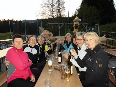
Finally a Thursday evening that was warm and sunny. We cycled through Vilstal and Jungholz to the Sorg Alpe. Shortly after we arrived the other group also appeared so there were twenty of us in total.
Tried to cycle back along the lake but the path was still under water from the flooding.
35kms and 580 meters of climbing
Track at http://www.gpsies.com/map.do?fileId=vmqvzdkpumwpatfs
Pictures at https://picasaweb.google.com/103827427036815679772/2013CyclingIII

Tried to cycle back along the lake but the path was still under water from the flooding.
35kms and 580 meters of climbing
Track at http://www.gpsies.com/map.do?fileId=vmqvzdkpumwpatfs
Pictures at https://picasaweb.google.com/103827427036815679772/2013CyclingIII
... link (0 Kommentare) ... comment
Freitag, 31. Mai 2013
130530 Brenner Pass
neill, 19:30h
Got out of the train at the top of the Brenner Pass and then cycled the 38kms downhill to the station in Innsbruck.
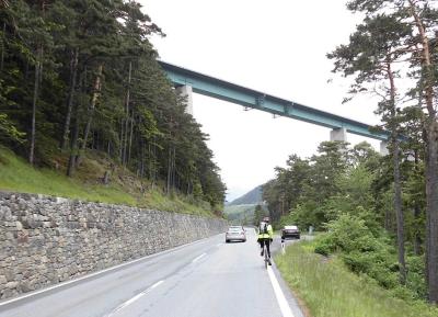
We left the top of the pass in rain and arrived in rain but the 30 kms in between were dry allowing for some fast curves. Fun!
Track at http://www.gpsies.com/map.do?fileId=aismbsddjhknyowg
Photos at https://picasaweb.google.com/103827427036815679772/2013Milan?noredirect=1

We left the top of the pass in rain and arrived in rain but the 30 kms in between were dry allowing for some fast curves. Fun!
Track at http://www.gpsies.com/map.do?fileId=aismbsddjhknyowg
Photos at https://picasaweb.google.com/103827427036815679772/2013Milan?noredirect=1
... link (0 Kommentare) ... comment
130530 Rovereto
neill, 19:28h
Had a few hours to wait for the train to the Brenner Pass so we cycled 480 meters up out of the valley, changed in to dry tricots and then cycled back down for a cappucino and ice.
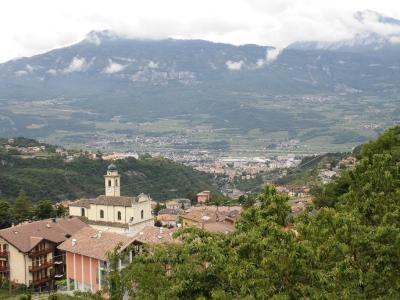
Despite the 500 kms the last four days, the route was great fun and the views were stunning.
16 kms and 480 meters of climbing. Track at http://www.gpsies.com/map.do?fileId=zcbugechphrrkqyl
Photos at https://picasaweb.google.com/103827427036815679772/2013Milan?noredirect=1

Despite the 500 kms the last four days, the route was great fun and the views were stunning.
16 kms and 480 meters of climbing. Track at http://www.gpsies.com/map.do?fileId=zcbugechphrrkqyl
Photos at https://picasaweb.google.com/103827427036815679772/2013Milan?noredirect=1
... link (0 Kommentare) ... comment
Mittwoch, 29. Mai 2013
130529 Lake Garda
neill, 21:58h
On the way home from Milan, we got off the train at Desenzano del Garda at the south end of Lake Garda and then cycled along the west shore before crossing the pass to Rovereto.
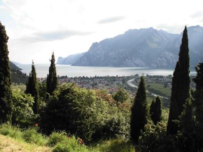
The route was 88kms with "only" 760 meters of climbing and would have been easy if I hadn't have cycled the 400 kms the previous three days.
http://www.gpsies.com/map.do?fileId=pcpiwstehaeudkwh
The weather was warm but windy. Only half an hour of rain and we sat that out while eating pizza.
Photos at https://picasaweb.google.com/103827427036815679772/2013Milan?noredirect=1
... link (0 Kommentare) ... comment
Dienstag, 28. Mai 2013
130526 Milan
neill, 21:27h
Two of us took three days to cycle the 418kms from Nesselwang to Milan. Set off in rain and at a temperature of 6°C but the weather got better and we had a fun five days (including the two days of cycling and train riding to get back).
418 kms with 4000 meters of climbing. Track at http://www.gpsies.com/map.do?fileId=anftazlpzetzogeg
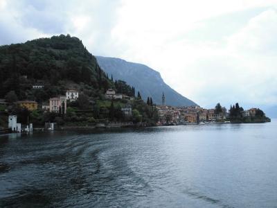
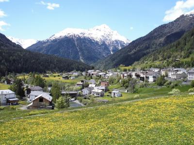
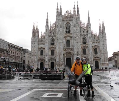
The first day we cycled from home, over the Fernpass and then along the Inn Valley to beyond Landeck. On the second day we rode in to Switzerland, on up to St. Moritz (and the Cresta Run) and then over the Maloja Pass. The third day we rode past Lake Como and on to Milan. On the fourth day we rode to the cathedral for a photo and then caught the train to start home.
Photos at https://picasaweb.google.com/103827427036815679772/2013Milan?noredirect=1

418 kms with 4000 meters of climbing. Track at http://www.gpsies.com/map.do?fileId=anftazlpzetzogeg

The first day we cycled from home, over the Fernpass and then along the Inn Valley to beyond Landeck. On the second day we rode in to Switzerland, on up to St. Moritz (and the Cresta Run) and then over the Maloja Pass. The third day we rode past Lake Como and on to Milan. On the fourth day we rode to the cathedral for a photo and then caught the train to start home.
Photos at https://picasaweb.google.com/103827427036815679772/2013Milan?noredirect=1

... link (0 Kommentare) ... comment
Sonntag, 26. Mai 2013
130523 Buronhütte
neill, 00:05h
An overcast Thursday evening and later rain. The second half of the ride was wet and very cold.
17 kms and 460 meters of climbing.
Track at http://www.gpsies.com/map.do?fileId=cfxiucszmssduzcx
Camera was broken as I pushed Jon's buggy over it.
17 kms and 460 meters of climbing.
Track at http://www.gpsies.com/map.do?fileId=cfxiucszmssduzcx
Camera was broken as I pushed Jon's buggy over it.
... link (0 Kommentare) ... comment
Montag, 20. Mai 2013
130516 Mühlbach
neill, 19:44h
The weather forecast said rain but luckily they lied.
An enjoyable tour with more tracks and trails than roads.
28kms and 550 meters of climbing
Track at http://www.gpsies.com/map.do?fileId=zwozmvizmsvvbcvm
An enjoyable tour with more tracks and trails than roads.
28kms and 550 meters of climbing
Track at http://www.gpsies.com/map.do?fileId=zwozmvizmsvvbcvm
... link (0 Kommentare) ... comment
Dienstag, 14. Mai 2013
130514 Tannheimertal
neill, 23:32h
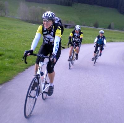
With the "Tuesday Bikers" on a sunny evening. Up in to Austria and then back down in to Germany. Doing 66km/h one meter behind Jon I was wondering how long you need to brake at that speed?
52 km and 561 meters of climbing
Track at http://www.gpsies.com/map.do?fileId=fqmtznpbiqotfpcy
Jon's pictures at https://plus.google.com/photos/100547066824249637955/albums/5865862959006086625/5878189394089432610

52 km and 561 meters of climbing
Track at http://www.gpsies.com/map.do?fileId=fqmtznpbiqotfpcy
Jon's pictures at https://plus.google.com/photos/100547066824249637955/albums/5865862959006086625/5878189394089432610
... link (0 Kommentare) ... comment
Donnerstag, 9. Mai 2013
130509 Faulensee
neill, 22:00h
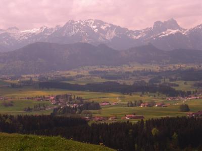
A Sunday tour to a lake I had never even heard of - the Faulensee. We rode over the Beichelstein to get there and add a few meters of climbing and back via Vils in Austria.
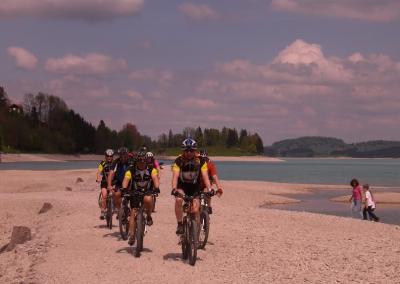
On the way back we also rode "through" the Forgensee lake. It is a resevoir and not currently full so the old road was above water level.
52 kms and nearly 800 meters of climbing.
Track is at http://www.gpsies.com/map.do?fileId=voekzodakucmmnbf
More pictures at https://plus.google.com/photos/103827427036815679772/albums/5876039696493748161?banner=pwa
Jon's pictures are at https://plus.google.com/photos/100547066824249637955/albums/5876255920545131825

On the way back we also rode "through" the Forgensee lake. It is a resevoir and not currently full so the old road was above water level.

52 kms and nearly 800 meters of climbing.
Track is at http://www.gpsies.com/map.do?fileId=voekzodakucmmnbf
More pictures at https://plus.google.com/photos/103827427036815679772/albums/5876039696493748161?banner=pwa
Jon's pictures are at https://plus.google.com/photos/100547066824249637955/albums/5876255920545131825
... link (0 Kommentare) ... comment
Sonntag, 5. Mai 2013
130505 Postsloch
neill, 23:51h
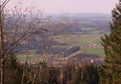
My first "mountain" mountain biking this year. After the 80kms yesterday, a gentle mountain bike ride half way up the local mountain and back down again.
Only 9km but nearly 400 meters of climbing.
Track at http://www.gpsies.com/map.do?fileId=xnoptxunouqeolxb

Only 9km but nearly 400 meters of climbing.
Track at http://www.gpsies.com/map.do?fileId=xnoptxunouqeolxb
... link (0 Kommentare) ... comment
Samstag, 4. Mai 2013
130504 Stötten
neill, 23:23h
Out with Heidi for a training run on our race bikes. We had no plan of where to go and decided at each turn based on in which direction there were the least clouds.
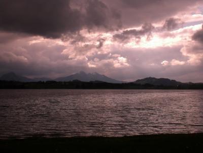
Ended up doing a fantastic 80km trip largely on routes we had never been on before. The old railway line from MArktoberdorf to Roßhaupten has been converted to a cycling path and is fantastic as a race bike route. The next picture is an old station on the route.
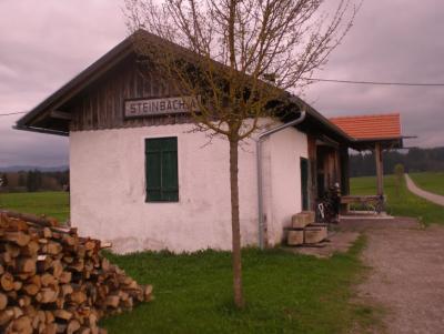
82km with 800 meters of climbing
Track at http://www.gpsies.com/map.do?fileId=yptbysrlcnxhhzme
More pictures at https://plus.google.com/photos/103827427036815679772/albums/5866409348860352993?banner=pwa

Ended up doing a fantastic 80km trip largely on routes we had never been on before. The old railway line from MArktoberdorf to Roßhaupten has been converted to a cycling path and is fantastic as a race bike route. The next picture is an old station on the route.

82km with 800 meters of climbing
Track at http://www.gpsies.com/map.do?fileId=yptbysrlcnxhhzme
More pictures at https://plus.google.com/photos/103827427036815679772/albums/5866409348860352993?banner=pwa
... link (0 Kommentare) ... comment
130502 Pfronten
neill, 23:17h
Thursday evening and 10 of us cycled to and then around Pfronten. We got absolutely soaked in Achtal - the same thing happened there a few years ago.
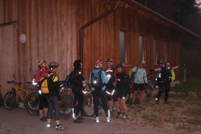
28km and 345 meters of climbing.
Track at http://www.gpsies.com/map.do?fileId=xurgtnlzospzuuwt
More photos at https://plus.google.com/photos/103827427036815679772/albums/5866409348860352993?banner=pwa

28km and 345 meters of climbing.
Track at http://www.gpsies.com/map.do?fileId=xurgtnlzospzuuwt
More photos at https://plus.google.com/photos/103827427036815679772/albums/5866409348860352993?banner=pwa
... link (0 Kommentare) ... comment
Mittwoch, 1. Mai 2013
130501 Mayday
neill, 22:12h
Missed the Tuesday night reace biketour last night so went out for an hour today.
In all the villages I passed through, they were putting up the new maypoles.
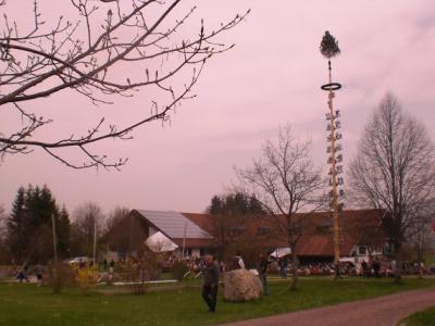
22kms and 250 meters of climbing.
Track at http://www.gpsies.com/map.do?fileId=wiarczqkirgobnqz
In all the villages I passed through, they were putting up the new maypoles.

22kms and 250 meters of climbing.
Track at http://www.gpsies.com/map.do?fileId=wiarczqkirgobnqz
... link (0 Kommentare) ... comment
Freitag, 26. April 2013
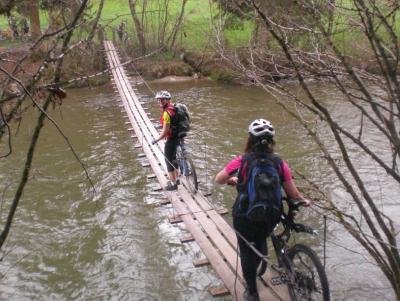
130425 Hanging Bridge
neill, 21:44h
A classic "beginning of season" tour.
11 of us were out on a lovely warm spring evening.
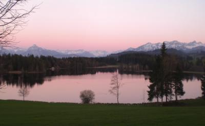
28kms and 450 meters of climbing
Track is at http://www.gpsies.com/map.do?fileId=eejopzztpnwzoqww
More pictures at https://plus.google.com/photos/103827427036815679772/albums/5866409348860352993?banner=pwa
11 of us were out on a lovely warm spring evening.

28kms and 450 meters of climbing
Track is at http://www.gpsies.com/map.do?fileId=eejopzztpnwzoqww

More pictures at https://plus.google.com/photos/103827427036815679772/albums/5866409348860352993?banner=pwa
... link (0 Kommentare) ... comment
Freitag, 19. April 2013
130418 Sechs Weiher
neill, 02:03h
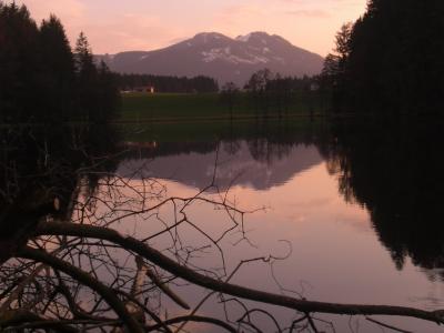
After the great race bike tour at lunch time, we were out with the mountain bikes this evening. Through the local countryside past six lakes.
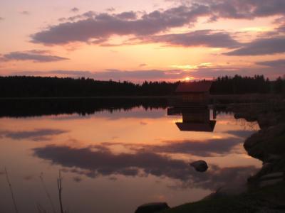
22km and 300 meters of climbing
Track at http://www.gpsies.com/map.do?fileId=ynfvqgknblohaxcp
More pictures at https://plus.google.com/photos/103827427036815679772/albums/5866409348860352993?banner=pwa

22km and 300 meters of climbing
Track at http://www.gpsies.com/map.do?fileId=ynfvqgknblohaxcp

More pictures at https://plus.google.com/photos/103827427036815679772/albums/5866409348860352993?banner=pwa
... link (0 Kommentare) ... comment
Donnerstag, 18. April 2013
130418 Ottaker and back
neill, 17:23h
Sun shine and warm weather today. It is a Wednesday but by taking an extended „lunch break“ we (Heidi and I) managed a two hour race bike tour across the Allgäu hills. 40 kilometers and 620 meters of climbing with an average speed of 20km/h isn't bad for the first „serious“ ride of 2013.

Track is at http://www.gpsies.com/map.do?fileId=gyyasgininvacdja

Track is at http://www.gpsies.com/map.do?fileId=gyyasgininvacdja
... link (0 Kommentare) ... comment
... older stories
