... newer stories
Sonntag, 14. Juli 2013
110714 Tannheimertal & Namlostal
neill, 18:01h
Not the longest bike ride I have ever done but probably the steepest.
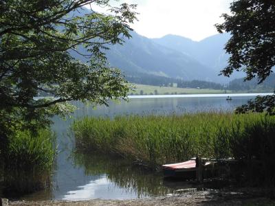
From home Heidi and I cycled up to Grän in Tannheimertal and then down the Gaichtpass. We then followed the Lech up to Stanzach and then cycled up the ridiculously steep pass to Namlos and on zo Berwang before losing 500 meters back down to Bichlbach. From there we cycled home the opposite way to the route we took to Milan.

Pictures at https://plus.google.com/photos/103827427036815679772/albums/5897918979729496513/5900468196802179234?banner=pwa&pid=5900468196802179234&oid=103827427036815679772
110 kms with 1400 meters of climbing.
Track is at http://www.gpsies.com/map.do?fileId=vlamltweugilxgli

From home Heidi and I cycled up to Grän in Tannheimertal and then down the Gaichtpass. We then followed the Lech up to Stanzach and then cycled up the ridiculously steep pass to Namlos and on zo Berwang before losing 500 meters back down to Bichlbach. From there we cycled home the opposite way to the route we took to Milan.

Pictures at https://plus.google.com/photos/103827427036815679772/albums/5897918979729496513/5900468196802179234?banner=pwa&pid=5900468196802179234&oid=103827427036815679772
110 kms with 1400 meters of climbing.
Track is at http://www.gpsies.com/map.do?fileId=vlamltweugilxgli
... link (0 Kommentare) ... comment
Samstag, 13. Juli 2013
110711 Untermaiselstein
neill, 23:54h
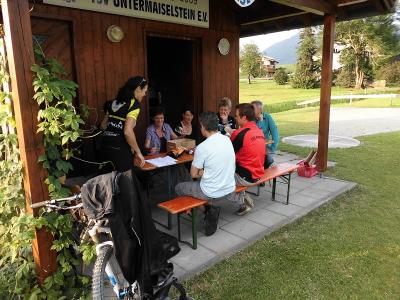
Heidi and I had to attend a meeting in Untermaiselstein so, rather than miss an evenings cycling, we cycled there and back.
Photos at https://picasaweb.google.com/103827427036815679772/2013CyclingIV?noredirect=1#5900192242510684034
45 kms and 650 meters of climbing
Track at http://www.gpsies.com/map.do?fileId=vakdzlpgzsydjowu

Photos at https://picasaweb.google.com/103827427036815679772/2013CyclingIV?noredirect=1#5900192242510684034
45 kms and 650 meters of climbing
Track at http://www.gpsies.com/map.do?fileId=vakdzlpgzsydjowu
... link (0 Kommentare) ... comment
Mittwoch, 10. Juli 2013
130709 Schnitzlertal reloaded
neill, 00:41h
It is only 5 days since the last time I cycled the Schnitzlertal but today we were there again.
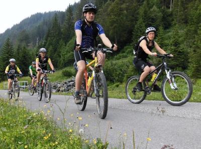
Normally on Tuesday we race bike but this week we decided to show Max the Schnitzlertal as he had never been there. After disorganisational chaos to begin with caused by the plan being changed twice in the last hour, we eventually found every one who had said they wanted to ride and set off.
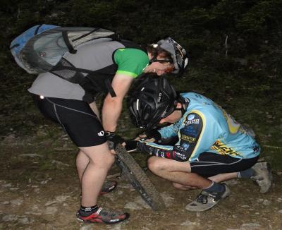
Took a completely different route up and down to last week. The path up was much steeper and with far less tarmac but we rode fantastic trails on the way down :-)
39km and 850 meters of climbing. Less distance than last week but more climbing.
Track is at http://www.gpsies.com/map.do?fileId=mnglgybjhilxmjxz
Great video of the tour by Nico at http://www.youtube.com/watch?v=N1Jd2VS-jc8&feature=youtu.be
My pictures are at https://plus.google.com/photos/103827427036815679772/albums/5897918979729496513/5898720030151492354?banner=pwa&pid=5898720030151492354&oid=103827427036815679772
Max's blog is at http://maxhogarth.blogspot.de/2013/07/tuesday-schnitzlertal.html

Normally on Tuesday we race bike but this week we decided to show Max the Schnitzlertal as he had never been there. After disorganisational chaos to begin with caused by the plan being changed twice in the last hour, we eventually found every one who had said they wanted to ride and set off.

Took a completely different route up and down to last week. The path up was much steeper and with far less tarmac but we rode fantastic trails on the way down :-)
39km and 850 meters of climbing. Less distance than last week but more climbing.
Track is at http://www.gpsies.com/map.do?fileId=mnglgybjhilxmjxz
Great video of the tour by Nico at http://www.youtube.com/watch?v=N1Jd2VS-jc8&feature=youtu.be
My pictures are at https://plus.google.com/photos/103827427036815679772/albums/5897918979729496513/5898720030151492354?banner=pwa&pid=5898720030151492354&oid=103827427036815679772
Max's blog is at http://maxhogarth.blogspot.de/2013/07/tuesday-schnitzlertal.html
... link (0 Kommentare) ... comment
Sonntag, 7. Juli 2013
130707 Roßberg Alpe
neill, 20:39h
Twelve of us set off in cloud but later broke through in to sun. Stopped for a coffee at the Mooshütte and then cycled, pushed and carried up to the Roßberg Alpe for a fantastic lunch. Cycled back to Nesselwang for coffee, beer and Ramazotti at Brandler's.

44 kms and 960 meters of climbing.
http://www.gpsies.com/map.do?fileId=jidsvvzyqukhocic

Photos at https://plus.google.com/photos/103827427036815679772/albums/5897918979729496513/5897919186426428210?banner=pwa&pid=5897919186426428210&oid=103827427036815679772
Jon's photos at https://plus.google.com/photos/100547066824249637955/albums/5865862959006086625/5897954392270741058?pid=5897954392270741058&oid=100547066824249637955

44 kms and 960 meters of climbing.
http://www.gpsies.com/map.do?fileId=jidsvvzyqukhocic

Photos at https://plus.google.com/photos/103827427036815679772/albums/5897918979729496513/5897919186426428210?banner=pwa&pid=5897919186426428210&oid=103827427036815679772
Jon's photos at https://plus.google.com/photos/100547066824249637955/albums/5865862959006086625/5897954392270741058?pid=5897954392270741058&oid=100547066824249637955
... link (0 Kommentare) ... comment
Freitag, 5. Juli 2013
130704 Schnitzlertal
neill, 13:53h
The weather promised rain but we are all waterproof so we cycled up to the Schnitzlertal. In the end we stayed dry until the last five minutes when it started to rain.
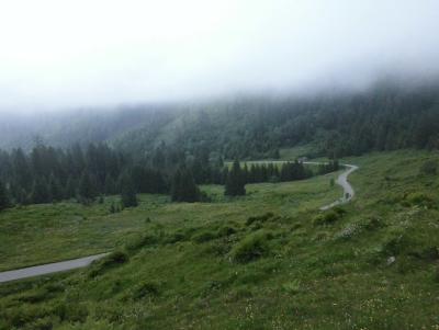
42 kilometers 820 meters of climbing
http://www.gpsies.com/map.do?fileId=mlpxljyvyiawartb
My pictures are at https://plus.google.com/photos/103827427036815679772/albums/5887203753058455121/5897197375371678690?banner=pwa&pid=5897197375371678690&oid=103827427036815679772
Jon's pictures are at https://plus.google.com/photos/100547066824249637955/albums/5865862959006086625/5897027947237202770?pid=5897027947237202770&oid=100547066824249637955
... link (0 Kommentare) ... comment
Dienstag, 2. Juli 2013
130702 Petersthal
neill, 23:19h
Three of us out on our racebikes. First out to Petersthal and then Görisried.
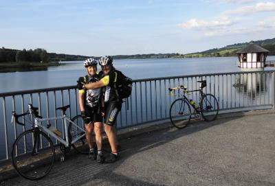
And 15 minutes after we got back it started raining!
48km and 725 meters of climbing
http://www.gpsies.com/map.do?fileId=wydkdxbqmgjxkgjz
Take a look at that horrible hill at 34.7km. 12% and incredibly long.
Pictures at https://plus.google.com/photos/103827427036815679772/albums/5887203753058455121/5896098708355260082?banner=pwa&pid=5896098708355260082&oid=103827427036815679772
Jon's pictures at https://plus.google.com/photos/100547066824249637955/albums/5865862959006086625/5896285518619780546?pid=5896285518619780546&oid=100547066824249637955
... link (0 Kommentare) ... comment
Sonntag, 30. Juni 2013
130630 Grüntensee
neill, 12:55h
Despite the weather forecast it was not raining so I took my race bike out for the "standard trip" round the Grüntensee.
22km and 280 meters of climbing.
Track at http://www.gpsies.com/map.do?fileId=vpjqpfnloszoothq
22km and 280 meters of climbing.
Track at http://www.gpsies.com/map.do?fileId=vpjqpfnloszoothq
... link (0 Kommentare) ... comment
Freitag, 28. Juni 2013
130627 Edelsberg
neill, 09:40h
Because it was cloudy and had rained earlier we cycled up the Edelsberg. By the time we reached the top, it was obvious that it was not going to rain again so we carried on over the top and then back home through Stubental.
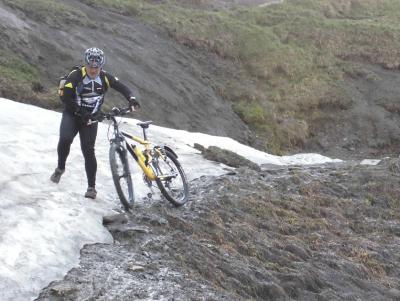
Despite this being one of the longest days this year, we only just made it to the bottom before it was dark and cycled home with lights on.
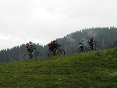
Pictures at https://plus.google.com/photos/103827427036815679772/albums/5887203753058455121/5894583397968195458?banner=pwa&pid=5894583397968195458&oid=103827427036815679772
25km and 950 meters of climbing
The track is at http://www.gpsies.com/map.do?fileId=yonzgdnfmqwpjpqf
Jon's pictures are at https://plus.google.com/photos/100547066824249637955/albums/5865862959006086625/5894440861998852338?pid=5894440861998852338&oid=100547066824249637955

Despite this being one of the longest days this year, we only just made it to the bottom before it was dark and cycled home with lights on.

Pictures at https://plus.google.com/photos/103827427036815679772/albums/5887203753058455121/5894583397968195458?banner=pwa&pid=5894583397968195458&oid=103827427036815679772
25km and 950 meters of climbing
The track is at http://www.gpsies.com/map.do?fileId=yonzgdnfmqwpjpqf
Jon's pictures are at https://plus.google.com/photos/100547066824249637955/albums/5865862959006086625/5894440861998852338?pid=5894440861998852338&oid=100547066824249637955
... link (0 Kommentare) ... comment
Dienstag, 25. Juni 2013
130625 Kappel
neill, 23:07h
Today is Tuesday so we would normally have been out on our race bikes but it was cold (12°C) and threatened rain so we went mountain biking. Max and Nico normally mountain bike on Tuesday so they joined us and Wera met us at Jon's by chance so there were seven of us.
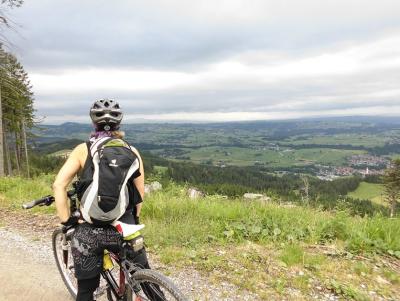
Cycled up the Alpspitz to the turn off towards Kappel where Max and Nico left us to do crazy stuff. Then down in to Kappel and home along a trail.
16km and 700 meters of climbing
Track at http://www.gpsies.com/map.do?fileId=muhcguscvhwhhbxb
Photos at https://plus.google.com/photos/103827427036815679772/albums/5887203753058455121/5893501047692165346?banner=pwa&pid=5893501047692165346&oid=103827427036815679772
Max's blog is at http://maxhogarth.blogspot.de/2013/06/alpspitze-grat.html
and his pictures are at https://plus.google.com/photos/102257273463070793435/albums/5870116469012067889/5893531272077922354?pid=5893531272077922354&oid=102257273463070793435
Jon posted two pictures at https://plus.google.com/photos/100547066824249637955/albums/5865862959006086625/5894440779827842610?pid=5894440779827842610&oid=100547066824249637955
Nico has posted a picture of the crazy stuff that Max and him get up to at https://www.youtube.com/watch?feature=player_embedded&v=lUewvDetebk
... link (0 Kommentare) ... comment
Freitag, 21. Juni 2013
130620 Himmelsreich
neill, 17:37h
Two hours before we were due to set off this evening there was a huge thunder storm with sheets of water. By the time we left the sun was shining again so seven of us cycled up the long steep track to the Himmelsreich pass in Pfronten.
From Himmelreich we followed the super steep and stony trail back down in to the valley. All of us managed to cycle at the least most of the way which was a great achievement.
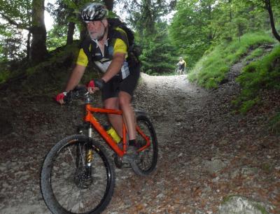
Photo by Jon
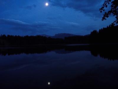
We next cycled to the Kögelweiher lake for a swim in the moonlight. It really is a tough life.
30 kms and 574 meters of climbing
http://www.gpsies.com/map.do?fileId=bvodnpsvdghdnnre
Pictures at https://plus.google.com/photos/103827427036815679772/albums/5887203753058455121/5892013168505436338?banner=pwa&pid=5892013168505436338&oid=103827427036815679772
Jons photos are at https://plus.google.com/photos/100547066824249637955/albums/5865862959006086625/5891854948848635890?pid=5891854948848635890&oid=100547066824249637955

From Himmelreich we followed the super steep and stony trail back down in to the valley. All of us managed to cycle at the least most of the way which was a great achievement.

Photo by Jon
We next cycled to the Kögelweiher lake for a swim in the moonlight. It really is a tough life.
30 kms and 574 meters of climbing
http://www.gpsies.com/map.do?fileId=bvodnpsvdghdnnre
Pictures at https://plus.google.com/photos/103827427036815679772/albums/5887203753058455121/5892013168505436338?banner=pwa&pid=5892013168505436338&oid=103827427036815679772
Jons photos are at https://plus.google.com/photos/100547066824249637955/albums/5865862959006086625/5891854948848635890?pid=5891854948848635890&oid=100547066824249637955
... link (0 Kommentare) ... comment
Mittwoch, 19. Juni 2013
130618 Marktoberdorf
neill, 01:10h
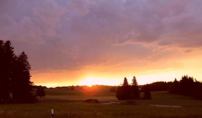
At the end of a really hot day (33°C in the shade) we went out on our race bikes this evening. Finished the ride with a swim in the warm Grundweiher. When I got back two ex-colleagues invited me for a drink outside the local pub. What a great way to spend an evening.
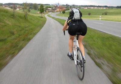
53km with 600 meters of climbing.
http://www.gpsies.com/map.do?fileId=wqgefhyjwrtpuchw
Pictures at https://plus.google.com/photos/103827427036815679772/albums/5887203753058455121/5890934060708825778?banner=pwa&pid=5890934060708825778&oid=103827427036815679772
Jons pictures at https://plus.google.com/photos/100547066824249637955/albums/5865862959006086625/5891108934355601650?pid=5891108934355601650&oid=100547066824249637955

53km with 600 meters of climbing.
http://www.gpsies.com/map.do?fileId=wqgefhyjwrtpuchw

Pictures at https://plus.google.com/photos/103827427036815679772/albums/5887203753058455121/5890934060708825778?banner=pwa&pid=5890934060708825778&oid=103827427036815679772
Jons pictures at https://plus.google.com/photos/100547066824249637955/albums/5865862959006086625/5891108934355601650?pid=5891108934355601650&oid=100547066824249637955
... link (0 Kommentare) ... comment
Sonntag, 16. Juni 2013
130616 Rehbach
neill, 20:46h
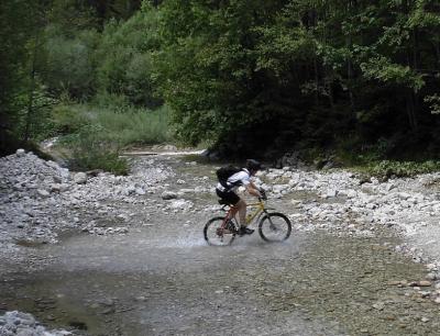
Gabi, Irene, Max and I went for a gentle ride up the Vils valley and then back down the Wertach valley. For three of us it was a chance to reduce the alcohol in our blood after Christa's 50th birthday yesterday.
Pictures at https://plus.google.com/photos/103827427036815679772/albums/5887203753058455121/5890126296502806386?banner=pwa&pid=5890126296502806386&oid=103827427036815679772
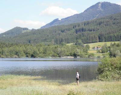
38 kms and 590 meters of climbing.
Track at http://www.gpsies.com/map.do?fileId=ecxbollcdpduenem
Max's report at http://maxhogarth.blogspot.de/2013/06/sunday-rehbach.html

Pictures at https://plus.google.com/photos/103827427036815679772/albums/5887203753058455121/5890126296502806386?banner=pwa&pid=5890126296502806386&oid=103827427036815679772

38 kms and 590 meters of climbing.
Track at http://www.gpsies.com/map.do?fileId=ecxbollcdpduenem
Max's report at http://maxhogarth.blogspot.de/2013/06/sunday-rehbach.html
... link (0 Kommentare) ... comment
Freitag, 14. Juni 2013
130613 Reuttewanne
neill, 15:51h
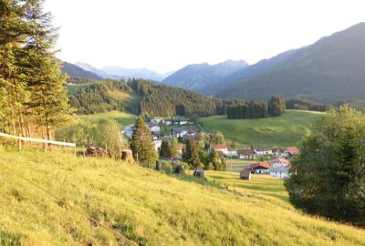
Nine of us sweated our way to the Upper Reuttewanne Alp and then enjoyed the run down in to Jungholz. Because it was such a nice evening, we then returned to Nesselwang through the Vils valley.
Jon joined Group 2 today. Welcome to fun cycling Jon.
Pictures at https://plus.google.com/photos/103827427036815679772/albums/5887203753058455121/5890128364602735986?banner=pwa&pid=5890128364602735986&oid=103827427036815679772
27 kms and 750 meters of climbing.
Track at http://www.gpsies.com/map.do?fileId=gfsoizgrvyiismls
Jon's pictures at https://plus.google.com/photos/100547066824249637955/albums/5865862959006086625/5889317188572514162?pid=5889317188572514162&oid=100547066824249637955
Jon joined Group 2 today. Welcome to fun cycling Jon.

Pictures at https://plus.google.com/photos/103827427036815679772/albums/5887203753058455121/5890128364602735986?banner=pwa&pid=5890128364602735986&oid=103827427036815679772
27 kms and 750 meters of climbing.
Track at http://www.gpsies.com/map.do?fileId=gfsoizgrvyiismls
Jon's pictures at https://plus.google.com/photos/100547066824249637955/albums/5865862959006086625/5889317188572514162?pid=5889317188572514162&oid=100547066824249637955
... link (0 Kommentare) ... comment
Samstag, 8. Juni 2013
130608 Jochpass
neill, 23:46h
Out alone on my race bike. Over the Jochpass to Sonthofen and then back over the Kranzegger Steig.
62kms with 750 meters of climbing and a fantastic 300 meter descent to Hindelang.
Track at http://www.gpsies.com/map.do?fileId=dahhfaawhyjdebvq
62kms with 750 meters of climbing and a fantastic 300 meter descent to Hindelang.
Track at http://www.gpsies.com/map.do?fileId=dahhfaawhyjdebvq
... link (0 Kommentare) ... comment
... older stories
