
... newer stories
Mittwoch, 31. Juli 2013
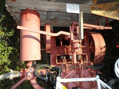
130730 Geocaching in Wald
neill, 09:17h
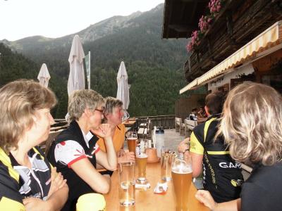
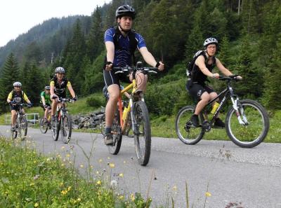
This evening Jon suggested a bit of "race bike geocaching".

We cycled to Wald and then did four geocaches.
https://www.geocaching.com/seek/cache_details.aspx?guid=b8c46363-557d-485c-9c44-9f0cb59b3f3f
https://www.geocaching.com/seek/cache_details.aspx?guid=3b7f9ba3-4ba7-488c-aeb1-9f73cc2f23ce
https://www.geocaching.com/seek/cache_details.aspx?guid=78d0443e-bcef-47e3-a3c1-cbfa0e27d027
https://www.geocaching.com/seek/cache_details.aspx?guid=a8d1e5a3-b968-47f6-93fd-aa3a0a94e632
Couldn't find the first one but the other three we found (Jon found two and a local showed us the fourth). We also got a guided tour of the local museum.
Cycled back via Lengenwang and Seeg to avoid finishing the tour with the "Ruckholzer Steig".
39kms with 500 meters of climbing
http://www.gpsies.com/map.do?fileId=dacpdazcyxruggxy
Jon's photos are at https://plus.google.com/photos/100547066824249637955/albums/5865862959006086625
... link (0 Kommentare) ... comment
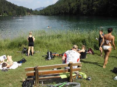
Sonntag, 28. Juli 2013
130728 Allatsee
neill, 21:20h
Today we had temperatures in the upper 30s so five of us cycled to the Allatsee for a swim. Afterwards we went for an ice in Nesselwang. It is a tough life.
34 kms but only 300 meters of climbing - enough in these temperatures.
Track at http://www.gpsies.com/map.do?fileId=jjtvblvppkcpnphy
Photos at https://plus.google.com/photos/103827427036815679772/albums/5887203753058455121/5905722997877746834?banner=pwa&pid=5905722997877746834&oid=103827427036815679772
... link (0 Kommentare) ... comment
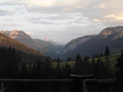
Samstag, 27. Juli 2013
130725 Bärenmoos
neill, 11:36h
Only six of us this evening. We cycled to Pfronten and then up to the Bärenmoos Alm. Enjoyed a drink and the views at sunset in to the mountains.
On the way home we stopped off at the Kögelweiher for a swim and to enjoy the moon rise.
36 kms and 700 meters of climbing.
Track is at http://www.gpsies.com/map.do?fileId=thvnykbpoytlphdc
Pictures at https://plus.google.com/photos/103827427036815679772/albums/5887203753058455121/5905198345684128642?banner=pwa&pid=5905198345684128642&oid=103827427036815679772
Jon's pictures at https://plus.google.com/photos/100547066824249637955/albums/5865862959006086625/5904896672989803170?pid=5904896672989803170&oid=100547066824249637955
... link (0 Kommentare) ... comment
Dienstag, 23. Juli 2013
130722 Water skiing
neill, 00:09h
Water skiing this evening with the kids from Heidi's sports group. Great fun. Every one managed to get all the way round the lake on a variety of devices including mono skis, wake boards, plates and knee boards.

... link (0 Kommentare) ... comment
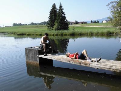
Sonntag, 21. Juli 2013
130721 Hängesteg
neill, 14:28h
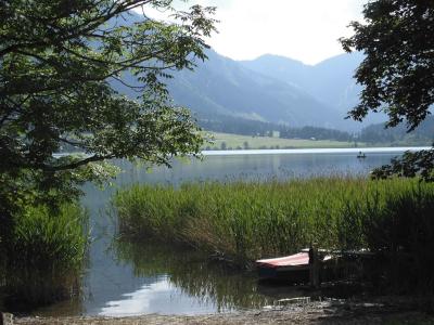
Sunday morning trip with Alison and Max. Across the suspension bridge and then for a swim in the Grundweiher.
When I jumped in the lake I very kindly aimed such that Max got a free shower. Unfortunately he was still clothed :-)
22km with 500 meters of climbing.
Track at http://www.gpsies.com/map.do?fileId=nugxuxgsqlnixfbf
When I jumped in the lake I very kindly aimed such that Max got a free shower. Unfortunately he was still clothed :-)
22km with 500 meters of climbing.
Track at http://www.gpsies.com/map.do?fileId=nugxuxgsqlnixfbf
... link (0 Kommentare) ... comment
Freitag, 19. Juli 2013
130718 Vilser Alm
neill, 09:24h
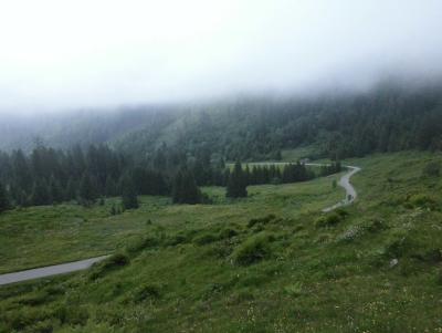
Thursday evening and another lovely evening. While the cracks in Group 1 stormed up the Breitenberg, we cycled across the border to Vils in Austria and then up to the Vilser Alm. After a drink we cycled back via the hidden back paths of Pfronten.
40 kilometers with 620 meters of climbing
Track at http://www.gpsies.com/map.do?fileId=qrsmzytgzlpyehxb
My pictures are at https://plus.google.com/photos/103827427036815679772/albums/5903015570987104113?banner=pwa
Jon's pictures at https://plus.google.com/photos/100547066824249637955/albums/5865862959006086625/5902245300446719762?pid=5902245300446719762&oid=100547066824249637955
... link (0 Kommentare) ... comment
130718 Mast building
neill, 09:20h
This morning we were back on top of the Grauen Stein at our new mast. It was a wonderful change to walk up without carrying batteries, screws or whatever.
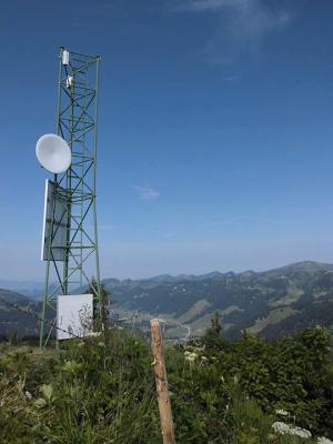
I rebuilt all the fences that we had taken down while Simon set the antennas up.
I rebuilt all the fences that we had taken down while Simon set the antennas up.
... link (0 Kommentare) ... comment
Dienstag, 16. Juli 2013
130715 Grauen Stein
neill, 23:13h
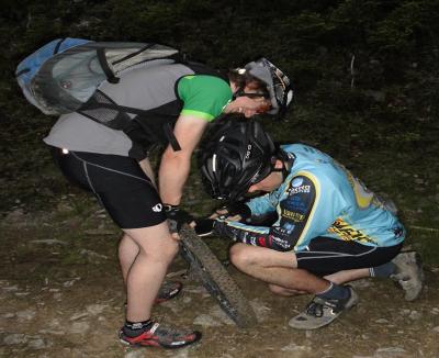
Today we built a mast on top of a 1700 meter high mountain. Drove as far as we could with quads, tractors and 4WD vehicles and the carried everything to the top. Luckily 10 locals came to help.

A day later I am still having trouble walking up the stairs.
Facebook gallery at https://www.facebook.com/photo.php?fbid=550336998363806&set=a.550336608363845.1073741825.175143275883182&type=1&theater
A day later I am still having trouble walking up the stairs.
Facebook gallery at https://www.facebook.com/photo.php?fbid=550336998363806&set=a.550336608363845.1073741825.175143275883182&type=1&theater
... link (0 Kommentare) ... comment
Sonntag, 14. Juli 2013
110714 Tannheimertal & Namlostal
neill, 18:01h
Not the longest bike ride I have ever done but probably the steepest.
From home Heidi and I cycled up to Grän in Tannheimertal and then down the Gaichtpass. We then followed the Lech up to Stanzach and then cycled up the ridiculously steep pass to Namlos and on zo Berwang before losing 500 meters back down to Bichlbach. From there we cycled home the opposite way to the route we took to Milan.

Pictures at https://plus.google.com/photos/103827427036815679772/albums/5897918979729496513/5900468196802179234?banner=pwa&pid=5900468196802179234&oid=103827427036815679772
110 kms with 1400 meters of climbing.
Track is at http://www.gpsies.com/map.do?fileId=vlamltweugilxgli
From home Heidi and I cycled up to Grän in Tannheimertal and then down the Gaichtpass. We then followed the Lech up to Stanzach and then cycled up the ridiculously steep pass to Namlos and on zo Berwang before losing 500 meters back down to Bichlbach. From there we cycled home the opposite way to the route we took to Milan.
Pictures at https://plus.google.com/photos/103827427036815679772/albums/5897918979729496513/5900468196802179234?banner=pwa&pid=5900468196802179234&oid=103827427036815679772
110 kms with 1400 meters of climbing.
Track is at http://www.gpsies.com/map.do?fileId=vlamltweugilxgli
... link (0 Kommentare) ... comment
Samstag, 13. Juli 2013
110711 Untermaiselstein
neill, 23:54h
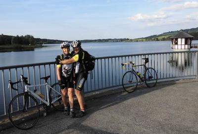
Heidi and I had to attend a meeting in Untermaiselstein so, rather than miss an evenings cycling, we cycled there and back.
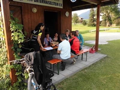
Photos at https://picasaweb.google.com/103827427036815679772/2013CyclingIV?noredirect=1#5900192242510684034
45 kms and 650 meters of climbing
Track at http://www.gpsies.com/map.do?fileId=vakdzlpgzsydjowu
Photos at https://picasaweb.google.com/103827427036815679772/2013CyclingIV?noredirect=1#5900192242510684034
45 kms and 650 meters of climbing
Track at http://www.gpsies.com/map.do?fileId=vakdzlpgzsydjowu
... link (0 Kommentare) ... comment
Mittwoch, 10. Juli 2013
130709 Schnitzlertal reloaded
neill, 00:41h
It is only 5 days since the last time I cycled the Schnitzlertal but today we were there again.
Normally on Tuesday we race bike but this week we decided to show Max the Schnitzlertal as he had never been there. After disorganisational chaos to begin with caused by the plan being changed twice in the last hour, we eventually found every one who had said they wanted to ride and set off.
Took a completely different route up and down to last week. The path up was much steeper and with far less tarmac but we rode fantastic trails on the way down :-)
39km and 850 meters of climbing. Less distance than last week but more climbing.
Track is at http://www.gpsies.com/map.do?fileId=mnglgybjhilxmjxz
Great video of the tour by Nico at http://www.youtube.com/watch?v=N1Jd2VS-jc8&feature=youtu.be
My pictures are at https://plus.google.com/photos/103827427036815679772/albums/5897918979729496513/5898720030151492354?banner=pwa&pid=5898720030151492354&oid=103827427036815679772
Max's blog is at http://maxhogarth.blogspot.de/2013/07/tuesday-schnitzlertal.html
... link (0 Kommentare) ... comment
Sonntag, 7. Juli 2013
130707 Roßberg Alpe
neill, 20:39h
Twelve of us set off in cloud but later broke through in to sun. Stopped for a coffee at the Mooshütte and then cycled, pushed and carried up to the Roßberg Alpe for a fantastic lunch. Cycled back to Nesselwang for coffee, beer and Ramazotti at Brandler's.

44 kms and 960 meters of climbing.
http://www.gpsies.com/map.do?fileId=jidsvvzyqukhocic

Photos at https://plus.google.com/photos/103827427036815679772/albums/5897918979729496513/5897919186426428210?banner=pwa&pid=5897919186426428210&oid=103827427036815679772
Jon's photos at https://plus.google.com/photos/100547066824249637955/albums/5865862959006086625/5897954392270741058?pid=5897954392270741058&oid=100547066824249637955
44 kms and 960 meters of climbing.
http://www.gpsies.com/map.do?fileId=jidsvvzyqukhocic
Photos at https://plus.google.com/photos/103827427036815679772/albums/5897918979729496513/5897919186426428210?banner=pwa&pid=5897919186426428210&oid=103827427036815679772
Jon's photos at https://plus.google.com/photos/100547066824249637955/albums/5865862959006086625/5897954392270741058?pid=5897954392270741058&oid=100547066824249637955
... link (0 Kommentare) ... comment
Freitag, 5. Juli 2013
130704 Schnitzlertal
neill, 13:53h
The weather promised rain but we are all waterproof so we cycled up to the Schnitzlertal. In the end we stayed dry until the last five minutes when it started to rain.
42 kilometers 820 meters of climbing
http://www.gpsies.com/map.do?fileId=mlpxljyvyiawartb
My pictures are at https://plus.google.com/photos/103827427036815679772/albums/5887203753058455121/5897197375371678690?banner=pwa&pid=5897197375371678690&oid=103827427036815679772
Jon's pictures are at https://plus.google.com/photos/100547066824249637955/albums/5865862959006086625/5897027947237202770?pid=5897027947237202770&oid=100547066824249637955
... link (0 Kommentare) ... comment
Dienstag, 2. Juli 2013
130702 Petersthal
neill, 23:19h
Three of us out on our racebikes. First out to Petersthal and then Görisried.
And 15 minutes after we got back it started raining!
48km and 725 meters of climbing
http://www.gpsies.com/map.do?fileId=wydkdxbqmgjxkgjz
Take a look at that horrible hill at 34.7km. 12% and incredibly long.
Pictures at https://plus.google.com/photos/103827427036815679772/albums/5887203753058455121/5896098708355260082?banner=pwa&pid=5896098708355260082&oid=103827427036815679772
Jon's pictures at https://plus.google.com/photos/100547066824249637955/albums/5865862959006086625/5896285518619780546?pid=5896285518619780546&oid=100547066824249637955
... link (0 Kommentare) ... comment
Sonntag, 30. Juni 2013
130630 Grüntensee
neill, 12:55h
Despite the weather forecast it was not raining so I took my race bike out for the "standard trip" round the Grüntensee.
22km and 280 meters of climbing.
Track at http://www.gpsies.com/map.do?fileId=vpjqpfnloszoothq
22km and 280 meters of climbing.
Track at http://www.gpsies.com/map.do?fileId=vpjqpfnloszoothq
... link (0 Kommentare) ... comment
... older stories