
... newer stories
Sonntag, 8. M‰rz 2015
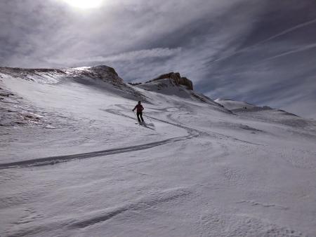
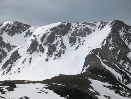
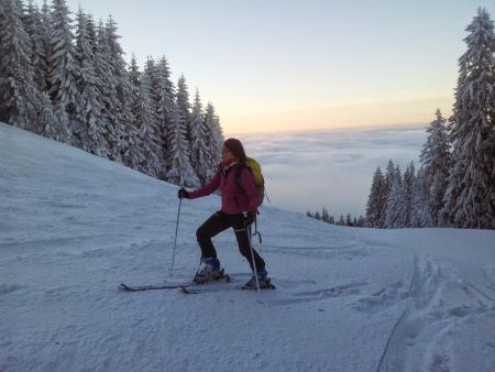
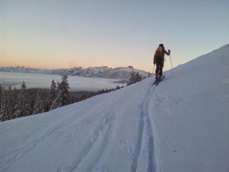
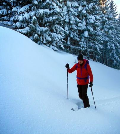
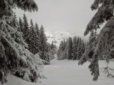
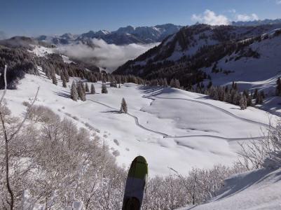
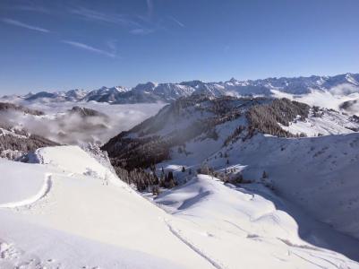
150308 Hahnenköpfle
neill, 18:17h
A gentle ski tour to a summit just below the Hoher Ifen. Stunning weather and great companions.
All the pictures are at https://plus.google.com/u/0/photos/103827427036815679772/albums/6097506762533868817
500 meters of climbing with the touring skis.
Track is at http://www.gpsies.com/map.do?fileId=sofpjrjodxsixbfr
All the pictures are at https://plus.google.com/u/0/photos/103827427036815679772/albums/6097506762533868817
500 meters of climbing with the touring skis.
Track is at http://www.gpsies.com/map.do?fileId=sofpjrjodxsixbfr
... link (0 Kommentare) ... comment
Samstag, 7. M‰rz 2015
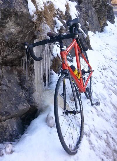
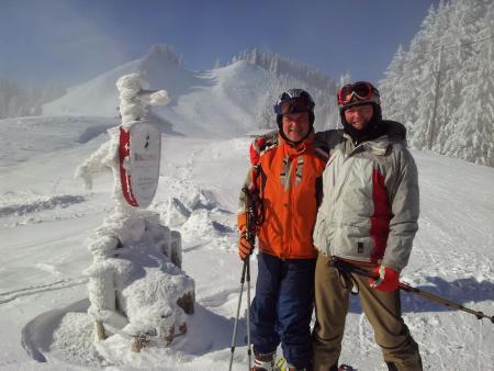
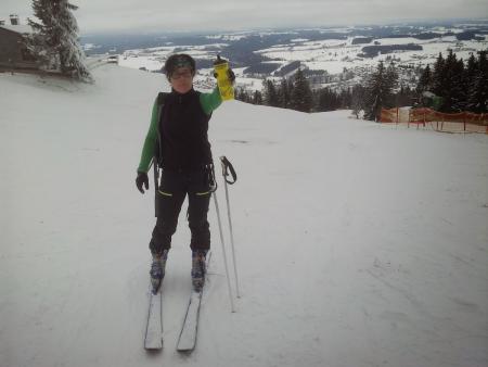
150307 Füssen
neill, 17:00h
My last time on a bike was Christmas Day just as it started snowing. That was 10 weeks ago. In 9 weeks we are cycling the 1000km to Rome.
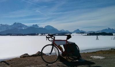
So today I opened the cycling season with a race bike ride to Füssen for a Cappuccino. Then on the Hopfensee.
44 kms with 450 meters of climbing. Track is at
http://www.gpsies.com/map.do?fileId=irchyspuctkfloue
So today I opened the cycling season with a race bike ride to Füssen for a Cappuccino. Then on the Hopfensee.
44 kms with 450 meters of climbing. Track is at
http://www.gpsies.com/map.do?fileId=irchyspuctkfloue
... link (0 Kommentare) ... comment
Sonntag, 1. M‰rz 2015
150301 Oberjoch
neill, 18:00h
A morning of skiing with two guests from England. No view and not so good weather. But good to watch them both getting better.
... link (0 Kommentare) ... comment
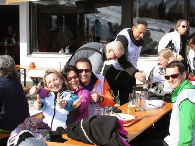
Samstag, 28. Februar 2015
150228 Off-piste
neill, 18:08h
This morning Max taught his cousins girlfriend to ski while I skied with my sister. In the afternoon the girls went home and we went up to the top of the mountain for "boys only skiing". Tom, Max and I spent two hours off piste in the forest in fresh snow. Brilliant fun. But my legs know that I am 30 years older than the boys.
... link (0 Kommentare) ... comment
Sonntag, 22. Februar 2015
150222 Sportheim Böck
neill, 21:57h
I needed a few more hours of training this week and it had snowed in the night so Heidi and I walked up to Sportheim Böck with our touring skis.
We skied back down via the "Grüne Strich". Steep with huge hillocks. Daniel took his ski course down there yesterday and said you could lose kids between the hillocks :-)
7 kms with 580 meters of climbing. Track is at http://www.gpsies.com/map.do?fileId=fdckkkegrbxfuwht
We skied back down via the "Grüne Strich". Steep with huge hillocks. Daniel took his ski course down there yesterday and said you could lose kids between the hillocks :-)
7 kms with 580 meters of climbing. Track is at http://www.gpsies.com/map.do?fileId=fdckkkegrbxfuwht
... link (0 Kommentare) ... comment
Samstag, 21. Februar 2015
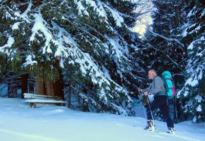
150221 Sportheim Böck
neill, 16:44h
A gentle afternoon walk with the touring skis to Sportheim Böck for a coffee. Stopped to be amazed at all the kids doing their tricks in the various "parks" ...

... and to use the free WLAN at the Redbull park - http://thestation.redbull.com/en/
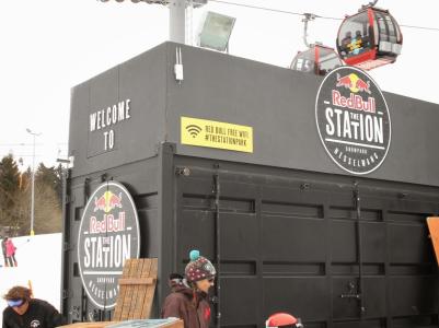
... and to use the free WLAN at the Redbull park - http://thestation.redbull.com/en/
... link (1 Kommentar) ... comment
Samstag, 14. Februar 2015
150214 Füssener Jöchl
neill, 20:04h
Today Caro and I took our touring skis and walked up through the woods to the Füssener Jöchl.
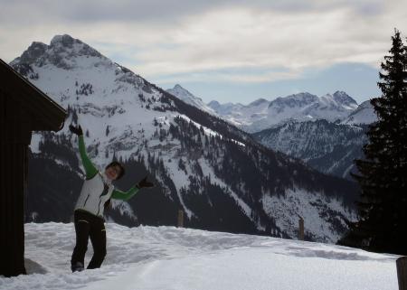
After coffee and cake at the restaurant at the top we skied back down the perfect piste.
Track (670 meters of climbing) is at http://www.gpsies.com/map.do?fileId=ujhtqwzcetvtrqrr
More photos at https://plus.google.com/u/0/photos/103827427036815679772/albums/6097506762533868817
After coffee and cake at the restaurant at the top we skied back down the perfect piste.
Track (670 meters of climbing) is at http://www.gpsies.com/map.do?fileId=ujhtqwzcetvtrqrr
More photos at https://plus.google.com/u/0/photos/103827427036815679772/albums/6097506762533868817
... link (0 Kommentare) ... comment
Donnerstag, 12. Februar 2015
150212 Gaishorn
neill, 16:37h
The Gaishorn summit is 2247 meters above sea level and a classic skitour in neighbouring Tannheimertal. A picture is at http://de.wikipedia.org/wiki/Gaishorn_(Allg%C3%A4uer_Alpen)#mediaviewer/File:Gaishorn_am_Gaishorn.JPG
A picture from Wikipedia showing the final part of our route. („Gaishorn Nordflanke02“ von Kauk0r - Eigenes Werk. Lizenziert unter CC BY-SA 3.0 über Wikimedia Commons).
Took the morning off today. Up at 05:00, Breakfast at 05:30, on our way to Austria at 06:10 and on the skis at 06:44.
As we left it was -7°C and you could just make out the difference between sky and mountains in the early morning light.
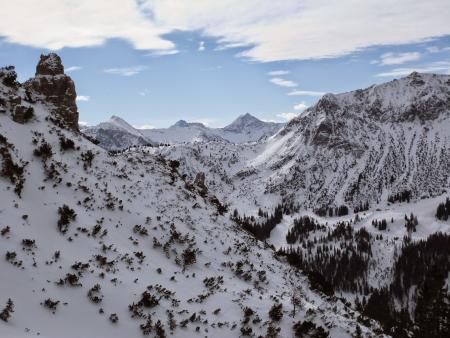
It took us four hours to walk with our skis up to the summit of the Gaishorn. A lot of that was spent on the steep 400 meter ascent to the Gaiseck. Here we had to repeatedly do kick turns which slowly drained us of energy. We are both fit but by the time we reached the Gaiseck we had pulses of well over 140 beats per minute.

At the Gaiseck we left our skis and walked along the snow covered ridge to the Gaishorn. Finally we could enjoy the sun as until this point we had been in the shadow on the north flank of the mountain. The picture at http://de.wikipedia.org/wiki/Gaishorn_(Allg%C3%A4uer_Alpen)#mediaviewer/File:Gaishorn_Nordflanke02.JPG shows the route well - firstly up the steep snow field on the right and then along the ridge to the summit on the left.
The total climb was 1100 meters.
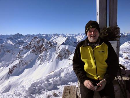
A bite to eat, a flask of hot tea and many photos kept us occupied at the summit while enjoying the amazing views in every direction.
We then walked back to the Gaiseck and enjoyed a super steep run through the fresh snow back down in to the valley.
1150 meters of climbing. Route is at http://www.gpsies.com/map.do?fileId=nutxmdtazgdhqtif
More photos at https://plus.google.com/u/0/photos/103827427036815679772/albums/6097506762533868817
#mediaviewer/File:Gaishorn_am_Gaishorn.JPG)
A picture from Wikipedia showing the final part of our route. („Gaishorn Nordflanke02“ von Kauk0r - Eigenes Werk. Lizenziert unter CC BY-SA 3.0 über Wikimedia Commons).
Took the morning off today. Up at 05:00, Breakfast at 05:30, on our way to Austria at 06:10 and on the skis at 06:44.
As we left it was -7°C and you could just make out the difference between sky and mountains in the early morning light.
It took us four hours to walk with our skis up to the summit of the Gaishorn. A lot of that was spent on the steep 400 meter ascent to the Gaiseck. Here we had to repeatedly do kick turns which slowly drained us of energy. We are both fit but by the time we reached the Gaiseck we had pulses of well over 140 beats per minute.
At the Gaiseck we left our skis and walked along the snow covered ridge to the Gaishorn. Finally we could enjoy the sun as until this point we had been in the shadow on the north flank of the mountain. The picture at http://de.wikipedia.org/wiki/Gaishorn_(Allg%C3%A4uer_Alpen)#mediaviewer/File:Gaishorn_Nordflanke02.JPG shows the route well - firstly up the steep snow field on the right and then along the ridge to the summit on the left.
#mediaviewer/File:Gaishorn_Nordflanke02.JPG)
The total climb was 1100 meters.
A bite to eat, a flask of hot tea and many photos kept us occupied at the summit while enjoying the amazing views in every direction.
We then walked back to the Gaiseck and enjoyed a super steep run through the fresh snow back down in to the valley.
1150 meters of climbing. Route is at http://www.gpsies.com/map.do?fileId=nutxmdtazgdhqtif
More photos at https://plus.google.com/u/0/photos/103827427036815679772/albums/6097506762533868817
... link (0 Kommentare) ... comment
Sonntag, 8. Februar 2015
150208 Buchelalpe
neill, 18:12h
Heidi and I took our touring skis and skied up towards the Wertacher Hörnle. Coming out of the trees we were met with a driving blizzard so we hid behind a strategic tree to take our skins off.

The first part of the descent was through deep snow in the forest and was the sort of skiing that they show in adverts for ski holidays. Amazing!

The second part was across a wide open field where we found fresh untouched snow. After a coffee in the Alpe, we continued on back down to the car. Brilliant!
Track is at http://www.gpsies.com/map.do?fileId=xaceprcvvmsryhem
Fotos are at https://plus.google.com/u/0/photos/103827427036815679772/albums/6097506762533868817
The first part of the descent was through deep snow in the forest and was the sort of skiing that they show in adverts for ski holidays. Amazing!
The second part was across a wide open field where we found fresh untouched snow. After a coffee in the Alpe, we continued on back down to the car. Brilliant!
Track is at http://www.gpsies.com/map.do?fileId=xaceprcvvmsryhem
Fotos are at https://plus.google.com/u/0/photos/103827427036815679772/albums/6097506762533868817
... link (0 Kommentare) ... comment
Sonntag, 8. Februar 2015
150207 Alpspitz
neill, 00:05h
In the morning Chris and I spent a few hours on perfectly prepared and largely empty pistes on the Alpspitz. At the top of the mountain we enjoyed the sun above the clouds.
In the afternoon Caro and I walked up the mountain to watch the sun setting above the clouds. We skied down and had the newly prepared and flood lit piste to ourselves for the second half.
Pictures at https://plus.google.com/u/0/photos/103827427036815679772/albums/6097506762533868817
In the afternoon Caro and I walked up the mountain to watch the sun setting above the clouds. We skied down and had the newly prepared and flood lit piste to ourselves for the second half.
Pictures at https://plus.google.com/u/0/photos/103827427036815679772/albums/6097506762533868817
... link (1 Kommentar) ... comment
Samstag, 31. Januar 2015
150131 Blösse
neill, 18:49h
Yesterday we had a problem at one of our relay stations. We tried reaching it with the tracked quad but the huge snowdrifts eventually defeated us. The snow was deep. Once I walked round the quad and disappeared up to my shoulders in snow - another snow covered bush. Luckily Tom was there to pull me out while standing on the quad.
Asked the lift just over the border if they had a machine that could get through but they said no. Went and asked at the ski lift that runs up to the station if they could give me a lift at least half way but the storm wind made it impossible to run the lift.
We used the quad to drive about half way up and then I continued with touring skies and the needed components in my rucsac. The snow was deep so breaking a track was hard going but eventually I reached the top - four hours after we originally set out on the quad.
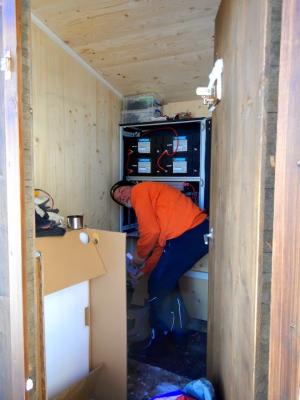
After making the necessary changes to the electrics, I skied down virgin, untouched, deep, steep snow. It really is a tough life.
Today Max and I skied back up with our touring skies. We started right at the bottom so it took some time. The steep part was still deep snow and there was no track to fiollow. Luckily Max is young and fit so he broke trail most of the way. We did some more rewiring and then enjoyed the descent down steep sun soaked snow.
5km and 570 meters of climbing. Track is at http://www.gpsies.com/map.do?fileId=ifmpoyqhjrjhdpyo
Max's blog is at http://maxhogarth.blogspot.de/ and his pictures at https://plus.google.com/photos/102257273463070793435/albums/6077174649141629985
Asked the lift just over the border if they had a machine that could get through but they said no. Went and asked at the ski lift that runs up to the station if they could give me a lift at least half way but the storm wind made it impossible to run the lift.
We used the quad to drive about half way up and then I continued with touring skies and the needed components in my rucsac. The snow was deep so breaking a track was hard going but eventually I reached the top - four hours after we originally set out on the quad.
After making the necessary changes to the electrics, I skied down virgin, untouched, deep, steep snow. It really is a tough life.
Today Max and I skied back up with our touring skies. We started right at the bottom so it took some time. The steep part was still deep snow and there was no track to fiollow. Luckily Max is young and fit so he broke trail most of the way. We did some more rewiring and then enjoyed the descent down steep sun soaked snow.
5km and 570 meters of climbing. Track is at http://www.gpsies.com/map.do?fileId=ifmpoyqhjrjhdpyo
Max's blog is at http://maxhogarth.blogspot.de/ and his pictures at https://plus.google.com/photos/102257273463070793435/albums/6077174649141629985
... link (0 Kommentare) ... comment
Sonntag, 25. Januar 2015
150125 Sportheim Böck
neill, 19:05h
Planned was ski mountaineering to the Geishorn in Tirol but that did not happen so I took my equipment for a walk up to Sportheim Böck.
7.5 kilometers with nearly 600 meters of climbing. Track is at http://www.gpsies.com/map.do?fileId=uxjmdtolsxowwdje
7.5 kilometers with nearly 600 meters of climbing. Track is at http://www.gpsies.com/map.do?fileId=uxjmdtolsxowwdje
... link (0 Kommentare) ... comment
Dienstag, 20. Januar 2015
150120 Nadel Loch
neill, 15:40h
Extended lunch break today. Caro and I took our touring skis and walked up to Nadel Loch (part way up the local mountain) and then skied back down through the unpisted snow.
Expresso and cake and then back to work.
Expresso and cake and then back to work.
... link (0 Kommentare) ... comment
Sonntag, 18. Januar 2015
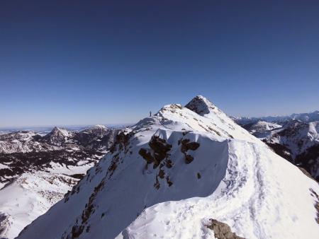
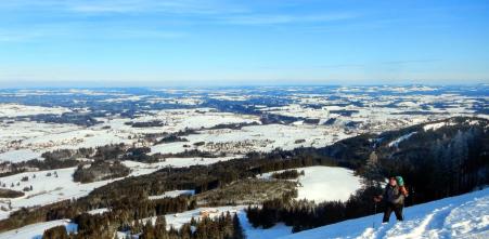
150118 Grauen Stein
neill, 16:22h
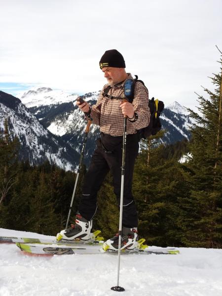
Another Sunday and another trip to the Grauen Stein.

(The Grauen Stein is on the right with the Riedbergerhorn on the right.)
I caught the Hörnerbahn to the top and then walked up the valley under the Weiherkopf and Ochsenkopf. I then turned up on to the ridge and tried to follow that to the Grauene Stein but a few very steep sections proved impossible. Skied off the ridge and then walked up between the Riedbergerhorn and Grauen Stein.
At the top the view in every direction was stunning. The Riedbergerhorn was full of people but on the Grauen Stein there were only three of us. Took some voltage measurements on the relay station we have up there and ate the cake that I had taken with me.
The run down was fantastic. New snow on a very steep slope. It is good that the avalance warn level is currently at 1 - the lowest.
Stopped at the Berghaus Schwaben for some lunch on the way back.
Pictures at https://plus.google.com/u/0/photos/+NeillHogarth/albums/6097506762533868817
Track is at http://www.gpsies.com/map.do?fileId=jfshwqbfdqbzojra
... link (0 Kommentare) ... comment
... older stories