
... newer stories
Mittwoch, 27. Mai 2015
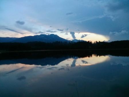
150526 Grat
neill, 00:20h
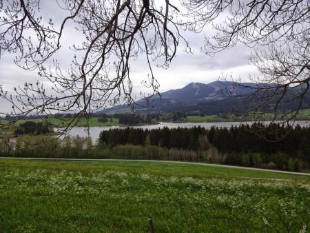
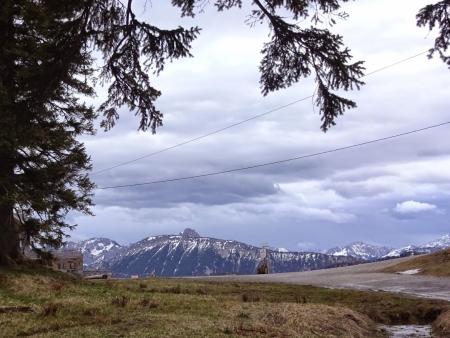
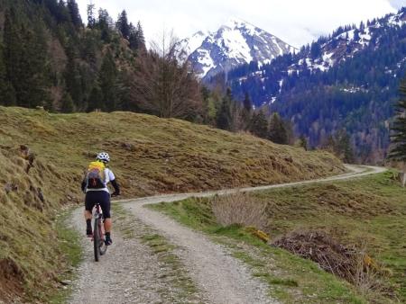
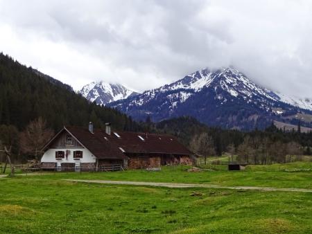
Tuesday evening but rain was forecast so Heidi and I took the mountain bikes out.
We cycled up to "the Grat" on the side of the Alpspitz. Actually we pushed quite a bit as it was steep, slippy and very muddy.
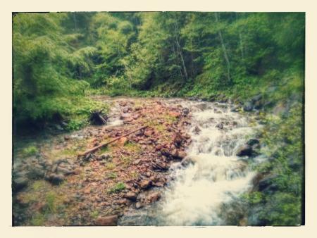
By the time we reached the top it was pouring down abd even sleeting so we put all our clothes on and then raced back to Nesselwang and hot showers.
17km and 620 meters of climbing. Track at http://www.gpsies.com/map.do?fileId=kijnksrjjrydpqjj
We cycled up to "the Grat" on the side of the Alpspitz. Actually we pushed quite a bit as it was steep, slippy and very muddy.
By the time we reached the top it was pouring down abd even sleeting so we put all our clothes on and then raced back to Nesselwang and hot showers.
17km and 620 meters of climbing. Track at http://www.gpsies.com/map.do?fileId=kijnksrjjrydpqjj
... link (0 Kommentare) ... comment
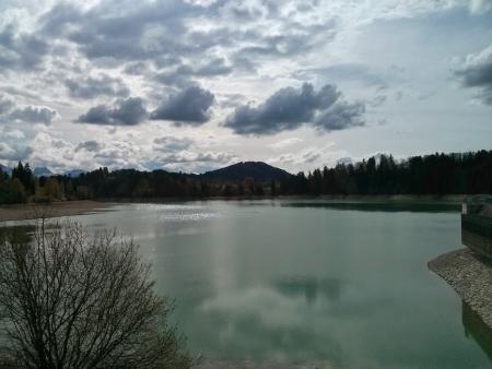
Montag, 25. Mai 2015
150525 Grasgehren
neill, 19:37h
Back in winter I fell in to a ravine in the snow and that was nearly the end of me - see the original story at http://neill.blogger.de/stories/2463603/
A few weeks later Max and I found one of my skis that I had stood up as a marker but the other one was at the bottom of the ravine. See the story at http://neill.blogger.de/stories/2467149/
Back then I set a waymark in my GPS and today I returned to reclaim the second ski. I found it a little down stream of where I had set the other one. Maybe the spring water pushed it downhill.
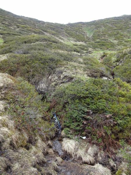
It was really strange being back in a place that so nearly killed me. The sun was shining and there was just the harmless brook running downhill but it still brought back some nightmare memories of drowning in deep deep snow.
More photos at https://plus.google.com/u/0/photos/103827427036815679772/albums/6152831343924761137
A few weeks later Max and I found one of my skis that I had stood up as a marker but the other one was at the bottom of the ravine. See the story at http://neill.blogger.de/stories/2467149/
Back then I set a waymark in my GPS and today I returned to reclaim the second ski. I found it a little down stream of where I had set the other one. Maybe the spring water pushed it downhill.
It was really strange being back in a place that so nearly killed me. The sun was shining and there was just the harmless brook running downhill but it still brought back some nightmare memories of drowning in deep deep snow.
More photos at https://plus.google.com/u/0/photos/103827427036815679772/albums/6152831343924761137
... link (1 Kommentar) ... comment
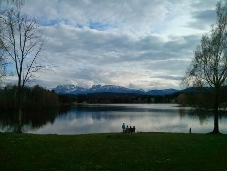
150525 Falkenstein
neill, 19:23h
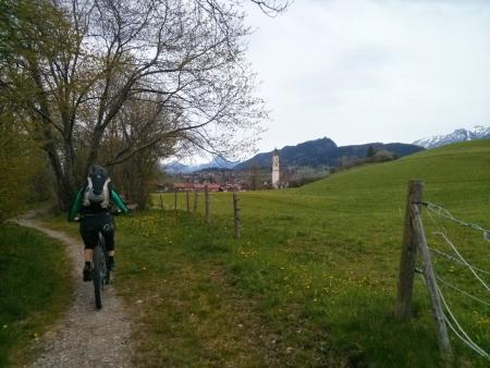
Marion and I cycled to Pfronten and then on up to the Falkenstein for a drink. It was actually very cold but we both sweated all the way up - maybe because we were going so fast? On the way down it was cold with three layers on.
31km and 690 meters of climbing. Track is at http://www.gpsies.com/map.do?fileId=aorlowqkhdhadtqv
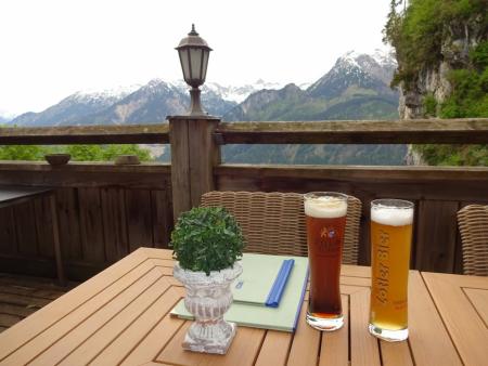
More photos at https://plus.google.com/u/0/photos/103827427036815679772/albums/6139495333132139777?sort=1
31km and 690 meters of climbing. Track is at http://www.gpsies.com/map.do?fileId=aorlowqkhdhadtqv
More photos at https://plus.google.com/u/0/photos/103827427036815679772/albums/6139495333132139777?sort=1
... link (0 Kommentare) ... comment
Sonntag, 24. Mai 2015
150524 Sportheim Böck
neill, 18:09h
On Christmas Day I cycled up the mountain to Sporthim Böck. On Easter Sunday Heidi and I walked up there on our touring skis. So today is Whit Sunday and I cycled up there.
Finally it had stopped raining and was just overcast. I set off with far too many clothes on but reached the top in shorts and short sleeved tricot after taking everything else off.
On the way up I stopped to watch the zipliners hurling down the mountain dangling on their steel cable. Nearly as much fun as mountain biking down.
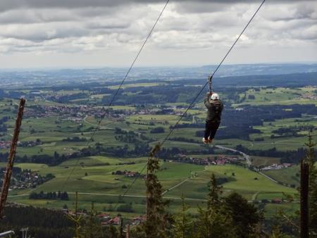
Capuccino and cheese cake was my reward for my efforts - and a super fast but muddy descent.
11km and 630 meters of climbing. Track is at http://www.gpsies.com/map.do?fileId=epkyxthjurjfecyb
Finally it had stopped raining and was just overcast. I set off with far too many clothes on but reached the top in shorts and short sleeved tricot after taking everything else off.
On the way up I stopped to watch the zipliners hurling down the mountain dangling on their steel cable. Nearly as much fun as mountain biking down.
Capuccino and cheese cake was my reward for my efforts - and a super fast but muddy descent.
11km and 630 meters of climbing. Track is at http://www.gpsies.com/map.do?fileId=epkyxthjurjfecyb
... link (0 Kommentare) ... comment
Freitag, 22. Mai 2015
150522 Alpspitz
neill, 08:55h
Thursday evening and it was pouring with rain. But Thursday evening is mountain biking so 4 of us - Wera, Bettina, Heidi and I - cycled up to the new snow on the mountaion.
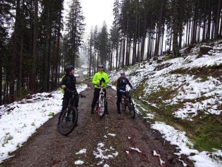
It was cold and wet so we cycled straight back down and, after a shower, I went to the pub for a Glühwein.
11km and 600 meters of climbing. Track is at http://www.gpsies.com/map.do?fileId=vevqptuotscpuaco
So why do we do it? Why leave a warm dry flat to cycle up a cold and wet mountain? Maybe the fear that if we don't then we will begin to vegetate. Start to stay at home when it is cold and dry and then when it is warm and sunny and then never leave? Or maybe we just enjoy the chance to live a real life? Or maybe we just enjoy the company and conversation which is just as good no matter what the weather?
... link (0 Kommentare) ... comment
Montag, 18. Mai 2015
150518 Kempten
neill, 18:52h
After catching the overnight train from Rome to Munich and an Alex to Kempten, we cycled the last few kilometers back to Nesselwang.
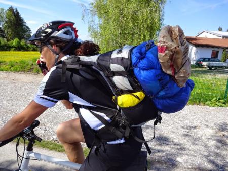
We were carrying "too much" luggage as we had to carry the extra clothing we had sent per post to Rome.
22km with 335 meters of climbing
Track is at http://www.gpsies.com/map.do?fileId=wkuoxzrsypzrrttt
We were carrying "too much" luggage as we had to carry the extra clothing we had sent per post to Rome.
22km with 335 meters of climbing
Track is at http://www.gpsies.com/map.do?fileId=wkuoxzrsypzrrttt
... link (0 Kommentare) ... comment
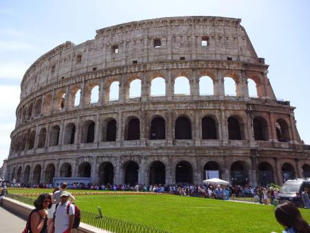
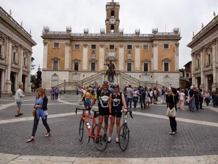
150517 Rome Sightseeing
neill, 18:51h
Yesterday Karl-Heinz was kind enough to show us Rome. He took us on foot, bus and tram so we had an entire day without our bikes - strange feeling. As a result, today on the way to the station we only had the Colluseum to "tick off" before taking the night train back to Germany.
Down in to the Tiber valley and out the other side.
Track is only 17 km with 175 meters of climbing and is at http://www.gpsies.com/map.do?fileId=xnlnyikcckbkpstn
Down in to the Tiber valley and out the other side.
Track is only 17 km with 175 meters of climbing and is at http://www.gpsies.com/map.do?fileId=xnlnyikcckbkpstn
... link (0 Kommentare) ... comment
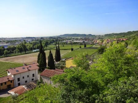
150508-15 Rome
neill, 18:36h
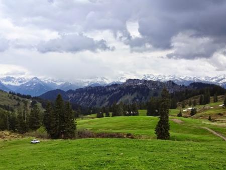
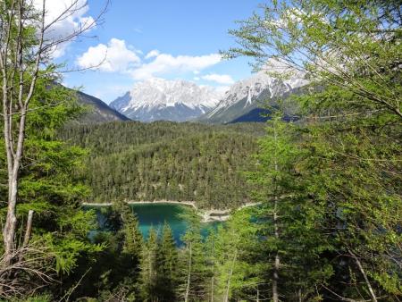
This year Heidi and I took our Frenchie bikes out for a new expedition. After Munich (2012), Milan (2013) and Poland (2014), this years trip was from Nesselwang to Rome.
We left on Friday afternoon after leaving work early and we arrived the following Friday afternoon. The trip was a little over 1050 kilometers and we climbed just under 10000 meters!
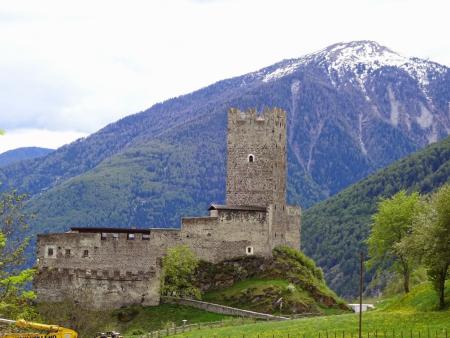
Day 1 - Nesselwang to Landeck.
http://www.gpsies.com/map.do?fileId=adrupolxnwmhyxlb
We left on Friday afternoon to get over the Fernpass and thus avoid having two passes on one day - Fern & Reschen. It was a good plan that worked well and took us to Landek at the foot of the Reschenpass.
Day 2 - to Branzoll
http://www.gpsies.com/map.do?fileId=qocrhlxxgnzaxhoe
From Landeck we cycled all the way up to the top of the pass at Reschen - and then (because it was all such fun) just carried on and on. We eventually stopped after 175km with about 1500 meters of climbing. The furthest I have ever cycled and that over the Alps.
At the Austrian-Swis border we met a guy on his way to Africa ( www.grindimwind.ch ). A little later another swiss person cycling to Istanbul. A few days later a cyclist about to set off for Iceland. There are lots of people out there having fun.
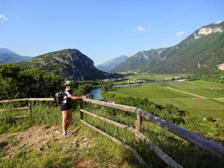
Day 3 - to Relais San Michele
http://www.gpsies.com/map.do?fileId=xjususlmtopyhqbh
A whole day of cycling down hill. Except for the last bit which was over a hill with 10% climbs. A lot of the day next to a canal that carries water to Verona.
Day 4 - to Bologna
http://www.gpsies.com/map.do?fileId=vvricivodllsckfs
All day across the Po Valley. Flat with great views from the dykes.
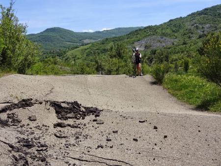
Day 5 - to Florence
http://www.gpsies.com/map.do?fileId=ctbtqqkcijodikbu
Mountains. Passes and steep hills. All topped off with the descent down the "Devil's Pass".
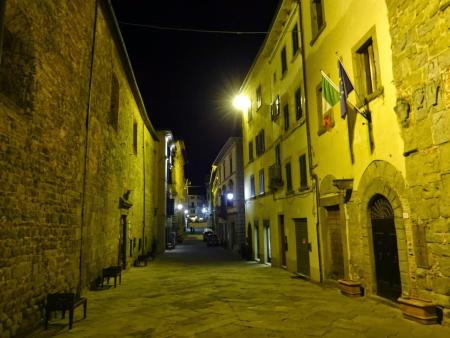
Day 6 - to Monte San Savino
http://www.gpsies.com/map.do?fileId=mpsdrwtafszqwhru
A "rest day". Started late and visited Florence before setting off at midday. Another day of hills. A hotel in a dream town on a hilltop.
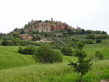
Day 7 - to Attigliano
http://www.gpsies.com/map.do?fileId=fiwhwivvynuzurcf (also includes Day 8
Through the Italian countryside. Including a diversion to an amazing town atop a mountain.
Day 8 - to Rome
Track is part of the link under Day 7
"Only 100km" but with nearly 2000 meters of climbing. A hard day but finally we reached our destination.
1053km with 9944 meters of climbing
Photos are at https://plus.google.com/u/0/photos/103827427036815679772/albums/6150267795226829809
Google created a picture story of the whole trip which you can see at https://plus.google.com/u/0/103827427036815679772/stories/5562c23c-80ca-3ec4-a032-fbfa0baf7dfe14d69d3cd06?cfem=1
We left on Friday afternoon after leaving work early and we arrived the following Friday afternoon. The trip was a little over 1050 kilometers and we climbed just under 10000 meters!
Day 1 - Nesselwang to Landeck.
http://www.gpsies.com/map.do?fileId=adrupolxnwmhyxlb
We left on Friday afternoon to get over the Fernpass and thus avoid having two passes on one day - Fern & Reschen. It was a good plan that worked well and took us to Landek at the foot of the Reschenpass.
Day 2 - to Branzoll
http://www.gpsies.com/map.do?fileId=qocrhlxxgnzaxhoe
From Landeck we cycled all the way up to the top of the pass at Reschen - and then (because it was all such fun) just carried on and on. We eventually stopped after 175km with about 1500 meters of climbing. The furthest I have ever cycled and that over the Alps.
At the Austrian-Swis border we met a guy on his way to Africa ( www.grindimwind.ch ). A little later another swiss person cycling to Istanbul. A few days later a cyclist about to set off for Iceland. There are lots of people out there having fun.
Day 3 - to Relais San Michele
http://www.gpsies.com/map.do?fileId=xjususlmtopyhqbh
A whole day of cycling down hill. Except for the last bit which was over a hill with 10% climbs. A lot of the day next to a canal that carries water to Verona.
Day 4 - to Bologna
http://www.gpsies.com/map.do?fileId=vvricivodllsckfs
All day across the Po Valley. Flat with great views from the dykes.
Day 5 - to Florence
http://www.gpsies.com/map.do?fileId=ctbtqqkcijodikbu
Mountains. Passes and steep hills. All topped off with the descent down the "Devil's Pass".
Day 6 - to Monte San Savino
http://www.gpsies.com/map.do?fileId=mpsdrwtafszqwhru
A "rest day". Started late and visited Florence before setting off at midday. Another day of hills. A hotel in a dream town on a hilltop.
Day 7 - to Attigliano
http://www.gpsies.com/map.do?fileId=fiwhwivvynuzurcf (also includes Day 8
Through the Italian countryside. Including a diversion to an amazing town atop a mountain.
Day 8 - to Rome
Track is part of the link under Day 7
"Only 100km" but with nearly 2000 meters of climbing. A hard day but finally we reached our destination.
1053km with 9944 meters of climbing
Photos are at https://plus.google.com/u/0/photos/103827427036815679772/albums/6150267795226829809
Google created a picture story of the whole trip which you can see at https://plus.google.com/u/0/103827427036815679772/stories/5562c23c-80ca-3ec4-a032-fbfa0baf7dfe14d69d3cd06?cfem=1
... link (0 Kommentare) ... comment
Dienstag, 5. Mai 2015
150505 twice round the Grüntensee
neill, 23:21h
Got to Jon and it was looking like rain so he said "Round the Grüntensee?" I countered with "Twice?" He answered "the second time without me!"
So that is what we did. One slightly linger run round the lake after which Jon went home with a big smile on his face and we did a second, shorter loop.
Great fun was had by all.
45km and 540 meters of climbing. Track is at http://www.gpsies.com/map.do?fileId=dmbcpddnsgxkochd
So that is what we did. One slightly linger run round the lake after which Jon went home with a big smile on his face and we did a second, shorter loop.
Great fun was had by all.
45km and 540 meters of climbing. Track is at http://www.gpsies.com/map.do?fileId=dmbcpddnsgxkochd
... link (0 Kommentare) ... comment
Sonntag, 3. Mai 2015
150503 Alpspitz
neill, 23:33h
Heidi had been working all weekend so she needed to get out and attack a mountain. No problem! Out and up the Alpspitz.
14 km and 600 meters of climbing. Track is at http://www.gpsies.com/map.do?fileId=yjtosrxdejhssxjp
14 km and 600 meters of climbing. Track is at http://www.gpsies.com/map.do?fileId=yjtosrxdejhssxjp
... link (0 Kommentare) ... comment
Sonntag, 3. Mai 2015
150502 Vils- & Achtal
neill, 01:40h
It rained all morning but in the afternoon it stopped so Caro and I jumped on our bikes and set off in to Austria. It was a ride too far as I had to be back in Nesselwang punctually for a procession and church. The result was that we did the second half of the trip at a ridiculous speed (overall average 18.4km/h and we were riding normally the first half).
We met no other bikers and hardly any walkers. The mountains, valleys and forests smelt so fresh after the rain.
At some time during the ride I passed the 1000 kilometer mark for this year so I guess I am fully trained to cycle to Rome next week.
50km and 650 meters of climbing. Track at http://www.gpsies.com/map.do?fileId=ubqwqyjawoithnid
Photos at https://plus.google.com/u/0/photos/103827427036815679772/albums/6139495333132139777
... link (0 Kommentare) ... comment
Freitag, 1. Mai 2015
150430 Pfronten
neill, 13:20h
Last day of April and definitely a case of "April showers". It is now tradition that when it rains, we cycle to Pfronten or maybe that when we cycle to Pfronten, it rains. Either way, rain and Pfronten are firmly linked in our cycling memories.
A really interesting route created by Wera. Amazing selection of small tracks and paths through Pfronten. You can spend hours riding through Pfronten and never hit a main road.
Luckily one of the group was sensible enough to suggest getting fully kitted up in rain gear as soon as the first drops started so we were warm and dry when it really started.
Afterwards some Glühwein followed by Baileys in the Bistro. And the next day was a bank holiday so a sleep in as well.
26km with 320 meters of climbing. Track is at http://www.gpsies.com/map.do?fileId=ujntvznhzsncqoaa
Photos at https://plus.google.com/u/0/photos/103827427036815679772/albums/6139495333132139777
... link (0 Kommentare) ... comment
Mittwoch, 29. April 2015
150429 Görisried
neill, 23:29h
Evening race bike ride. I got my second puncture of the season (and of the week) Shortly after we left which annoyed me but things got better from then on.
Because it was late, we cycled a route such that the second half of the route would be on a bike lane So it didn't matter that we returned after dark.
The section through the Wertach Valley was as steep as ever but we managed it in the middle cog.
32km and 550 meters of climbing Track is at http://www.gpsies.com/map.do?fileId=dymeznpycoubuasx
... link (0 Kommentare) ... comment
Dienstag, 28. April 2015
150427 Freyburg
neill, 00:04h
An after work mountain bike tour. There was thunder in the mountains and rain off to the west so we stayed near home.
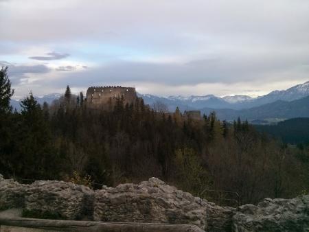
Took a diversion to the ruins of Höhenfreyburg and then stopped at the lake for a snack.
27km and 420 meters of climbing
Track at http://www.gpsies.com/map.do?fileId=ialonvzxqvtkqxia
Photos at https://plus.google.com/u/0/photos/103827427036815679772/albums/6139495333132139777
Took a diversion to the ruins of Höhenfreyburg and then stopped at the lake for a snack.
27km and 420 meters of climbing
Track at http://www.gpsies.com/map.do?fileId=ialonvzxqvtkqxia
Photos at https://plus.google.com/u/0/photos/103827427036815679772/albums/6139495333132139777
... link (0 Kommentare) ... comment
Sonntag, 26. April 2015
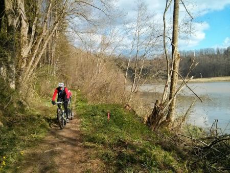
150426 Forgensee
neill, 23:32h
Training for Poland. The two of us cycled on our race bikes past the Hopfensee, Bannwaldsee and Forgensee.
From Roßhaupten we followed a track with no tarmac which cost me a punctured tyre.
70km and 760 meters of climbing.
Track ist at http://www.gpsies.com/map.do?fileId=csrgcuomxkqkgqfa
From Roßhaupten we followed a track with no tarmac which cost me a punctured tyre.
70km and 760 meters of climbing.
Track ist at http://www.gpsies.com/map.do?fileId=csrgcuomxkqkgqfa
... link (0 Kommentare) ... comment
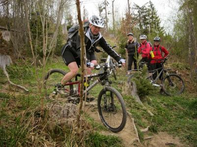
150425 MTB Training
neill, 09:17h
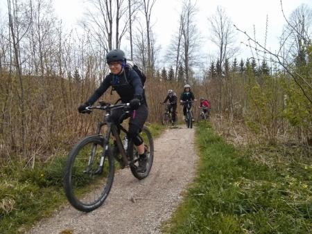
A group of ladies from the bike club went for some training in how to deal with steep downhill slopes with roots, steps and sharp curves. I attended as "official photographer".
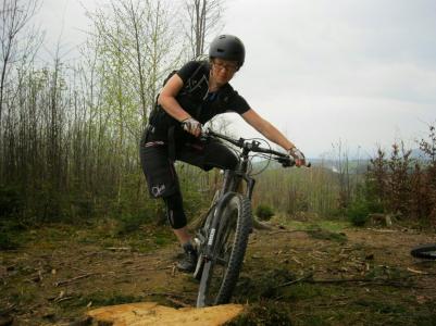
Photos at https://plus.google.com/u/0/photos/+NeillHogarth/albums/6141740589559442545
22km and 420 mters of climbing.
Track is at http://www.gpsies.com/map.do?fileId=foltlvjqfijkcrlt
Photos at https://plus.google.com/u/0/photos/+NeillHogarth/albums/6141740589559442545
22km and 420 mters of climbing.
Track is at http://www.gpsies.com/map.do?fileId=foltlvjqfijkcrlt
... link (0 Kommentare) ... comment
Donnerstag, 23. April 2015
150422 Kranzegg
neill, 10:03h
Last night I had to give a presentation at a rotary club meeting and so missed Tuesday cycling. Therefore today I went Wednesday cycling on my own.
Out to Kranzegg over the Kranzegger-Steig and then back through moosbach.
A warm evening so perfect race bike weather.
43km and 660 meters of climbing. Track is at http://www.gpsies.com/map.do?fileId=lmuqosxopywnranr
Out to Kranzegg over the Kranzegger-Steig and then back through moosbach.
A warm evening so perfect race bike weather.
43km and 660 meters of climbing. Track is at http://www.gpsies.com/map.do?fileId=lmuqosxopywnranr
... link (0 Kommentare) ... comment
Sonntag, 19. April 2015
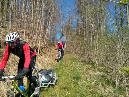
150418-19 Woringen
neill, 20:54h
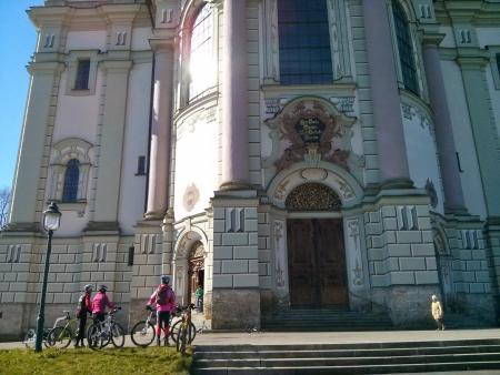
The spring tour this year started with only four people - Moni & Sepp, Hopsing and I. We rode along the Iller valley to Woringen and then back via Ottobeuren and Obergünzburg.
Both days there was a biting east wind and even with the sun out on Sunday it was still not perfect cycling east.
On the Saturday Sepp suggested a change of route along the riverside path next to the Illerschleife. Very adventurous, especially for Hopsing who was trying to pull a trailer.
Jon left Nesselwang on Sunday morning and met us in Obergünzbug for lunch. We cycled past the huge and impressive Ottobeuren Abbey.
Tracks are at:
Day 1 http://www.gpsies.com/map.do?fileId=okyxmigeqjzowinq
Day 2 http://www.gpsies.com/map.do?fileId=fjuyemxufucqunsj
A total of 130 kilometers with 1760 meters of climbing.
My photos are at https://plus.google.com/u/0/photos/103827427036815679772/albums/6139495333132139777?sort=1
Google has created a "story" which is at https://plus.google.com/u/0/103827427036815679772/stories/fbc9f9d6-32b8-3fbe-884c-b79d55fe3edc14cd3d875b4?cfem=1
A video by Jon is at https://youtu.be/iz4z7TyuOiY
... link (0 Kommentare) ... comment
... older stories