
... newer stories
Sonntag, 23. August 2015
150822 Rafting
neill, 18:31h
The "company summer party". This year we went down to the lake, built rafts and then raced them.
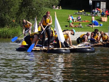
After the racing things got silly with each team trying to capture the others flags and untieing the knots that held the rafts together.
I ended up paddling two planks balanced on one inner tube back to the bank.
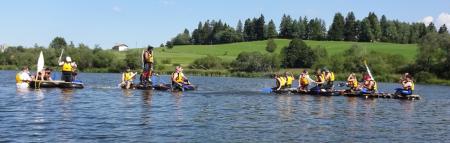
Afterwards we grilled on the beach until sunset.
Photos at https://goo.gl/photos/Kdz5kXdYBMkvnSYM8
After the racing things got silly with each team trying to capture the others flags and untieing the knots that held the rafts together.
I ended up paddling two planks balanced on one inner tube back to the bank.
Afterwards we grilled on the beach until sunset.
Photos at https://goo.gl/photos/Kdz5kXdYBMkvnSYM8
... link (0 Kommentare) ... comment
150823 Petersthal
neill, 18:05h
Stafano's birthday tour. Stefano, Caro, MArion, Robbi and I.
Up the Ellegg for a beer then down to the lake for lunch then back over the hills home.
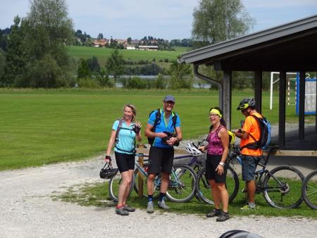
Track is at http://www.gpsies.com/map.do?fileId=xjoenwufxbssbich
Up the Ellegg for a beer then down to the lake for lunch then back over the hills home.
Track is at http://www.gpsies.com/map.do?fileId=xjoenwufxbssbich
... link (0 Kommentare) ... comment
Mittwoch, 19. August 2015
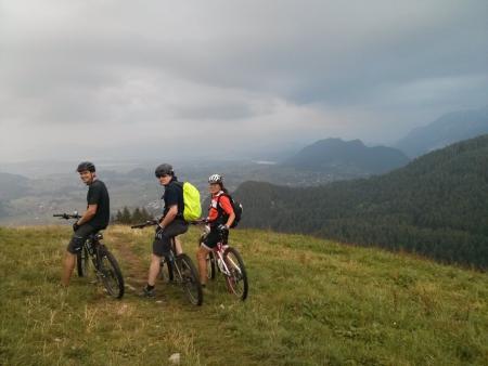
150818 Grüntensee
neill, 20:37h
In the morning we were on the Grauen Stein and then enjoyed a small bottle of wine on the Riedbergerhorn.
In the evening I needed to go to Isny but before that we did a short and flat run round the Grüntensee. Finally I have received my Polar training watch back and it seems to be repaired.
22km with 300 meters of climbing
Track is at http://www.gpsies.com/map.do?fileId=hgmjzaldylelbntz
In the evening I needed to go to Isny but before that we did a short and flat run round the Grüntensee. Finally I have received my Polar training watch back and it seems to be repaired.
22km with 300 meters of climbing
Track is at http://www.gpsies.com/map.do?fileId=hgmjzaldylelbntz
... link (0 Kommentare) ... comment
Dienstag, 11. August 2015
150810 Wiesenweg
neill, 16:03h
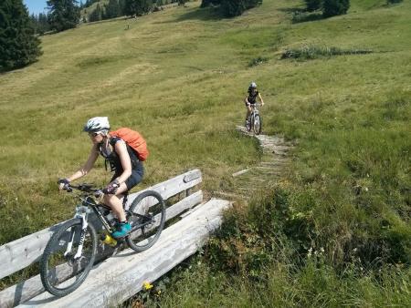
Heidi, Gremml & Tim-Tom out on our mountain bikes. We cycled up towards the Alpspitz and then down to the kappeller Alp.
From the Alp, we cycled/pushed/fell down the Wiesenweg to Kappel. Only Tim-Tom needed to be repaired by Heidi :-) Great fun.
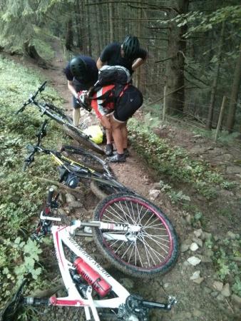
Rode back to Nesselwang and a home-brew at Gremmls.
16 km with 610 meters of climbing. Track is at http://www.gpsies.com/map.do?fileId=vnqoqzfmwqlvapuz
From the Alp, we cycled/pushed/fell down the Wiesenweg to Kappel. Only Tim-Tom needed to be repaired by Heidi :-) Great fun.
Rode back to Nesselwang and a home-brew at Gremmls.
16 km with 610 meters of climbing. Track is at http://www.gpsies.com/map.do?fileId=vnqoqzfmwqlvapuz
... link (0 Kommentare) ... comment
Samstag, 8. August 2015
150808 Bolgental - Kleinwalsertal
neill, 22:07h
The weather forecast said "very hot. don't do anything too physical outside!". So I cycled 46km with nearly 1700 meters of climbing before lunch.
inge, Karin, Hätti and Hopsing had planned a two day tour in to Austria and back. I need to drive to Italy tomorrow so I just went out with them for the "first bit".
From Obermaiselstein we climbed a 20% hill up in to Bolgental. Under the Riedbergerhorn we crossed a pass at 1600 meters and then dropped down to Rohmoos. Then on in to Kleinwalsertal and up to the Schrattenwangalpe for lunch.
The other four continued on to the Schroffenpass while I trailed down to Overstdorf and then through the Hirschsprung back to the car.
A truly stunning tour. Extremely hard in the heat but with rewarding trails and fantastic views.
Track at http://www.gpsies.com/map.do?fileId=rpkrpuauhtfwssfa
Fotos at https://goo.gl/photos/HGr8cAw2dQG3AHhu8
... link (0 Kommentare) ... comment
Freitag, 7. August 2015
150806 Attlesee
neill, 22:22h
Thursday evening and very hot so the general consensus was "swimming" but we managed a bit of cycling first.

25km and 400 meters of climbing. Track is at http://www.gpsies.com/map.do?fileId=mvudxfdzdsoelxck
25km and 400 meters of climbing. Track is at http://www.gpsies.com/map.do?fileId=mvudxfdzdsoelxck
... link (0 Kommentare) ... comment
Mittwoch, 5. August 2015
150805 Hopferau
neill, 23:54h
Yesterday we missed the Tuesday cycling so today Heidi and I went Wednesday cycling. We did not have long so it was a short race bike tour.
30km with 488 meters of climbing http://www.gpsies.com/map.do?fileId=wmkqwyznktvfbdlu
Photos in https://photos.google.com/album/AF1QipM6WdaUJLQzcPpcXD1XhdJOuLcFvWqg6YWLdfDJ
30km with 488 meters of climbing http://www.gpsies.com/map.do?fileId=wmkqwyznktvfbdlu
Photos in https://photos.google.com/album/AF1QipM6WdaUJLQzcPpcXD1XhdJOuLcFvWqg6YWLdfDJ
... link (0 Kommentare) ... comment
Samstag, 1. August 2015
150801 Hölleritzeralpe
neill, 15:02h
Inge had a great tour planned from Günzesried-Säge through to Balderschwang and back through Austria.
About half way up the first climb it started to rain and by the time we reached the Hölleritzeralpe we were getting wet and the clouds were coming down to envelope us.

Decided to save the tour for another day and turned round and went home. Good decision!
13 km with 560 meters of climbing http://www.gpsies.com/map.do?fileId=lspopleqsaasqizu
About half way up the first climb it started to rain and by the time we reached the Hölleritzeralpe we were getting wet and the clouds were coming down to envelope us.
Decided to save the tour for another day and turned round and went home. Good decision!
13 km with 560 meters of climbing http://www.gpsies.com/map.do?fileId=lspopleqsaasqizu
... link (0 Kommentare) ... comment
150730 Jungholz
neill, 15:00h
Karin chose tonights "Thursday Evening" tour. Past the Untere Reuttewanne Alpe and through to Jungholz and then down Vilstal and back through Pfronten.

32km with 625 meters of climbing. http://www.gpsies.com/map.do?fileId=cmehbfemsfjudqxb
32km with 625 meters of climbing. http://www.gpsies.com/map.do?fileId=cmehbfemsfjudqxb
... link (0 Kommentare) ... comment
Sonntag, 26. Juli 2015
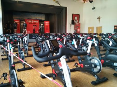
150725 Club Ride
neill, 12:15h
Five hours of spinning in Seeg.
... link (0 Kommentare) ... comment
Mittwoch, 22. Juli 2015
150721 Joch Pass
neill, 17:46h
Tuesday evening so Heidi, Jon and I were out race biking. Cycled to Wertach and then on through the Königsstrasse to Sonthofen.
From Sonthofen we returned via the Jochpass.
And the swimming in the Grüntensee.
64km and 952 meters of climbing. Track is at http://www.gpsies.com/map.do?fileId=cpcnaalzfmiffaud
From Sonthofen we returned via the Jochpass.
And the swimming in the Grüntensee.
64km and 952 meters of climbing. Track is at http://www.gpsies.com/map.do?fileId=cpcnaalzfmiffaud
... link (0 Kommentare) ... comment
Sonntag, 19. Juli 2015
150719 Roßbergalpe
neill, 20:06h
Today the "footballers" went mountain biking up to the Roßbergalpe and were kind enough to invite me.
We cycled straight there and then ate and drank too much before cycling back via the Dreiangelhütte and Untere Bichler Alpe.
49km and 993 meters of climbing. Track is at http://www.gpsies.com/map.do?fileId=mmvopdmerdilzceh

Photos at https://photos.google.com/album/AF1QipM6WdaUJLQzcPpcXD1XhdJOuLcFvWqg6YWLdfDJ
We cycled straight there and then ate and drank too much before cycling back via the Dreiangelhütte and Untere Bichler Alpe.
49km and 993 meters of climbing. Track is at http://www.gpsies.com/map.do?fileId=mmvopdmerdilzceh
Photos at https://photos.google.com/album/AF1QipM6WdaUJLQzcPpcXD1XhdJOuLcFvWqg6YWLdfDJ
... link (0 Kommentare) ... comment
Samstag, 18. Juli 2015
150718 Mittlere Stuibenalpe
neill, 18:15h
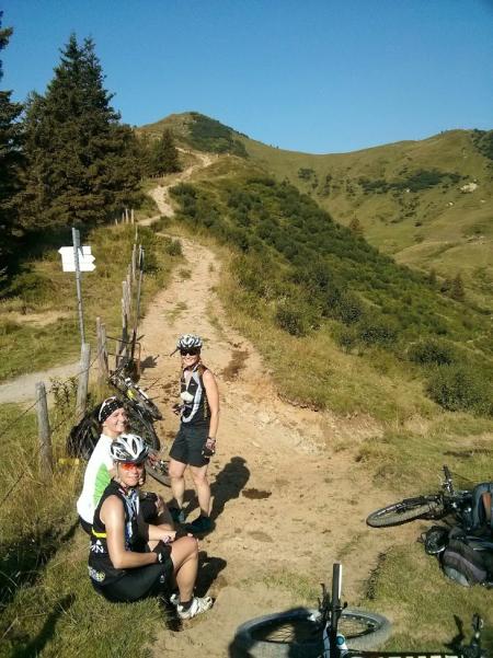
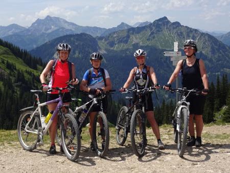
Inge planned a tour to the Alp via the Pfrontener Hütte.
Six ladies (Caro, Hätti, Heidi, Inge, Karin & Moni) and me took part. The weather was kind to us - not too hot and not too much rain.
60kms and 1500 meters of climbing in four and a half hours. Track is at http://www.gpsies.com/map.do?fileId=mxrkaqrwxtgmgvpe The route has a "ClimbByBike Index" of 73.36!
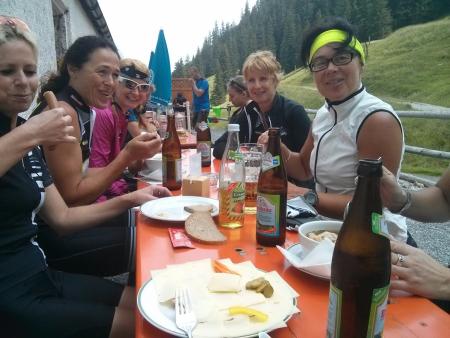
Photos at https://photos.google.com/album/AF1QipM6WdaUJLQzcPpcXD1XhdJOuLcFvWqg6YWLdfDJ
Six ladies (Caro, Hätti, Heidi, Inge, Karin & Moni) and me took part. The weather was kind to us - not too hot and not too much rain.
60kms and 1500 meters of climbing in four and a half hours. Track is at http://www.gpsies.com/map.do?fileId=mxrkaqrwxtgmgvpe The route has a "ClimbByBike Index" of 73.36!
Photos at https://photos.google.com/album/AF1QipM6WdaUJLQzcPpcXD1XhdJOuLcFvWqg6YWLdfDJ
... link (0 Kommentare) ... comment
Mittwoch, 15. Juli 2015
150714 Jungholz
neill, 23:12h
Gremml, Heidi and I out to climb lots of steep stuff (up to 21%), ride great trails and have fun.
36km and 1004 meters of climbing.
Track is at http://www.gpsies.com/map.do?fileId=xvsxybofvpvqdnqd
36km and 1004 meters of climbing.
Track is at http://www.gpsies.com/map.do?fileId=xvsxybofvpvqdnqd
... link (0 Kommentare) ... comment
Montag, 13. Juli 2015
150712 Breitenberg
neill, 00:02h
At 09:15 I received an invitation from Karin to be at the sports hall in an hour to cycle the Breitenberg.
There wer five of us. I was the token man. Hopsing later joined us at the Alm where we stopped for lunch.
On the way down Marion slipped on a curve. Lots of blood but hopefully no serious damage.
42 km with 1100 meters of climbing. Track is at http://www.gpsies.com/map.do?fileId=wbknsvanmaebdgrn
Pictures at https://photos.google.com/album/AF1QipM6WdaUJLQzcPpcXD1XhdJOuLcFvWqg6YWLdfDJ
... link (0 Kommentare) ... comment
Sonntag, 12. Juli 2015
150711 Schwarzenberg
neill, 00:17h
Heidi had an hour and a half off so we went for a quick race bike ride.
29 km and 430 meters of climbing. Track is at http://www.gpsies.com/map.do?fileId=wkcwpskvomqnxrmw
29 km and 430 meters of climbing. Track is at http://www.gpsies.com/map.do?fileId=wkcwpskvomqnxrmw
... link (0 Kommentare) ... comment
150711 Ruhbach
neill, 16:38h
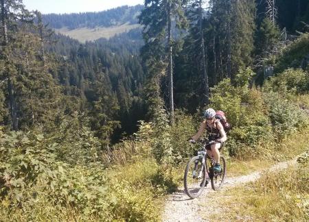
Out on my own enjoying the mountains and valleys near Balderschwang.

From Balderschwang I headed towards the Riedbergerpass and then south past the Toniskopf Alpe. Trail down to Rohmoos was steep and washed out so I fell off at one point but luckily no one saw me.
Along the Starlach valley and then across the European watershed and on down the Ruhbach valley. Back to Balderschwang across the Sättele Pass.

Stopped at the Fuchs Alpe for lunch. The last hut in Germany in the middle of nowhere but free fast Internet thanks to our company. My colleague mounted an antenna in a tree and it works perfectly.
As I was sat at the Alpe 10 mountainbikers turned up who had watched me ride down the top of the pass. Their comments were "Respect, Crazy, Impressive and Suicidal" :-)
The tour until the Fuchs Alpe took just under three hours. After lunch back down to the village and car.
31 km with 975 meters of climbing. http://www.gpsies.com/map.do?fileId=clymioliwwmvjjft
Pictures at https://photos.google.com/album/AF1QipM6WdaUJLQzcPpcXD1XhdJOuLcFvWqg6YWLdfDJ
From Balderschwang I headed towards the Riedbergerpass and then south past the Toniskopf Alpe. Trail down to Rohmoos was steep and washed out so I fell off at one point but luckily no one saw me.
Along the Starlach valley and then across the European watershed and on down the Ruhbach valley. Back to Balderschwang across the Sättele Pass.
Stopped at the Fuchs Alpe for lunch. The last hut in Germany in the middle of nowhere but free fast Internet thanks to our company. My colleague mounted an antenna in a tree and it works perfectly.
As I was sat at the Alpe 10 mountainbikers turned up who had watched me ride down the top of the pass. Their comments were "Respect, Crazy, Impressive and Suicidal" :-)
The tour until the Fuchs Alpe took just under three hours. After lunch back down to the village and car.
31 km with 975 meters of climbing. http://www.gpsies.com/map.do?fileId=clymioliwwmvjjft
Pictures at https://photos.google.com/album/AF1QipM6WdaUJLQzcPpcXD1XhdJOuLcFvWqg6YWLdfDJ
... link (2 Kommentare) ... comment
... older stories