Mittwoch, 5. August 2015
150805 Hopferau
neill, 23:54h
Yesterday we missed the Tuesday cycling so today Heidi and I went Wednesday cycling. We did not have long so it was a short race bike tour.

30km with 488 meters of climbing http://www.gpsies.com/map.do?fileId=wmkqwyznktvfbdlu
Photos in https://photos.google.com/album/AF1QipM6WdaUJLQzcPpcXD1XhdJOuLcFvWqg6YWLdfDJ

30km with 488 meters of climbing http://www.gpsies.com/map.do?fileId=wmkqwyznktvfbdlu
Photos in https://photos.google.com/album/AF1QipM6WdaUJLQzcPpcXD1XhdJOuLcFvWqg6YWLdfDJ
... link (0 Kommentare) ... comment
Samstag, 1. August 2015
150801 Hölleritzeralpe
neill, 15:02h
Inge had a great tour planned from Günzesried-Säge through to Balderschwang and back through Austria.
About half way up the first climb it started to rain and by the time we reached the Hölleritzeralpe we were getting wet and the clouds were coming down to envelope us.

Decided to save the tour for another day and turned round and went home. Good decision!
13 km with 560 meters of climbing http://www.gpsies.com/map.do?fileId=lspopleqsaasqizu
About half way up the first climb it started to rain and by the time we reached the Hölleritzeralpe we were getting wet and the clouds were coming down to envelope us.

Decided to save the tour for another day and turned round and went home. Good decision!
13 km with 560 meters of climbing http://www.gpsies.com/map.do?fileId=lspopleqsaasqizu
... link (0 Kommentare) ... comment
Sonntag, 19. Juli 2015
150719 Roßbergalpe
neill, 20:06h
Today the "footballers" went mountain biking up to the Roßbergalpe and were kind enough to invite me.
We cycled straight there and then ate and drank too much before cycling back via the Dreiangelhütte and Untere Bichler Alpe.
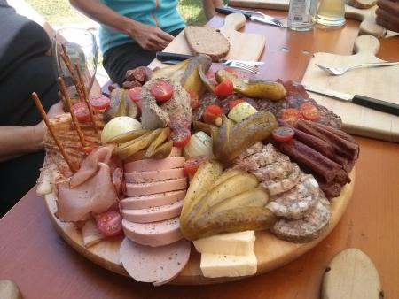
49km and 993 meters of climbing. Track is at http://www.gpsies.com/map.do?fileId=mmvopdmerdilzceh

Photos at https://photos.google.com/album/AF1QipM6WdaUJLQzcPpcXD1XhdJOuLcFvWqg6YWLdfDJ
We cycled straight there and then ate and drank too much before cycling back via the Dreiangelhütte and Untere Bichler Alpe.

49km and 993 meters of climbing. Track is at http://www.gpsies.com/map.do?fileId=mmvopdmerdilzceh

Photos at https://photos.google.com/album/AF1QipM6WdaUJLQzcPpcXD1XhdJOuLcFvWqg6YWLdfDJ
... link (0 Kommentare) ... comment
Samstag, 18. Juli 2015
150718 Mittlere Stuibenalpe
neill, 18:15h
Inge planned a tour to the Alp via the Pfrontener Hütte.
Six ladies (Caro, Hätti, Heidi, Inge, Karin & Moni) and me took part. The weather was kind to us - not too hot and not too much rain.
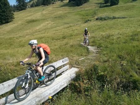
60kms and 1500 meters of climbing in four and a half hours. Track is at http://www.gpsies.com/map.do?fileId=mxrkaqrwxtgmgvpe The route has a "ClimbByBike Index" of 73.36!
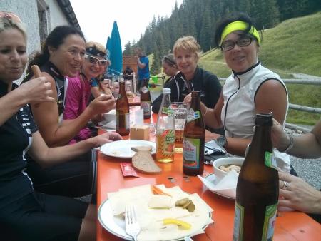
Photos at https://photos.google.com/album/AF1QipM6WdaUJLQzcPpcXD1XhdJOuLcFvWqg6YWLdfDJ
Six ladies (Caro, Hätti, Heidi, Inge, Karin & Moni) and me took part. The weather was kind to us - not too hot and not too much rain.

60kms and 1500 meters of climbing in four and a half hours. Track is at http://www.gpsies.com/map.do?fileId=mxrkaqrwxtgmgvpe The route has a "ClimbByBike Index" of 73.36!

Photos at https://photos.google.com/album/AF1QipM6WdaUJLQzcPpcXD1XhdJOuLcFvWqg6YWLdfDJ
... link (0 Kommentare) ... comment
Montag, 13. Juli 2015
150712 Breitenberg
neill, 00:02h
At 09:15 I received an invitation from Karin to be at the sports hall in an hour to cycle the Breitenberg.
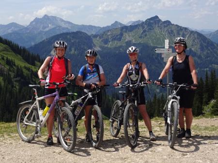
There wer five of us. I was the token man. Hopsing later joined us at the Alm where we stopped for lunch.
On the way down Marion slipped on a curve. Lots of blood but hopefully no serious damage.
42 km with 1100 meters of climbing. Track is at http://www.gpsies.com/map.do?fileId=wbknsvanmaebdgrn
Pictures at https://photos.google.com/album/AF1QipM6WdaUJLQzcPpcXD1XhdJOuLcFvWqg6YWLdfDJ
... link (0 Kommentare) ... comment
Sonntag, 12. Juli 2015
150711 Schwarzenberg
neill, 00:17h
Heidi had an hour and a half off so we went for a quick race bike ride.
29 km and 430 meters of climbing. Track is at http://www.gpsies.com/map.do?fileId=wkcwpskvomqnxrmw
29 km and 430 meters of climbing. Track is at http://www.gpsies.com/map.do?fileId=wkcwpskvomqnxrmw
... link (0 Kommentare) ... comment
150711 Ruhbach
neill, 16:38h
Out on my own enjoying the mountains and valleys near Balderschwang.

From Balderschwang I headed towards the Riedbergerpass and then south past the Toniskopf Alpe. Trail down to Rohmoos was steep and washed out so I fell off at one point but luckily no one saw me.
Along the Starlach valley and then across the European watershed and on down the Ruhbach valley. Back to Balderschwang across the Sättele Pass.

Stopped at the Fuchs Alpe for lunch. The last hut in Germany in the middle of nowhere but free fast Internet thanks to our company. My colleague mounted an antenna in a tree and it works perfectly.
As I was sat at the Alpe 10 mountainbikers turned up who had watched me ride down the top of the pass. Their comments were "Respect, Crazy, Impressive and Suicidal" :-)
The tour until the Fuchs Alpe took just under three hours. After lunch back down to the village and car.
31 km with 975 meters of climbing. http://www.gpsies.com/map.do?fileId=clymioliwwmvjjft
Pictures at https://photos.google.com/album/AF1QipM6WdaUJLQzcPpcXD1XhdJOuLcFvWqg6YWLdfDJ

From Balderschwang I headed towards the Riedbergerpass and then south past the Toniskopf Alpe. Trail down to Rohmoos was steep and washed out so I fell off at one point but luckily no one saw me.
Along the Starlach valley and then across the European watershed and on down the Ruhbach valley. Back to Balderschwang across the Sättele Pass.

Stopped at the Fuchs Alpe for lunch. The last hut in Germany in the middle of nowhere but free fast Internet thanks to our company. My colleague mounted an antenna in a tree and it works perfectly.
As I was sat at the Alpe 10 mountainbikers turned up who had watched me ride down the top of the pass. Their comments were "Respect, Crazy, Impressive and Suicidal" :-)
The tour until the Fuchs Alpe took just under three hours. After lunch back down to the village and car.
31 km with 975 meters of climbing. http://www.gpsies.com/map.do?fileId=clymioliwwmvjjft
Pictures at https://photos.google.com/album/AF1QipM6WdaUJLQzcPpcXD1XhdJOuLcFvWqg6YWLdfDJ
... link (2 Kommentare) ... comment
Sonntag, 21. Juni 2015
150621 Pfrontner Alpe
neill, 18:15h
Today a Sunday tour was planned but shortly before it was due to start Inge cancelled it because it was cold and wet. But Heidi and I were already dressed and ready to go so we went alone.
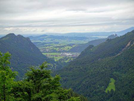
I had a new route that I wanted to try so we went out and did that. To Pfronten and up to the Pfrontner Alpe and then along the path towards the Bärenmoosalp. Before the Achsele we turned down in to Hölltal. Much of the descent I could not ride with soaking wet stones but we'll try again when it is drier.
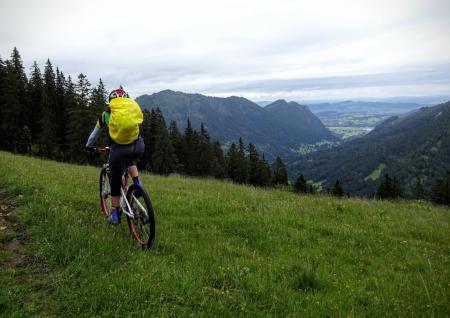
In Vilstal we went to the Kalbele Hof for a coffee and then via Rehbach, Unterjoch and the Grüntensee home.
Lots of very light drizzle but the only real rain was just before we got home in Gschwend.
51 km with 1187 meters of climbing. Track is at http://www.gpsies.com/map.do?fileId=edlmrmizxaxcemit
Photos are at https://photos.google.com/album/AF1QipNv1rMqVebUDOGzhnPcKFiq4lEpul7V6AzE_1to

I had a new route that I wanted to try so we went out and did that. To Pfronten and up to the Pfrontner Alpe and then along the path towards the Bärenmoosalp. Before the Achsele we turned down in to Hölltal. Much of the descent I could not ride with soaking wet stones but we'll try again when it is drier.

In Vilstal we went to the Kalbele Hof for a coffee and then via Rehbach, Unterjoch and the Grüntensee home.
Lots of very light drizzle but the only real rain was just before we got home in Gschwend.
51 km with 1187 meters of climbing. Track is at http://www.gpsies.com/map.do?fileId=edlmrmizxaxcemit
Photos are at https://photos.google.com/album/AF1QipNv1rMqVebUDOGzhnPcKFiq4lEpul7V6AzE_1to
... link (0 Kommentare) ... comment
Sonntag, 7. Juni 2015
150507 The "Legend of the non-existent Trail"
neill, 20:41h
There is a legend that you can ride a mountain bike from Tannheimertal, past the Schönkahler to the Bärenmoos Alm. It is a story that every mountainbiker hears. The track is not shown on any map and there are no links to it in Internet but "it is definitely possible".
The newest person to hear the legend was Caro. I explained that it was untrue and that you had to push your bike but she knew better. So today she, Stefano and I set out to cycle this ghost.
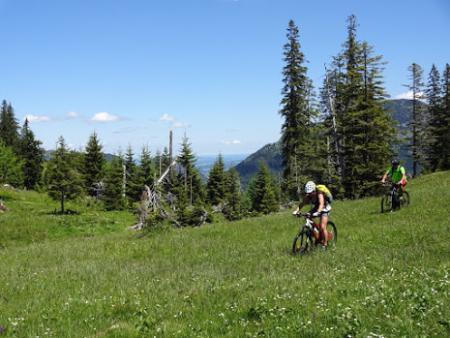
We cycled through Vilstal to Tannheimertal, up to the Zugspitzblick and then along the forest track towards the Einstein. We ignored the sign to the Schönkahler as I knew from previous attempts that this led through a bog and took the next left. Much pushing, carrying and bog-riding later we reached a new forest track that went round the Pirschling. Followed that to the end and then pushed up to the ridge between the Pirschling and Schönkahler. Amazing views and great photos.
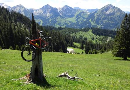
We cycled down to the Pfrontener Alpe. From here a path continued on to the Bärenmoos but Caro was against more pushing/carrying. She was certain the track going downhill would meet the Bärenmoos trail so we headed off downhill and as expected ended up in Achtal. Change of plan - drink in the Fallmühle. And then another change of plan - home via the Hündelskopfhütte.
55km and 1450 meters of climbing. Track is at http://www.gpsies.com/map.do?fileId=kxuqzpqitsakxfib
All the pictures are at https://photos.google.com/u/0/album/AF1QipNv1rMqVebUDOGzhnPcKFiq4lEpul7V6AzE_1to
The newest person to hear the legend was Caro. I explained that it was untrue and that you had to push your bike but she knew better. So today she, Stefano and I set out to cycle this ghost.

We cycled through Vilstal to Tannheimertal, up to the Zugspitzblick and then along the forest track towards the Einstein. We ignored the sign to the Schönkahler as I knew from previous attempts that this led through a bog and took the next left. Much pushing, carrying and bog-riding later we reached a new forest track that went round the Pirschling. Followed that to the end and then pushed up to the ridge between the Pirschling and Schönkahler. Amazing views and great photos.

We cycled down to the Pfrontener Alpe. From here a path continued on to the Bärenmoos but Caro was against more pushing/carrying. She was certain the track going downhill would meet the Bärenmoos trail so we headed off downhill and as expected ended up in Achtal. Change of plan - drink in the Fallmühle. And then another change of plan - home via the Hündelskopfhütte.
55km and 1450 meters of climbing. Track is at http://www.gpsies.com/map.do?fileId=kxuqzpqitsakxfib
All the pictures are at https://photos.google.com/u/0/album/AF1QipNv1rMqVebUDOGzhnPcKFiq4lEpul7V6AzE_1to
... link (0 Kommentare) ... comment
Samstag, 6. Juni 2015
150606 Grüntensee
neill, 18:14h
A very quick ride round the lake with Heidi. There is always time for "once round the lake".
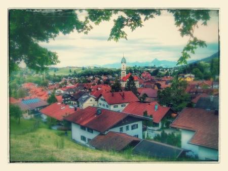
21km with 220 meters of climbing. Track is at http://www.gpsies.com/map.do?fileId=qlflfnmumtdeelav

21km with 220 meters of climbing. Track is at http://www.gpsies.com/map.do?fileId=qlflfnmumtdeelav
... link (0 Kommentare) ... comment
... nächste Seite
