Freitag, 5. Juni 2015
150604 Jäger Steig
neill, 01:24h
Out Mountain biking with Hetti, Hopsing, Karin and Moni. It took us a bit to reach the start of the tour in Austria as today is the day the catholics process around town so the road was closed for 20 minutes. A fantastic tour through stunning scenery. All track and trail with hardly any road. From Austria we cycled across the hills back to Germany and past the King's Castles. From there we cycled back to Austria climbing 700 meters.
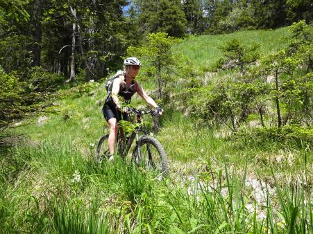
After a rest next to a hut we rode down the "Jäger Steig" - an amazing steep, rocky trail.
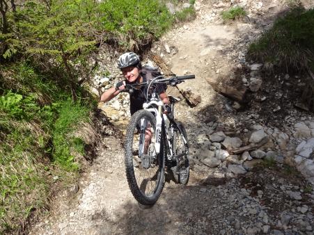
Finally another 700 meters of climbing up to an Alp in the full heat of the midday sun. One part was stupidly steep gravel and only Hopsing rode it all. We ate lunch accompanied with the lots of liquid and enjoyed the views across the mountains.
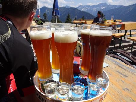
On the way back to the cars we depressed a few young men by sailing past them with each of the ladies giving them a sweet smile :-)
45kms with 1482 meters of climbing! Track is at http://www.gpsies.com/map.do?fileId=tjejiynxmpoljnhl

After a rest next to a hut we rode down the "Jäger Steig" - an amazing steep, rocky trail.

Finally another 700 meters of climbing up to an Alp in the full heat of the midday sun. One part was stupidly steep gravel and only Hopsing rode it all. We ate lunch accompanied with the lots of liquid and enjoyed the views across the mountains.

On the way back to the cars we depressed a few young men by sailing past them with each of the ladies giving them a sweet smile :-)
45kms with 1482 meters of climbing! Track is at http://www.gpsies.com/map.do?fileId=tjejiynxmpoljnhl
... link (0 Kommentare) ... comment
Donnerstag, 4. Juni 2015
150603 Vils
neill, 01:57h
Because she did not have time last night, Heidi wanted to go out on the race bikes tonight.
No problem!
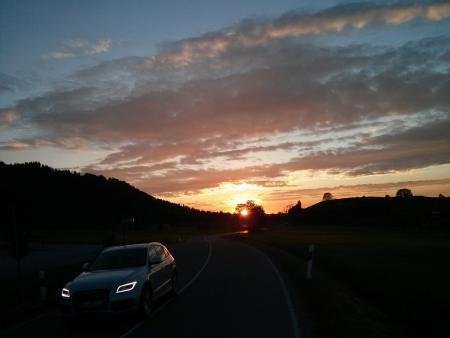
47km eith 434 meters of climbing. Track at http://www.gpsies.com/map.do?fileId=ixgvmjsyawjrbtti
No problem!

47km eith 434 meters of climbing. Track at http://www.gpsies.com/map.do?fileId=ixgvmjsyawjrbtti
... link (0 Kommentare) ... comment
Sonntag, 31. Mai 2015
150630 Ellegg
neill, 20:09h
An afternoon MTB tour round the Grüntensee taking in the Ellegg with its stunning views in to Tannheimertal.
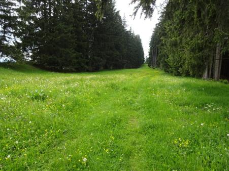
24km and 508 meters of climbing. Track is at http://www.gpsies.com/map.do?fileId=obonnrogyxaihysf

24km and 508 meters of climbing. Track is at http://www.gpsies.com/map.do?fileId=obonnrogyxaihysf
... link (0 Kommentare) ... comment
Montag, 25. Mai 2015
150525 Falkenstein
neill, 19:23h
Marion and I cycled to Pfronten and then on up to the Falkenstein for a drink. It was actually very cold but we both sweated all the way up - maybe because we were going so fast? On the way down it was cold with three layers on.

31km and 690 meters of climbing. Track is at http://www.gpsies.com/map.do?fileId=aorlowqkhdhadtqv
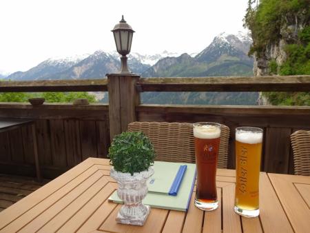
More photos at https://plus.google.com/u/0/photos/103827427036815679772/albums/6139495333132139777?sort=1

31km and 690 meters of climbing. Track is at http://www.gpsies.com/map.do?fileId=aorlowqkhdhadtqv

More photos at https://plus.google.com/u/0/photos/103827427036815679772/albums/6139495333132139777?sort=1
... link (0 Kommentare) ... comment
Sonntag, 24. Mai 2015
150524 Sportheim Böck
neill, 18:09h
On Christmas Day I cycled up the mountain to Sporthim Böck. On Easter Sunday Heidi and I walked up there on our touring skis. So today is Whit Sunday and I cycled up there.
Finally it had stopped raining and was just overcast. I set off with far too many clothes on but reached the top in shorts and short sleeved tricot after taking everything else off.
On the way up I stopped to watch the zipliners hurling down the mountain dangling on their steel cable. Nearly as much fun as mountain biking down.
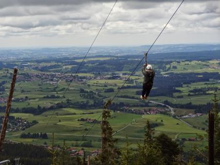
Capuccino and cheese cake was my reward for my efforts - and a super fast but muddy descent.
11km and 630 meters of climbing. Track is at http://www.gpsies.com/map.do?fileId=epkyxthjurjfecyb
Finally it had stopped raining and was just overcast. I set off with far too many clothes on but reached the top in shorts and short sleeved tricot after taking everything else off.
On the way up I stopped to watch the zipliners hurling down the mountain dangling on their steel cable. Nearly as much fun as mountain biking down.

Capuccino and cheese cake was my reward for my efforts - and a super fast but muddy descent.
11km and 630 meters of climbing. Track is at http://www.gpsies.com/map.do?fileId=epkyxthjurjfecyb
... link (0 Kommentare) ... comment
Montag, 18. Mai 2015
150518 Kempten
neill, 18:52h
After catching the overnight train from Rome to Munich and an Alex to Kempten, we cycled the last few kilometers back to Nesselwang.
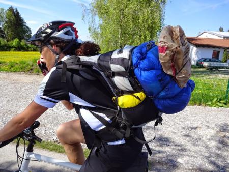
We were carrying "too much" luggage as we had to carry the extra clothing we had sent per post to Rome.
22km with 335 meters of climbing
Track is at http://www.gpsies.com/map.do?fileId=wkuoxzrsypzrrttt

We were carrying "too much" luggage as we had to carry the extra clothing we had sent per post to Rome.
22km with 335 meters of climbing
Track is at http://www.gpsies.com/map.do?fileId=wkuoxzrsypzrrttt
... link (0 Kommentare) ... comment
150517 Rome Sightseeing
neill, 18:51h
Yesterday Karl-Heinz was kind enough to show us Rome. He took us on foot, bus and tram so we had an entire day without our bikes - strange feeling. As a result, today on the way to the station we only had the Colluseum to "tick off" before taking the night train back to Germany.
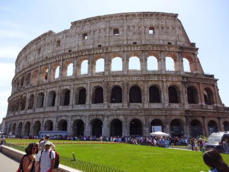
Down in to the Tiber valley and out the other side.
Track is only 17 km with 175 meters of climbing and is at http://www.gpsies.com/map.do?fileId=xnlnyikcckbkpstn

Down in to the Tiber valley and out the other side.
Track is only 17 km with 175 meters of climbing and is at http://www.gpsies.com/map.do?fileId=xnlnyikcckbkpstn
... link (0 Kommentare) ... comment
150508-15 Rome
neill, 18:36h
This year Heidi and I took our Frenchie bikes out for a new expedition. After Munich (2012), Milan (2013) and Poland (2014), this years trip was from Nesselwang to Rome.
We left on Friday afternoon after leaving work early and we arrived the following Friday afternoon. The trip was a little over 1050 kilometers and we climbed just under 10000 meters!
Day 1 - Nesselwang to Landeck.
http://www.gpsies.com/map.do?fileId=adrupolxnwmhyxlb
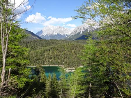
We left on Friday afternoon to get over the Fernpass and thus avoid having two passes on one day - Fern & Reschen. It was a good plan that worked well and took us to Landek at the foot of the Reschenpass.
Day 2 - to Branzoll
http://www.gpsies.com/map.do?fileId=qocrhlxxgnzaxhoe
From Landeck we cycled all the way up to the top of the pass at Reschen - and then (because it was all such fun) just carried on and on. We eventually stopped after 175km with about 1500 meters of climbing. The furthest I have ever cycled and that over the Alps.
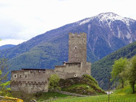
At the Austrian-Swis border we met a guy on his way to Africa ( www.grindimwind.ch ). A little later another swiss person cycling to Istanbul. A few days later a cyclist about to set off for Iceland. There are lots of people out there having fun.
Day 3 - to Relais San Michele
http://www.gpsies.com/map.do?fileId=xjususlmtopyhqbh
A whole day of cycling down hill. Except for the last bit which was over a hill with 10% climbs. A lot of the day next to a canal that carries water to Verona.
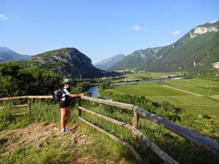
Day 4 - to Bologna
http://www.gpsies.com/map.do?fileId=vvricivodllsckfs
All day across the Po Valley. Flat with great views from the dykes.
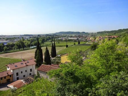
Day 5 - to Florence
http://www.gpsies.com/map.do?fileId=ctbtqqkcijodikbu
Mountains. Passes and steep hills. All topped off with the descent down the "Devil's Pass".
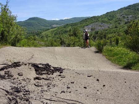
Day 6 - to Monte San Savino
http://www.gpsies.com/map.do?fileId=mpsdrwtafszqwhru
A "rest day". Started late and visited Florence before setting off at midday. Another day of hills. A hotel in a dream town on a hilltop.
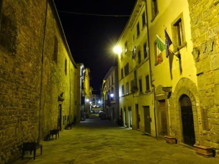
Day 7 - to Attigliano
http://www.gpsies.com/map.do?fileId=fiwhwivvynuzurcf (also includes Day 8
Through the Italian countryside. Including a diversion to an amazing town atop a mountain.
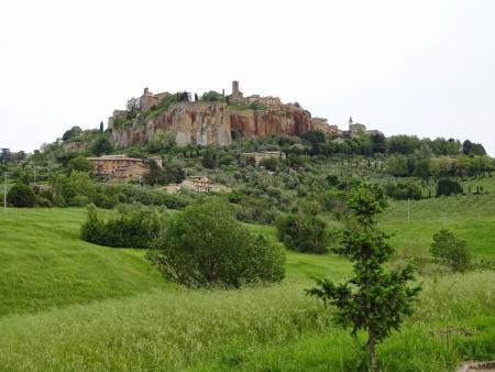
Day 8 - to Rome
Track is part of the link under Day 7
"Only 100km" but with nearly 2000 meters of climbing. A hard day but finally we reached our destination.
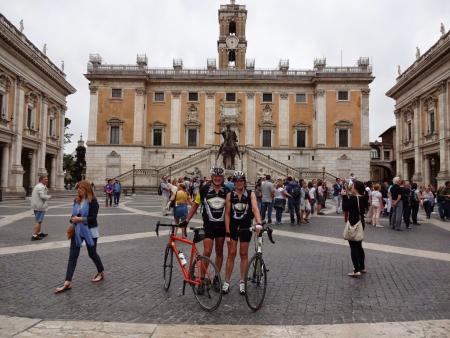
1053km with 9944 meters of climbing
Photos are at https://plus.google.com/u/0/photos/103827427036815679772/albums/6150267795226829809
Google created a picture story of the whole trip which you can see at https://plus.google.com/u/0/103827427036815679772/stories/5562c23c-80ca-3ec4-a032-fbfa0baf7dfe14d69d3cd06?cfem=1
We left on Friday afternoon after leaving work early and we arrived the following Friday afternoon. The trip was a little over 1050 kilometers and we climbed just under 10000 meters!
Day 1 - Nesselwang to Landeck.
http://www.gpsies.com/map.do?fileId=adrupolxnwmhyxlb

We left on Friday afternoon to get over the Fernpass and thus avoid having two passes on one day - Fern & Reschen. It was a good plan that worked well and took us to Landek at the foot of the Reschenpass.
Day 2 - to Branzoll
http://www.gpsies.com/map.do?fileId=qocrhlxxgnzaxhoe
From Landeck we cycled all the way up to the top of the pass at Reschen - and then (because it was all such fun) just carried on and on. We eventually stopped after 175km with about 1500 meters of climbing. The furthest I have ever cycled and that over the Alps.

At the Austrian-Swis border we met a guy on his way to Africa ( www.grindimwind.ch ). A little later another swiss person cycling to Istanbul. A few days later a cyclist about to set off for Iceland. There are lots of people out there having fun.
Day 3 - to Relais San Michele
http://www.gpsies.com/map.do?fileId=xjususlmtopyhqbh
A whole day of cycling down hill. Except for the last bit which was over a hill with 10% climbs. A lot of the day next to a canal that carries water to Verona.

Day 4 - to Bologna
http://www.gpsies.com/map.do?fileId=vvricivodllsckfs
All day across the Po Valley. Flat with great views from the dykes.

Day 5 - to Florence
http://www.gpsies.com/map.do?fileId=ctbtqqkcijodikbu
Mountains. Passes and steep hills. All topped off with the descent down the "Devil's Pass".

Day 6 - to Monte San Savino
http://www.gpsies.com/map.do?fileId=mpsdrwtafszqwhru
A "rest day". Started late and visited Florence before setting off at midday. Another day of hills. A hotel in a dream town on a hilltop.

Day 7 - to Attigliano
http://www.gpsies.com/map.do?fileId=fiwhwivvynuzurcf (also includes Day 8
Through the Italian countryside. Including a diversion to an amazing town atop a mountain.

Day 8 - to Rome
Track is part of the link under Day 7
"Only 100km" but with nearly 2000 meters of climbing. A hard day but finally we reached our destination.

1053km with 9944 meters of climbing
Photos are at https://plus.google.com/u/0/photos/103827427036815679772/albums/6150267795226829809
Google created a picture story of the whole trip which you can see at https://plus.google.com/u/0/103827427036815679772/stories/5562c23c-80ca-3ec4-a032-fbfa0baf7dfe14d69d3cd06?cfem=1
... link (0 Kommentare) ... comment
Sonntag, 3. Mai 2015
150503 Alpspitz
neill, 23:33h
Heidi had been working all weekend so she needed to get out and attack a mountain. No problem! Out and up the Alpspitz.
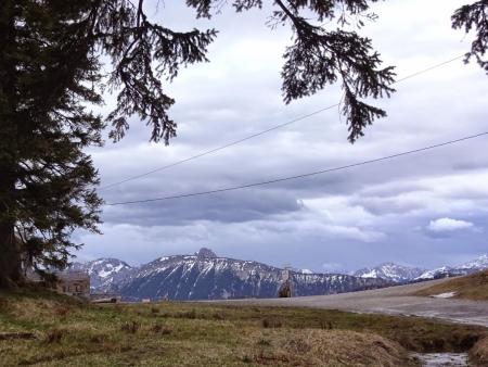
14 km and 600 meters of climbing. Track is at http://www.gpsies.com/map.do?fileId=yjtosrxdejhssxjp

14 km and 600 meters of climbing. Track is at http://www.gpsies.com/map.do?fileId=yjtosrxdejhssxjp
... link (0 Kommentare) ... comment
Sonntag, 3. Mai 2015
150502 Vils- & Achtal
neill, 01:40h
It rained all morning but in the afternoon it stopped so Caro and I jumped on our bikes and set off in to Austria. It was a ride too far as I had to be back in Nesselwang punctually for a procession and church. The result was that we did the second half of the trip at a ridiculous speed (overall average 18.4km/h and we were riding normally the first half).
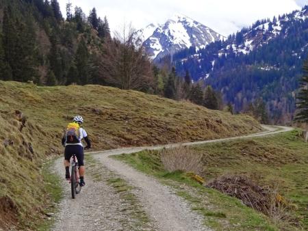
We met no other bikers and hardly any walkers. The mountains, valleys and forests smelt so fresh after the rain.
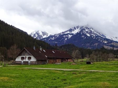
At some time during the ride I passed the 1000 kilometer mark for this year so I guess I am fully trained to cycle to Rome next week.
50km and 650 meters of climbing. Track at http://www.gpsies.com/map.do?fileId=ubqwqyjawoithnid
Photos at https://plus.google.com/u/0/photos/103827427036815679772/albums/6139495333132139777

We met no other bikers and hardly any walkers. The mountains, valleys and forests smelt so fresh after the rain.

At some time during the ride I passed the 1000 kilometer mark for this year so I guess I am fully trained to cycle to Rome next week.
50km and 650 meters of climbing. Track at http://www.gpsies.com/map.do?fileId=ubqwqyjawoithnid
Photos at https://plus.google.com/u/0/photos/103827427036815679772/albums/6139495333132139777
... link (0 Kommentare) ... comment
... nächste Seite
