
Freitag, 5. Juli 2013
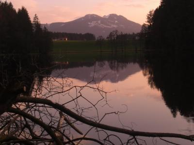
130704 Schnitzlertal
neill, 13:53h
The weather promised rain but we are all waterproof so we cycled up to the Schnitzlertal. In the end we stayed dry until the last five minutes when it started to rain.
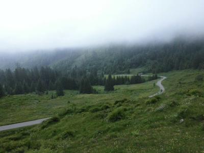
42 kilometers 820 meters of climbing
http://www.gpsies.com/map.do?fileId=mlpxljyvyiawartb
My pictures are at https://plus.google.com/photos/103827427036815679772/albums/5887203753058455121/5897197375371678690?banner=pwa&pid=5897197375371678690&oid=103827427036815679772
Jon's pictures are at https://plus.google.com/photos/100547066824249637955/albums/5865862959006086625/5897027947237202770?pid=5897027947237202770&oid=100547066824249637955
... link (0 Kommentare) ... comment
Freitag, 28. Juni 2013
130627 Edelsberg
neill, 09:40h
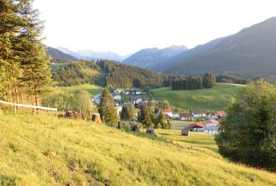
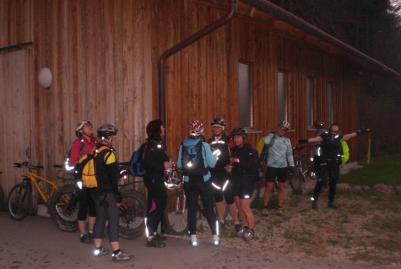
Because it was cloudy and had rained earlier we cycled up the Edelsberg. By the time we reached the top, it was obvious that it was not going to rain again so we carried on over the top and then back home through Stubental.
Despite this being one of the longest days this year, we only just made it to the bottom before it was dark and cycled home with lights on.
Pictures at https://plus.google.com/photos/103827427036815679772/albums/5887203753058455121/5894583397968195458?banner=pwa&pid=5894583397968195458&oid=103827427036815679772
25km and 950 meters of climbing
The track is at http://www.gpsies.com/map.do?fileId=yonzgdnfmqwpjpqf
Jon's pictures are at https://plus.google.com/photos/100547066824249637955/albums/5865862959006086625/5894440861998852338?pid=5894440861998852338&oid=100547066824249637955
... link (0 Kommentare) ... comment
Freitag, 21. Juni 2013
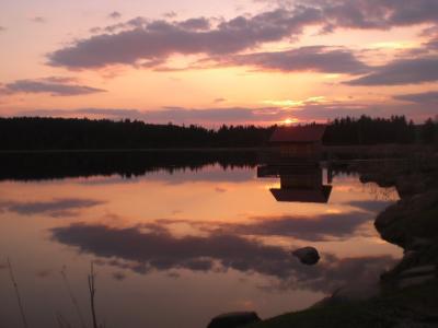
130620 Himmelsreich
neill, 17:37h
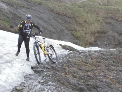
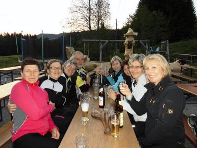
Two hours before we were due to set off this evening there was a huge thunder storm with sheets of water. By the time we left the sun was shining again so seven of us cycled up the long steep track to the Himmelsreich pass in Pfronten.
From Himmelreich we followed the super steep and stony trail back down in to the valley. All of us managed to cycle at the least most of the way which was a great achievement.
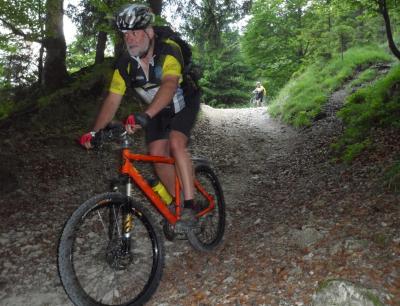
Photo by Jon
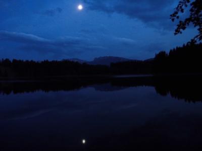
We next cycled to the Kögelweiher lake for a swim in the moonlight. It really is a tough life.
30 kms and 574 meters of climbing
http://www.gpsies.com/map.do?fileId=bvodnpsvdghdnnre
Pictures at https://plus.google.com/photos/103827427036815679772/albums/5887203753058455121/5892013168505436338?banner=pwa&pid=5892013168505436338&oid=103827427036815679772
Jons photos are at https://plus.google.com/photos/100547066824249637955/albums/5865862959006086625/5891854948848635890?pid=5891854948848635890&oid=100547066824249637955
From Himmelreich we followed the super steep and stony trail back down in to the valley. All of us managed to cycle at the least most of the way which was a great achievement.
Photo by Jon
We next cycled to the Kögelweiher lake for a swim in the moonlight. It really is a tough life.
30 kms and 574 meters of climbing
http://www.gpsies.com/map.do?fileId=bvodnpsvdghdnnre
Pictures at https://plus.google.com/photos/103827427036815679772/albums/5887203753058455121/5892013168505436338?banner=pwa&pid=5892013168505436338&oid=103827427036815679772
Jons photos are at https://plus.google.com/photos/100547066824249637955/albums/5865862959006086625/5891854948848635890?pid=5891854948848635890&oid=100547066824249637955
... link (0 Kommentare) ... comment
Freitag, 14. Juni 2013
130613 Reuttewanne
neill, 15:51h
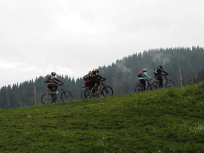
Nine of us sweated our way to the Upper Reuttewanne Alp and then enjoyed the run down in to Jungholz. Because it was such a nice evening, we then returned to Nesselwang through the Vils valley.
Jon joined Group 2 today. Welcome to fun cycling Jon.
Pictures at https://plus.google.com/photos/103827427036815679772/albums/5887203753058455121/5890128364602735986?banner=pwa&pid=5890128364602735986&oid=103827427036815679772
27 kms and 750 meters of climbing.
Track at http://www.gpsies.com/map.do?fileId=gfsoizgrvyiismls
Jon's pictures at https://plus.google.com/photos/100547066824249637955/albums/5865862959006086625/5889317188572514162?pid=5889317188572514162&oid=100547066824249637955
... link (0 Kommentare) ... comment
Freitag, 7. Juni 2013
130606 Sorg Alpe
neill, 12:43h
Finally a Thursday evening that was warm and sunny. We cycled through Vilstal and Jungholz to the Sorg Alpe. Shortly after we arrived the other group also appeared so there were twenty of us in total.
Tried to cycle back along the lake but the path was still under water from the flooding.
35kms and 580 meters of climbing
Track at http://www.gpsies.com/map.do?fileId=vmqvzdkpumwpatfs
Pictures at https://picasaweb.google.com/103827427036815679772/2013CyclingIII
Tried to cycle back along the lake but the path was still under water from the flooding.
35kms and 580 meters of climbing
Track at http://www.gpsies.com/map.do?fileId=vmqvzdkpumwpatfs
Pictures at https://picasaweb.google.com/103827427036815679772/2013CyclingIII
... link (0 Kommentare) ... comment
Sonntag, 26. Mai 2013
130523 Buronhütte
neill, 00:05h
An overcast Thursday evening and later rain. The second half of the ride was wet and very cold.
17 kms and 460 meters of climbing.
Track at http://www.gpsies.com/map.do?fileId=cfxiucszmssduzcx
Camera was broken as I pushed Jon's buggy over it.
17 kms and 460 meters of climbing.
Track at http://www.gpsies.com/map.do?fileId=cfxiucszmssduzcx
Camera was broken as I pushed Jon's buggy over it.
... link (0 Kommentare) ... comment
Montag, 20. Mai 2013
130516 Mühlbach
neill, 19:44h
The weather forecast said rain but luckily they lied.
An enjoyable tour with more tracks and trails than roads.
28kms and 550 meters of climbing
Track at http://www.gpsies.com/map.do?fileId=zwozmvizmsvvbcvm
An enjoyable tour with more tracks and trails than roads.
28kms and 550 meters of climbing
Track at http://www.gpsies.com/map.do?fileId=zwozmvizmsvvbcvm
... link (0 Kommentare) ... comment
Samstag, 4. Mai 2013
130502 Pfronten
neill, 23:17h
Thursday evening and 10 of us cycled to and then around Pfronten. We got absolutely soaked in Achtal - the same thing happened there a few years ago.
28km and 345 meters of climbing.
Track at http://www.gpsies.com/map.do?fileId=xurgtnlzospzuuwt
More photos at https://plus.google.com/photos/103827427036815679772/albums/5866409348860352993?banner=pwa
28km and 345 meters of climbing.
Track at http://www.gpsies.com/map.do?fileId=xurgtnlzospzuuwt
More photos at https://plus.google.com/photos/103827427036815679772/albums/5866409348860352993?banner=pwa
... link (0 Kommentare) ... comment
Freitag, 26. April 2013
130425 Hanging Bridge
neill, 21:44h
A classic "beginning of season" tour.
11 of us were out on a lovely warm spring evening.
28kms and 450 meters of climbing
Track is at http://www.gpsies.com/map.do?fileId=eejopzztpnwzoqww
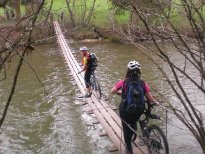
More pictures at https://plus.google.com/photos/103827427036815679772/albums/5866409348860352993?banner=pwa
11 of us were out on a lovely warm spring evening.
28kms and 450 meters of climbing
Track is at http://www.gpsies.com/map.do?fileId=eejopzztpnwzoqww
More pictures at https://plus.google.com/photos/103827427036815679772/albums/5866409348860352993?banner=pwa
... link (0 Kommentare) ... comment
Freitag, 19. April 2013
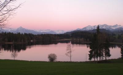
130418 Sechs Weiher
neill, 02:03h
After the great race bike tour at lunch time, we were out with the mountain bikes this evening. Through the local countryside past six lakes.
22km and 300 meters of climbing
Track at http://www.gpsies.com/map.do?fileId=ynfvqgknblohaxcp
More pictures at https://plus.google.com/photos/103827427036815679772/albums/5866409348860352993?banner=pwa
22km and 300 meters of climbing
Track at http://www.gpsies.com/map.do?fileId=ynfvqgknblohaxcp
More pictures at https://plus.google.com/photos/103827427036815679772/albums/5866409348860352993?banner=pwa
... link (0 Kommentare) ... comment
... nächste Seite