
... newer stories
Samstag, 27. August 2016
160827 Mindelheim for a Moneygram
neill, 21:12h
Rhiannon had sent me some money by Moneygram and the Internet side said that the next place that does that is in Kaufbeuren so I cycled the 30kms there. The guy in the shop was an unfriendly, arrogant idiot who lied to me and said he couldn't pay it out as he had not had the system at least a year.
So I cycled to Mindelheim where the guy was more than helpful. He only has the system 5 months but it was no problem for him.
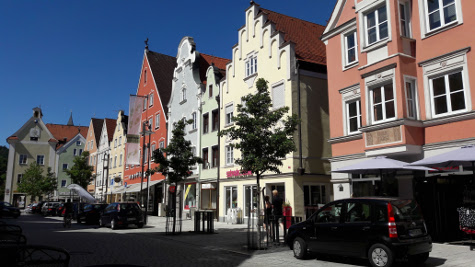
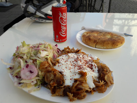
I used some of the money for a "Döner Teller" and used the free wifi that is powered by our company.
Then I cycled home - via a colleagues house to scrounge more water. Five hours cycling in 30°C needs a lot of water :-)
125km and 1165 meters of climbing. Track is at http://www.gpsies.com/map.do?fileId=vosqbrtziisucxzc
So I cycled to Mindelheim where the guy was more than helpful. He only has the system 5 months but it was no problem for him.
I used some of the money for a "Döner Teller" and used the free wifi that is powered by our company.
Then I cycled home - via a colleagues house to scrounge more water. Five hours cycling in 30°C needs a lot of water :-)
125km and 1165 meters of climbing. Track is at http://www.gpsies.com/map.do?fileId=vosqbrtziisucxzc
... link (0 Kommentare) ... comment
Freitag, 26. August 2016
160825 Edelsberg
neill, 12:01h
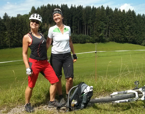
Heidi took the "cracks" up the Reuttewanne, Jon took his ladies swimming and three of us went "trailing".
18km and 756 meters of climbing. Track is at http://www.gpsies.com/map.do?fileId=mcfelbmxihkzncwi
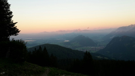
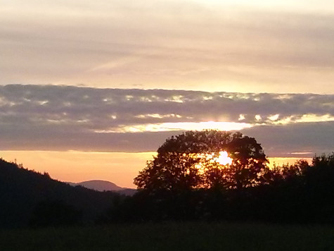
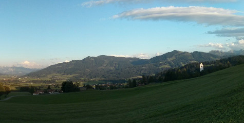
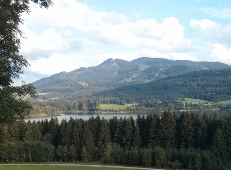
The following picture is of the view across the mountains at sunset. Thanks Marion.
Photos at https://goo.gl/photos/jqxzCujyshAs3j4z6
18km and 756 meters of climbing. Track is at http://www.gpsies.com/map.do?fileId=mcfelbmxihkzncwi
The following picture is of the view across the mountains at sunset. Thanks Marion.
Photos at https://goo.gl/photos/jqxzCujyshAs3j4z6
... link (0 Kommentare) ... comment
Mittwoch, 24. August 2016
160823 Kraftisried
neill, 09:13h
Tuesday night and Jon was so happy when we suggested a "flat land tour". Luckily we didn't realise that it would be 865 meters of climbing. Don't know what Jon has been taking - but he really pushed our pulses.
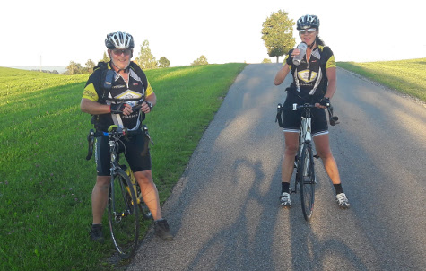
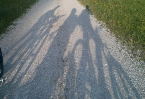
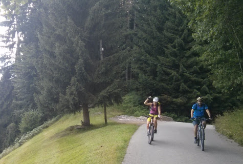
A sunny evening with the setting sun filtering through the trees and everything deep green from the last rays of sunlight.
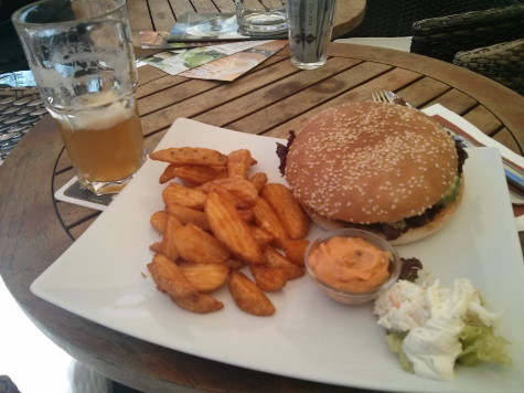
It was a good job we cycled so far, as this was my lunch
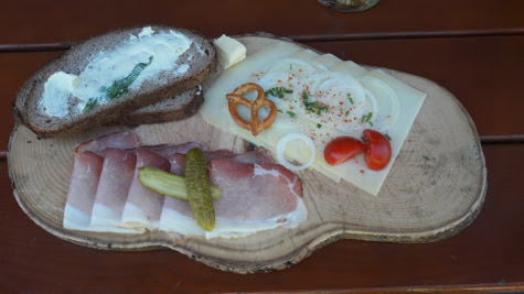
61km with 865 meters of climbingTrack is at http://www.gpsies.com/map.do?fileId=bgjdhggojtdpfpjs
A sunny evening with the setting sun filtering through the trees and everything deep green from the last rays of sunlight.
It was a good job we cycled so far, as this was my lunch
61km with 865 meters of climbingTrack is at http://www.gpsies.com/map.do?fileId=bgjdhggojtdpfpjs
... link (0 Kommentare) ... comment
Dienstag, 23. August 2016
160822 Seeg
neill, 11:50h
Racing bike after work.
26km and 390 meters of climbing. Track is at http://www.gpsies.com/map.do?fileId=arrpovdrfppeiewn
26km and 390 meters of climbing. Track is at http://www.gpsies.com/map.do?fileId=arrpovdrfppeiewn
... link (0 Kommentare) ... comment
Sonntag, 21. August 2016
160821 Usser Alp
neill, 18:08h
A sunday tour through the drizzle and low clouds to the Usser Alp above Tannheim.
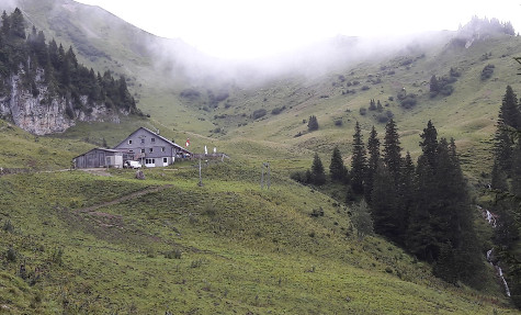
58 km and 1174 meters of climbing. Track is at http://www.gpsies.com/map.do?fileId=tltqhxsggvpahjek
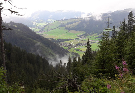
My photos at https://goo.gl/photos/jqxzCujyshAs3j4z6
58 km and 1174 meters of climbing. Track is at http://www.gpsies.com/map.do?fileId=tltqhxsggvpahjek
My photos at https://goo.gl/photos/jqxzCujyshAs3j4z6
... link (0 Kommentare) ... comment
160820 Mittelberg
neill, 18:06h
Rain forecast for the afternoon so a quick morning ride.
27km and 392 meters of climbing. Track is at http://www.gpsies.com/map.do?fileId=tzuiwlvkxihkccaa
27km and 392 meters of climbing. Track is at http://www.gpsies.com/map.do?fileId=tzuiwlvkxihkccaa
... link (0 Kommentare) ... comment
Montag, 15. August 2016
160815 Salzstrasse und Grüntenhütte
neill, 22:43h
We were planning on cycling the Jägersteig today but it was raining in the morning and in the mountains there was also lightning and hail so we headed off in the rain heading the other way towards the blue sky.
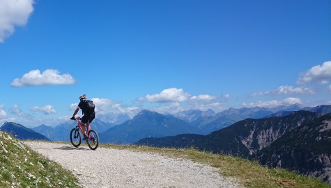
We made up the route situatively on the way and the result was a stunning tour with a bit of everything.
73km and 1923 meters of climbing. The 700 meter climb up to the Grüntenhütte and beyond was just as steep as it looks.
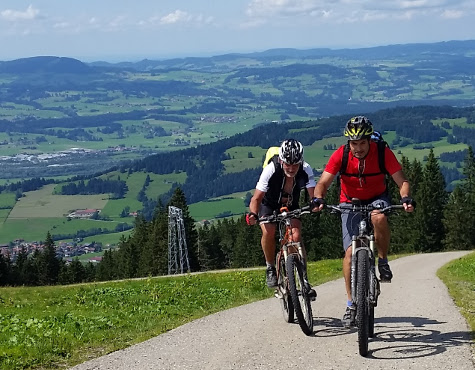
Track is at http://www.gpsies.com/map.do?fileId=qgslhptzrgcekquy
My pictures are at https://goo.gl/photos/jqxzCujyshAs3j4z6
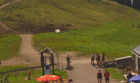
The following is a section from the panorama at http://gruenten.panomax.de (15. Aug. 2016 14:40) showing me taking the photo above.
We made up the route situatively on the way and the result was a stunning tour with a bit of everything.
73km and 1923 meters of climbing. The 700 meter climb up to the Grüntenhütte and beyond was just as steep as it looks.
Track is at http://www.gpsies.com/map.do?fileId=qgslhptzrgcekquy
My pictures are at https://goo.gl/photos/jqxzCujyshAs3j4z6
The following is a section from the panorama at http://gruenten.panomax.de (15. Aug. 2016 14:40) showing me taking the photo above.
... link (0 Kommentare) ... comment
Samstag, 13. August 2016
160813 Cheeseburger in Memmingen
neill, 20:52h
Warm and sunny for the first time this week so I cycled to Memmingen and enjoyed a cheeseburger in the town square.
123km with 1513 meters of climbing. Track is at http://www.gpsies.com/map.do?fileId=pqtjykyoghcgnqgl
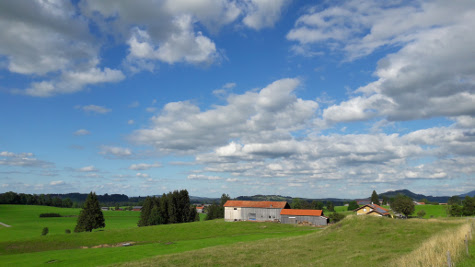
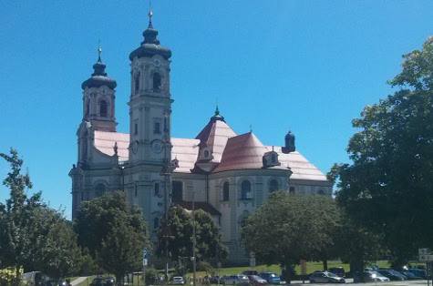
Cycled back through Ottobeuren where I took this picture
Photos at https://goo.gl/photos/jqxzCujyshAs3j4z6
123km with 1513 meters of climbing. Track is at http://www.gpsies.com/map.do?fileId=pqtjykyoghcgnqgl
Cycled back through Ottobeuren where I took this picture
Photos at https://goo.gl/photos/jqxzCujyshAs3j4z6
... link (0 Kommentare) ... comment
160811 Obere Reuttewanne
neill, 20:48h
Thursday evening and no Wera so we followed Bettina's suggestion. Going up hil was no problem but back down was absolutely freezing. I had a Glühwein as soon as we got back to Nesselwang.
29km and 722 meters of climbing. Track is at http://www.gpsies.com/map.do?fileId=rdzuorjgbfdzltxy
Photos at https://goo.gl/photos/jqxzCujyshAs3j4z6
29km and 722 meters of climbing. Track is at http://www.gpsies.com/map.do?fileId=rdzuorjgbfdzltxy
Photos at https://goo.gl/photos/jqxzCujyshAs3j4z6
... link (0 Kommentare) ... comment
Dienstag, 9. August 2016
160808 Mittelberg
neill, 00:50h
After a weekend of cycling, i was planning a lazy evening. But! A colleague had brought some cake with her and I had a tasty sauce on my dinner so I was almost 400 calories over my plan for the day.
I nearly convinced myself that it did not matter because I had burned so many calories at the weekend but I knew that those were the sort of thoughts that would have me back at 100kg in no time.
So I did a quick trip around the lake and added the climb up to Mittelberg to get all the needed calories.
25km and 402 meters of climbing. Track is at http://www.gpsies.com/map.do?fileId=rklhngwfvqoyldrf
... link (0 Kommentare) ... comment
Sonntag, 7. August 2016
160807 Gappenfeldalm
neill, 23:22h
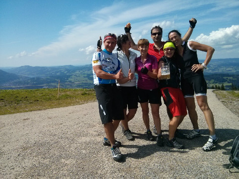
An absolutely classic tour. Suggested as Sunday tour by Caro. With Caro, Stefano, Jon, Moni, Bettina and Heidi (the first part).
73km and 1581 meters of climbing. Track is at http://www.gpsies.com/map.do?fileId=xfgcykpzbnrwpsfk
The last time I did this ride was in 2010 with Max and the Grüntensee was flooded over its banks. Exactly the same today.
My pictures are at https://goo.gl/photos/jqxzCujyshAs3j4z6
Jons pictures are at https://goo.gl/photos/isi8D1XwCb1M4Pd48
... link (0 Kommentare) ... comment
Samstag, 6. August 2016
160806 Landsberg
neill, 22:33h
This afternoon I set off on my race bike with no plan, no route and no destination - my favourite type of ride.
I ended up cycling to Landsberg am Lech and then taking the train back to Seeg and cycling home from there.
Track to Landsberg is at http://www.gpsies.com/map.do?fileId=zzhekceaffpxwybg (73km and 567 meters climbing)
Track from Seeg home is at http://www.gpsies.com/map.do?fileId=kingsldydhzizatc (12km and 192 meters cllimbing)
... link (0 Kommentare) ... comment
Freitag, 5. August 2016
160804 Gundhütte
neill, 17:37h
Thursday evening tour planned by Wera. Four of us and a great trail from the Gundhütte back down in to the valley.
27km and 856 meters of climbing. Track is at http://www.gpsies.com/map.do?fileId=zsvolkgegdfqrebf
27km and 856 meters of climbing. Track is at http://www.gpsies.com/map.do?fileId=zsvolkgegdfqrebf
... link (0 Kommentare) ... comment
Donnerstag, 4. August 2016
160803 Allatsee
neill, 19:14h
A "gentle" ride with Caro and Stefano. Caro's description, not mine.
36km and 508 meters of climbing
Track is at http://www.gpsies.com/map.do?fileId=ntblnpqpoorcwyeu
36km and 508 meters of climbing
Track is at http://www.gpsies.com/map.do?fileId=ntblnpqpoorcwyeu
... link (0 Kommentare) ... comment
Dienstag, 2. August 2016
160802 Grüntensee
neill, 23:02h
Tuesday night. And it was drizzling as we set off so we decided to stay near home. By the time we reached Wertach it was raining and by Oy we were soaking.

23km and 294 meters of climbing
http://www.gpsies.com/map.do?fileId=hzmkzujlawpwdxkb
23km and 294 meters of climbing
http://www.gpsies.com/map.do?fileId=hzmkzujlawpwdxkb
... link (0 Kommentare) ... comment
Montag, 1. August 2016
160801 Mittelberg
neill, 23:11h
A "round the lake" race bike tour after work.
24km and 326 meters of climbing.
http://www.gpsies.com/map.do?fileId=twdfjuvzmavbtyvb
24km and 326 meters of climbing.
http://www.gpsies.com/map.do?fileId=twdfjuvzmavbtyvb
... link (0 Kommentare) ... comment
... older stories