
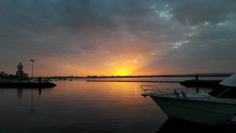
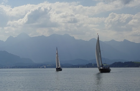
Then back to Mazagon and the next day on to El Rompido which we reached by navigating through the shallow and changeable channel where river and sea meet.
Back to Isla Christina and then, using blind navigation, on to Ayamonte.
Another great weeks sailing with a lot learned. And l finished off with my offshore skipper qualification and Marine VHF qualification.
The GPS tracks are at:
http://www.gpsies.com/map.do?fileId=pttstpnuxvfbdfxa
http://www.gpsies.com/map.do?fileId=vntwsywfnnhrcrpf
http://www.gpsies.com/map.do?fileId=bdacxqauozzaxnmf
http://www.gpsies.com/map.do?fileId=xqtjacpjfkvibbnc
http://www.gpsies.com/map.do?fileId=ryujqprucyykpwda
... link (0 Kommentare) ... comment
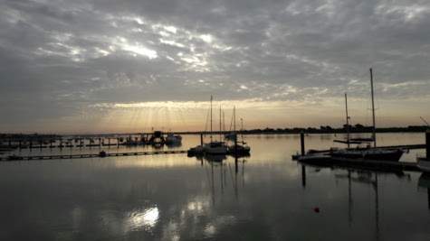
After a day and a half of boat skills we sailed "round the corner" to Isla Cenella at the end of the second day. From there on to Mazagon and then to Chipiona before the final leg to Cadiz where we are currently tied up in Puerto Americana.
A storm passed over us in Mazagon and the noise coupled with a cold meant I got no sleep. The next day there was a swell and plenty of wind. We were the only boat we saw out all day and finally I know what it like to be seasick :-)
Entering Chipiona, the wind got up and we had to reef. Then the rain lashed us and reduced visibility. So we were barrelling along at 7 knots with a wreck off to our left squinting through the rain looking for a small buoy that marked the marina.
A fun trip with lots learned.
The last three days sailing tracks are at:
http://www.gpsies.com/map.do?fileId=ruczaaqhlekobsro
http://www.gpsies.com/map.do?fileId=xfpobqkrrqwmozig
http://www.gpsies.com/map.do?fileId=pmqdrdzchssjdgqp
(it took me the first few days to work out how to save the tracks)
... link (0 Kommentare) ... comment
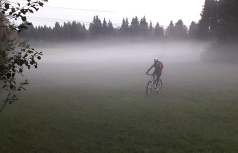
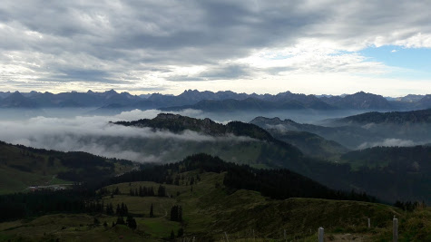
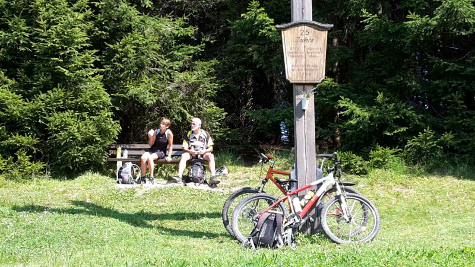
Inge, Heidi and I drove to Hindelang and then cycled up to the Burgschrofenweg in drizzle and then enjoyed a long descent along lots of interesting tracks.
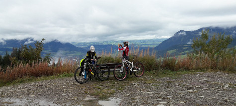
Arrived back at the car in sunshine.
My photos at https://goo.gl/photos/6ddzpfM69G3NzYWv6
25km and 890 meters of climbing. Track is at http://www.gpsies.com/map.do?fileId=qujzbaqtegyxautz
... link (0 Kommentare) ... comment
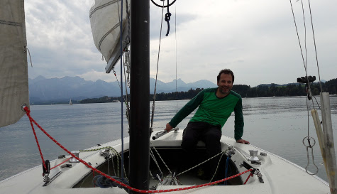
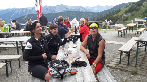
We began by seeing how many different ways we could find to tie a bowline. Next we unsucessfully "surveyed" a buoy using a compass and GPS enabled app in my camera. We then grounded on the lee shore of an island so I had to strip off and jump in to the lake to push us off while Stefano canted the boat as far as possible. Next we practiced sailing up to a buoy and just "kissing it" with the bow.
Our track is at http://www.gpsies.com/map.dofileId=ybcqrzeasltyzwzl
Photos at https://goo.gl/photos/RN65NJpM2SzdRNGw8
... link (0 Kommentare) ... comment
... link (0 Kommentare) ... comment
This time Stefano was setting places to aim for and then sailing the course to reach them. I was just happy to be getting in sailing time ready for my course in October and to be out with some one who enjoys sailing so much.
Track is at http://www.gpsies.com/map.do?fileId=obxfmzqnjemofpqi
My photos at https://goo.gl/photos/RN65NJpM2SzdRNGw8
... link (0 Kommentare) ... comment
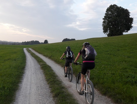
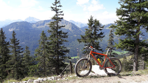
We left from the Fellhornbahn with the temperature hovering around 6°C, a little colder next to the river, and then cycled along the valley and up the Schrofen Pass. The last time I cycled this route was about 20 years ago and it was just as impressive then as it is now. Stefano admitted to "shaky knees" when he saw the route across the cliff face but we all managed the pass no problem.
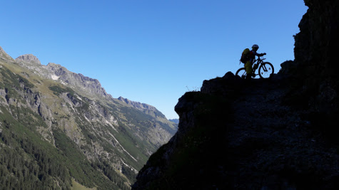
After a coffee in Warth, we crossed over in to the Bregenzerwald following the "alte Salzstrasse". Then it was 800 meters downhill on tarmac roads to Schoppernau. Since then I have been humming "Vo Mello bis ge Schoppornou" non stop.
We took the lift 800 meters up the mountain and then carried on cycling towards the Starzeljoch before pushing the last 40 minutes up to the pass. Once over the pass we stopped for a bite to eat at the Stierhofalpe.
By now it was late so we adopted "Plan B" and descended in to the valley and followed the road down through Kleinwalsertal. We took the shortcut back in to Stillachtal via the 300 meter climb to the Schrattenwangalpe.
I had estimated 10 hours and shortly after that, and just before dark, we were back at the car.
79 kilometers with 2336 meters of climbing. Tracks at http://www.gpsies.com/map.do?fileId=zdkaljprqpwbmakj and http://www.gpsies.com/map.do?fileId=mjktxskvclhrjlmm
My pictures at https://goo.gl/photos/4MQtaFepeMrDQWbo8
Stefano's track is at http://www.gpsies.com/map.do?fileId=arsjhixsctojubhw. This shows 3210 meters of climbing with 800 on the lift so 2410. we aren't going to argue about the odd 100 meters. We both agree about the 79 km.
Stefano's photos are at https://goo.gl/photos/4Vb3Q7NNnWgKLMtN7
... link (0 Kommentare) ... comment
21km and 200 meters of climbing. Track at http://www.gpsies.com/map.do?fileId=ywscljjzjnnydtci
... link (0 Kommentare) ... comment
7km with 370 meters of climbing. Track at http://www.gpsies.com/map.do?fileId=ceenoagyjzdnnrec
... link (0 Kommentare) ... comment
... link (0 Kommentare) ... comment
31km and 447 meters of climbing. Track is at http://www.gpsies.com/map.do?fileId=elijcvbvgloxsbba
... link (0 Kommentare) ... comment
And afterwards beer and a long and complicated discussion about correlation with Julia :-)
30km and 458 meters of climbing. Track is at http://www.gpsies.com/map.do?fileId=wgzutgnewbkxhfoi
... link (0 Kommentare) ... comment
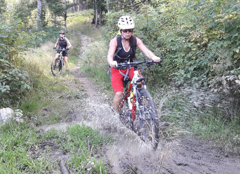
Two interesting (and steep) trails - one on slippy river stones and one down steps.
28km and 682 meters of climbing. Track is at http://www.gpsies.com/map.do?fileId=kwmmpmyvafgdfkgi
My pictures at https://goo.gl/photos/urhFXKrYeCWhZh4QA
... link (0 Kommentare) ... comment
Lots of interesting trails all the way back down to the hotel just beating the thunder and lightning.
32 kms and 1015 meters of climbing (without the 900 in the cable car). Track is at http://www.gpsies.com/map.do?fileId=oxghkpupzaoywogq
My pictures at https://goo.gl/photos/urhFXKrYeCWhZh4QA
... link (0 Kommentare) ... comment
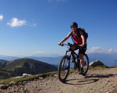
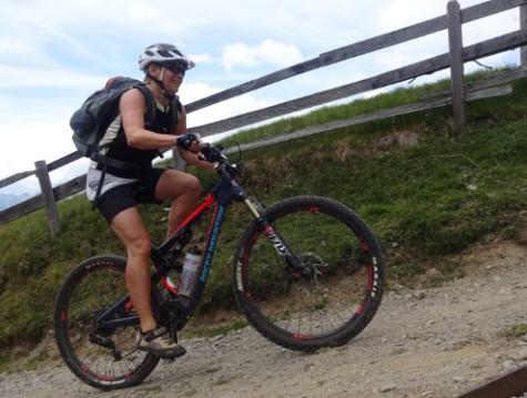
We used the Meran 2000 cable car to get up in to the mountains and then enjoyed some exciting trails and stunning views. On one descent I went over the handlebars and landed on my head directly on a sharp rock. Luckily my helmet took the impact and was destroyed but my head was OK.
47.7 km and 1414 meters of climbing (without the 1000 meters in the cable car). Track is at http://www.gpsies.com/map.do?fileId=izivjcmawajuypmt
My pictures at https://goo.gl/photos/urhFXKrYeCWhZh4QA
... link (0 Kommentare) ... comment
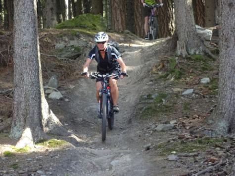
On the way down we followed an exciting bike trail (http://www.bikesport-magazin.de/holyhansen) which was great fun.
18.6km and 915 meters of climbing. Track is at http://www.gpsies.com/map.do?fileId=nkhhfegyfozfwmrx
My pictures at https://goo.gl/photos/urhFXKrYeCWhZh4QA
Hubert was with Group 1. His pictures are at https://drive.google.com/drive/folders/0B_sTz_QNmXn6RUgxLXZkN3lHWU0
... link (0 Kommentare) ... comment
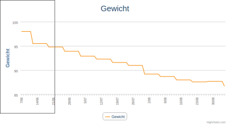
In the last 90 days I have gone from 0ver 98 to under 87 kilograms.
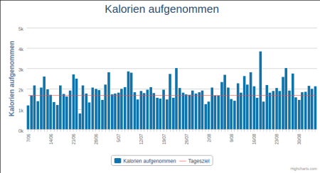
A lot of days I exceeded my calorie target as shown in this graph
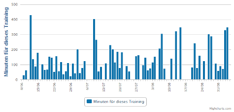
but I did a lot of exercise (about 2500 kilometers of cycling in about 170 hours) which burned the calories
so that the actual netto calories were (on average) well below the target.
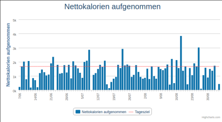
All the graphs in original size at https://goo.gl/photos/f2SCMnPEt4nzdsKA9
... link (0 Kommentare) ... comment
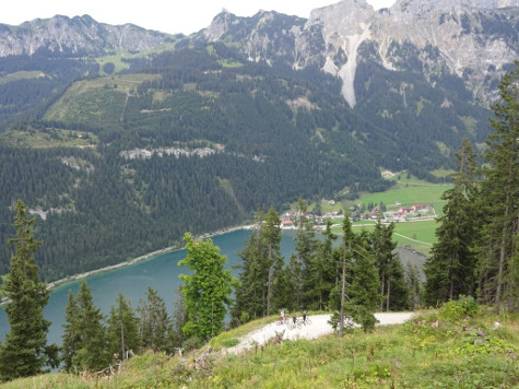
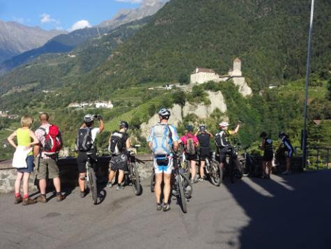
(take a close look at the picture and you can see the three ladies waving at the bottom.)
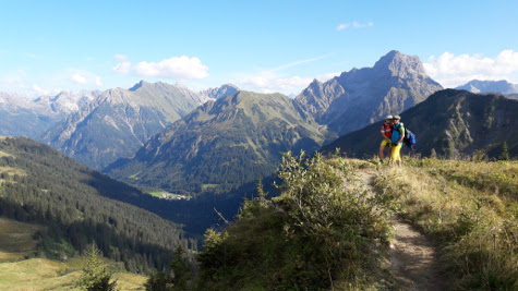
After cycling up to the Ödenalpe for lunch, we cycled to a cafe for capuccino and cake and then back over a small Austrian pass.
77km and 1746 meters of climbing. Track is at http://www.gpsies.com/map.do?fileId=hqfjvorimalnkfvx
My pictures are at https://goo.gl/photos/6ddzpfM69G3NzYWv6
... link (0 Kommentare) ... comment
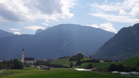
We cycled to Marktoberdorf and got lost twice on the way home but it was fun.
53km with 736 meters of climbing. Track is at http://www.gpsies.com/map.do?fileId=hemfzohlmdaicfvp
So today I totalled 93km and 1886 meters of climbing!
Picture are at https://goo.gl/photos/6ddzpfM69G3NzYWv6
... link (0 Kommentare) ... comment
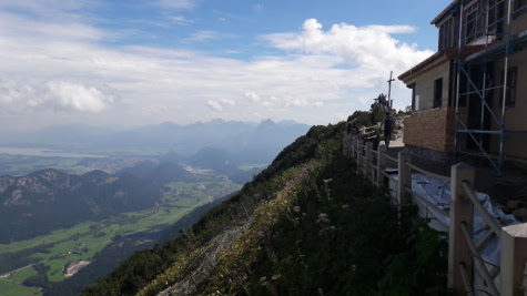
From the village of Pfronten to the restaurant on top of the mountain is 1000 meters of climbing but I took things nice and steady.
At the top I enjoyed a well deserved beer and soup and enjoyed the view. Last time I was up there was over 20 years ago when it was being rebuilt and I was doing the wiring.
Got home and enjoyed a coffee at Farina's and then Heidi rang and said "you want to go out on our race bikes?"
39km and 1156 meters of climbing. Track is at http://www.gpsies.com/map.do?fileId=guebvasgxmuphjme
Picture are at https://goo.gl/photos/6ddzpfM69G3NzYWv6
... link (0 Kommentare) ... comment
26km with 365 meters of climbing. Track is at http://www.gpsies.com/map.do?fileId=yiobacmiixzazobv
... link (0 Kommentare) ... comment
19km with 409 meters of climbing. Track is at http://www.gpsies.com/map.do?fileId=uwqrgrrokejtijie
... link (0 Kommentare) ... comment
22km with 300 meters of climbing. Track is at http://www.gpsies.com/map.do?fileId=zvflblcbuoisrqru
... link (0 Kommentare) ... comment

We were back at dark and enjoyed tea and biscuits at Jons.
20km and 602 meters of climbing. Track at http://www.gpsies.com/map.do?fileId=llqvcizpxhlsqgnt
... link (0 Kommentare) ... comment
We not only climbed to the Bildstöckle; we also climbed the old Joch Pass and came home past the Stuibental Alm. Being fit is fun.
56km and 1557 meters of climbing. Track is at http://www.gpsies.com/map.do?fileId=pxppghuvozuvkogm
My photos are at https://goo.gl/photos/6ddzpfM69G3NzYWv6
... link (0 Kommentare) ... comment